How to get to Frye by bus?
Click on the bus route to see step by step directions with maps, line arrival times and updated time schedules.
From C&O Canal Towpath, Washington
123 minFrom The Westin Arlington Gateway, Arlington County
43 minFrom Sibley Memorial Hospital, Washington
109 minFrom Intelligence Community Campus—Bethesda, Montgomery County
105 minFrom Defense Health Headquarters (DHHQ), Fairfax County
63 minFrom Carderock Division of the Naval Surface Warfare Center, Montgomery County
91 minFrom Kaiser Permanente - Falls Church Medical Center, Falls Church
28 minFrom Mosaic District, Fairfax County
32 minFrom Walmart, Arlington County
41 minFrom Falls Church Marriott Fairview Park, Fairfax County
58 min
How to get to Frye by metro?
Click on the metro route to see step by step directions with maps, line arrival times and updated time schedules.
Metro stations near Frye in Fairfax County
Bus stops near Frye in Fairfax County
- Tysons+Bay G, 4 min walk,VIEW
- Tysons Corner Metro Bay E, 4 min walk,VIEW
- Tysons Corner Metro Bay F, 4 min walk,VIEW
- International Dr And Tysons Corner Ct, 5 min walk,VIEW
- Tysons Corner Metro Bay B, 6 min walk,VIEW
- Tysons Corner Metro Bay C, 7 min walk,VIEW
- Tysons Corner Metro Bay A, 7 min walk,VIEW
- Tysons Corner Metro Station Departures, 8 min walk,VIEW
Bus lines to Frye in Fairfax County
- F20, East To King St-Old Town,VIEW
- 462, 462 Dunn Loring - Navy Fcu,VIEW
- 467, 467 Dunn Loring,VIEW
- 401, 401 Tysons West Park,VIEW
- 402, 402 Franconia- Springfield,VIEW
- 721, 721 Mclean Metro - Chain Br Rd,VIEW
- A70, West To Tysons,VIEW
- 423, 423 Park Run - West Park,VIEW
- 495, 495 Burke Ctr,VIEW
- 798, 798 Bethesda,VIEW
- 494, 494 Tysons Metro,VIEW
- 463, 463 Tysons Cnr - Maple Ave,VIEW
- 660, 660 Centreville Park & Ride,VIEW
- 60, Tysons Metro Station,VIEW
What are the closest stations to Frye?
The closest stations to Frye are:
- West Falls Church-Vt is 101 yards away, 2 min walk.
- Tysons+Bay G is 250 yards away, 4 min walk.
- Tysons Corner Metro Bay E is 304 yards away, 4 min walk.
- Tysons Corner Metro Bay F is 324 yards away, 4 min walk.
- International Dr And Tysons Corner Ct is 375 yards away, 5 min walk.
- Tysons Corner Metro Bay B is 475 yards away, 6 min walk.
- Tysons Corner Metro Bay C is 511 yards away, 7 min walk.
- Tysons Corner Metro Bay A is 575 yards away, 7 min walk.
- Tysons Corner Metro Station Departures is 603 yards away, 8 min walk.
- Greensboro is 1455 yards away, 18 min walk.
Which bus lines stop near Frye?
These bus lines stop near Frye: 401, 798, A70, F20.
Which metro line stops near Frye?
SILVER (Ashburn)
What’s the nearest metro station to Frye in Fairfax County?
The nearest metro station to Frye in Fairfax County is West Falls Church-Vt. It’s a 2 min walk away.
What’s the nearest bus station to Frye in Fairfax County?
The nearest bus stations to Frye in Fairfax County are Tysons+Bay G, Tysons Corner Metro Bay E and Tysons Corner Metro Bay F. The closest one is a 4 min walk away.
What time is the first metro to Frye in Fairfax County?
The SILVER is the first metro that goes to Frye in Fairfax County. It stops nearby at 5:07 AM.
What time is the last metro to Frye in Fairfax County?
The SILVER is the last metro that goes to Frye in Fairfax County. It stops nearby at 12:43 AM.
What time is the first bus to Frye in Fairfax County?
The 401 is the first bus that goes to Frye in Fairfax County. It stops nearby at 4:28 AM.
What time is the last bus to Frye in Fairfax County?
The F20 is the last bus that goes to Frye in Fairfax County. It stops nearby at 2:03 AM.
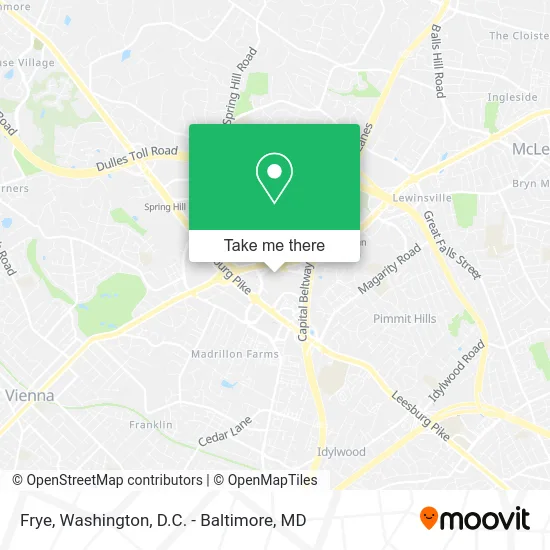
See Frye, Fairfax County, on the map
Public Transit to Frye in Fairfax County
Wondering how to get to Frye in Fairfax County? Moovit helps you find the best way to get to Frye with step-by-step directions from the nearest public transit station.
Moovit provides free maps and live directions to help you navigate through your city. View schedules, routes, timetables, and find out how long does it take to get to Frye in real time.
Looking for the nearest stop or station to Frye? Check out this list of stops closest to your destination: West Falls Church-Vt; Tysons+Bay G; Tysons Corner Metro Bay E; Tysons Corner Metro Bay F; International Dr And Tysons Corner Ct; Tysons Corner Metro Bay B; Tysons Corner Metro Bay C; Tysons Corner Metro Bay A; Tysons Corner Metro Station Departures; Greensboro.
Bus: 401, 798, A70, F20, 462, 467, 402, 721.Metro: SILVER, ORANGE.
Want to see if there’s another route that gets you there at an earlier time? Moovit helps you find alternative routes or times. Get directions from and directions to Frye easily from the Moovit App or Website.
We make riding to Frye easy, which is why over 1.5 million users, including users in Fairfax County, trust Moovit as the best app for public transit. You don’t need to download an individual bus app or train app, Moovit is your all-in-one transit app that helps you find the best bus time or train time available.
For information on prices of bus and metro, costs and ride fares to Frye, please check the Moovit app.
Use the app to navigate to popular places including to the airport, hospital, stadium, grocery store, mall, coffee shop, school, college, and university.
Frye Address: 1961 Chain Bridge Rd McLean, VA 22102 street in Fairfax County
- Tysons FC,
- GNC,
- True Classic - Tysons Corner,
- H&M,
- CF Gallery,
- Olivia Macaron,
- Primark,
- Diba Fresh,
- Wrap N Roll Tyson,
- CALZEDONIA,
- MANGO,
- Dhoom,
- Great American Restaurants,
- Bengbeng Chicken & Grill,
- Marhaba,
- Mo's Fried Chicken,
- Chopathi,
- Naan & Beyond,
- Taste of India,
- Moon & Rosie Studio
Places Near Frye (Fairfax County)
- Sibley Memorial Hospital, Washington,
- Camden Yards, Baltimore,
- Rock Creek Tennis Center, Washington,
- Marriott Marquis Washington, DC, Washington,
- The Anthem, Washington,
- Westfield Montgomery Mall, Montgomery County,
- Washington DC VA Medical Center, Washington,
- Amazon Hq2, Arlington County,
- Georgetown, Washington,
- Capital One Arena, Washington,
- M&T Bank Stadium, Baltimore,
- National Mall, Washington,
- National Zoo, Washington,
- Pennsylvania Ave NW (3rd st and pennsylvania), Washington,
- PG Mall, Prince George's County,
- Basilica of the National Shrine, Washington,
- Warner Theatre, Washington,
- National Museum of African American History and Culture, Washington,
- Museum Of The Bible, Washington,
- Washington National Cathedral, Washington
How to get to popular places in Washington, D.C. - Baltimore, MD with public transit
Get around Fairfax County by public transit!
Traveling around Fairfax County has never been so easy. See step by step directions as you travel to any attraction, street or major public transit station. View bus and train schedules, arrival times, service alerts and detailed routes on a map, so you know exactly how to get to anywhere in Fairfax County.
When traveling to any destination around Fairfax County use Moovit's Live Directions with Get Off Notifications to know exactly where and how far to walk, how long to wait for your line, and how many stops are left. Moovit will alert you when it's time to get off — no need to constantly re-check whether yours is the next stop.
Wondering how to use public transit in Fairfax County or how to pay for public transit in Fairfax County? Moovit public transit app can help you navigate your way with public transit easily, and at minimum cost. It includes public transit fees, ticket prices, and costs. Looking for a map of Fairfax County public transit lines? Moovit public transit app shows all public transit maps in Fairfax County with all Bus, Train, Metro, Light Rail and Ferry routes and stops on an interactive map.
Washington, D.C. - Baltimore, MD has 5 transit type(s), including: Bus, Train, Metro, Light Rail and Ferry, operated by several transit agencies, including WMATA, Montgomery County Ride On, Fairfax Connector, TheBus, PRTC, DASH - Alexandria, Arlington Transit (ART), RTA of Central Maryland, MDOT MTA, MDOT MTA Light RailLink, MDOT MTA Commuter Bus, MDOT MTA Local Bus, FXBGO!, Virginia Railway Express (VRE) and MARC