How to get to Ftmobility by bus?
Click on the bus route to see step by step directions with maps, line arrival times and updated time schedules.
From Walmart, North Bergen
67 minFrom Bergen Community College, Paramus
44 minFrom Belleville, NJ, Belleville
63 minFrom Englewood, NJ, Englewood
51 minFrom Fort Lee, NJ, Fort Lee
51 minFrom Holy Name Hospital, Teaneck
47 minFrom Walmart, Secaucus
97 minFrom American Dream, East Rutherford
62 minFrom Medieval Times Dinner & Tournament, Lyndhurst
55 minFrom Totowa, NJ, Totowa
49 min
Train stations near Ftmobility in Saddle Brook
Bus stops near Ftmobility in Saddle Brook
Bus lines to Ftmobility in Saddle Brook
What are the closest stations to Ftmobility?
The closest stations to Ftmobility are:
- Plauderville is 616 yards away, 8 min walk.
- 5th St 150' S Of Jefferson Ave. is 652 yards away, 9 min walk.
- Us-46 at Sixth St is 737 yards away, 10 min walk.
- Hackensack - Essex is 2073 yards away, 25 min walk.
Which bus lines stop near Ftmobility?
These bus lines stop near Ftmobility: 160, 161, 707, 712.
Which train line stops near Ftmobility?
MCL (Suffern)
What’s the nearest train station to Ftmobility in Saddle Brook?
The nearest train station to Ftmobility in Saddle Brook is Plauderville. It’s a 8 min walk away.
What’s the nearest bus station to Ftmobility in Saddle Brook?
The nearest bus station to Ftmobility in Saddle Brook is 5th St 150' S Of Jefferson Ave.. It’s a 9 min walk away.
What time is the first train to Ftmobility in Saddle Brook?
The PJL is the first train that goes to Ftmobility in Saddle Brook. It stops nearby at 5:40 AM.
What time is the last train to Ftmobility in Saddle Brook?
The PJL is the last train that goes to Ftmobility in Saddle Brook. It stops nearby at 1:08 AM.
What time is the first bus to Ftmobility in Saddle Brook?
The 161 is the first bus that goes to Ftmobility in Saddle Brook. It stops nearby at 4:21 AM.
What time is the last bus to Ftmobility in Saddle Brook?
The 161 is the last bus that goes to Ftmobility in Saddle Brook. It stops nearby at 1:47 AM.
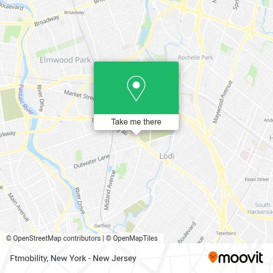
See Ftmobility, Saddle Brook, on the map
Public Transit to Ftmobility in Saddle Brook
Wondering how to get to Ftmobility in Saddle Brook? Moovit helps you find the best way to get to Ftmobility with step-by-step directions from the nearest public transit station.
Moovit provides free maps and live directions to help you navigate through your city. View schedules, routes, timetables, and find out how long does it take to get to Ftmobility in real time.
Looking for the nearest stop or station to Ftmobility? Check out this list of stops closest to your destination: Plauderville; 5th St 150' S Of Jefferson Ave.; Us-46 at Sixth St; Hackensack - Essex.
Bus: 160, 161, 707, 712, 151.Train: MCL, PJL, PVL.
Want to see if there’s another route that gets you there at an earlier time? Moovit helps you find alternative routes or times. Get directions from and directions to Ftmobility easily from the Moovit App or Website.
We make riding to Ftmobility easy, which is why over 1.5 million users, including users in Saddle Brook, trust Moovit as the best app for public transit. You don’t need to download an individual bus app or train app, Moovit is your all-in-one transit app that helps you find the best bus time or train time available.
For information on prices of bus and train, costs and ride fares to Ftmobility, please check the Moovit app.
Use the app to navigate to popular places including to the airport, hospital, stadium, grocery store, mall, coffee shop, school, college, and university.
Ftmobility Address: 255 US Highway 46 street in Saddle Brook
- Headmaster Automotive,
- 46 Furniture Gallery & Mattress,
- Rt46 Rims & Tires,
- Boldedge Garage Door Company,
- The Dispensary Of Saddle Brook,
- The Blvd Boutique,
- Care 49,
- Freightliner Service,
- Walmart,
- Hufnagel Landscaping,
- Royal Hibachi Buffet,
- 189 US-46 (RT-46),
- Blink,
- Powerhouse Gym Saddle Brook,
- Mishmash Catering,
- Minute Key,
- Sabor Latino Saddle Brook,
- Ecoatm,
- Home Base Furniture,
- Minutekey
Places Near Ftmobility (Saddle Brook)
- 3 Stone St, Manhattan,
- Times Square, Manhattan,
- Katz's Deli, Manhattan,
- Pier 83, Manhattan,
- Chinatown, Manhattan,
- 26 Federal Plaza, Manhattan,
- Bellevue Hospital, Manhattan,
- Queens Center Mall, Queens,
- Hudson Yards, Manhattan,
- qqqq, Manhattan,
- San Gennaro Feast, Manhattan,
- 66 John Street, Manhattan,
- 376 Hudson Street, Manhattan,
- 111 Centre New York City Supreme Court, Manhattan,
- Rockefeller Center, Manhattan,
- Mountainside Hospital, Glen Ridge,
- Wall Street, Manhattan,
- 911 Memorial, Manhattan,
- SoHo, Manhattan,
- 1 Police Plaza, Manhattan
How to get to popular places in New York - New Jersey with public transit
Get around Saddle Brook by public transit!
Traveling around Saddle Brook has never been so easy. See step by step directions as you travel to any attraction, street or major public transit station. View bus and train schedules, arrival times, service alerts and detailed routes on a map, so you know exactly how to get to anywhere in Saddle Brook.
When traveling to any destination around Saddle Brook use Moovit's Live Directions with Get Off Notifications to know exactly where and how far to walk, how long to wait for your line, and how many stops are left. Moovit will alert you when it's time to get off — no need to constantly re-check whether yours is the next stop.
Wondering how to use public transit in Saddle Brook or how to pay for public transit in Saddle Brook? Moovit public transit app can help you navigate your way with public transit easily, and at minimum cost. It includes public transit fees, ticket prices, and costs. Looking for a map of Saddle Brook public transit lines? Moovit public transit app shows all public transit maps in Saddle Brook with all Bus, Train, Subway, Light Rail, Ferry and Cable Car routes and stops on an interactive map.
New York - New Jersey has 6 transit type(s), including: Bus, Train, Subway, Light Rail, Ferry and Cable Car, operated by several transit agencies, including MTA Subway, Metro-North Railroad, LIRR, PATH, MTA New York City Transit - Express routes, MTA Bus, NJ Transit, NYC Ferry, NICE bus, Bee-Line Bus, NJ Transit Rail, Norwalk Transit District, Hartford Line, River Valley Transit and HART