How to get to Fucha by bus?
Click on the bus route to see step by step directions with maps, line arrival times and updated time schedules.
From TransMilenio: NQS - Calle 75, Barrios Unidos
54 minFrom Carrera 19a 76—34, Chapinero
58 minFrom Timiza, Kennedy
33 minFrom SITP Cafam Floresta, Engativá
55 minFrom Salud Total Americas, Puente Aranda
35 minFrom Parque Simon Bolivar, Ciudad Bolívar
43 minFrom Calle 77 13-35, Chapinero
57 minFrom Calle 77 / Calle 77 20C, Barrios Unidos
59 minFrom Candelaria La Nueva, Ciudad Bolívar
30 minFrom TransMilenio: Calle 76, Barrios Unidos
59 min
How to get to Fucha by cable car?
Click on the cable car route to see step by step directions with maps, line arrival times and updated time schedules.
From TransMilenio: NQS - Calle 75, Barrios Unidos
33 minFrom Carrera 19a 76—34, Chapinero
31 minFrom SITP Cafam Floresta, Engativá
75 minFrom Salud Total Americas, Puente Aranda
48 minFrom Calle 77 13-35, Chapinero
36 minFrom Calle 77 / Calle 77 20C, Barrios Unidos
35 minFrom Candelaria La Nueva, Ciudad Bolívar
47 minFrom TransMilenio: Calle 76, Barrios Unidos
28 min
Cable Car stations near Fucha in Antonio Nariño
Bus stops near Fucha in Antonio Nariño
- Estación Restrepo (Av. 1 De Mayo - Av. Caracas) (A), 6 min walk,VIEW
- Br. San José Sur (Av. 1 De Mayo - Kr 12g) (B), 6 min walk,VIEW
- Br. Olaya (Av. 1 De Mayo - Kr 16) (A), 6 min walk,VIEW
- Br. Restrepo (Kr 18 - Cl 18 Sur) (A), 6 min walk,VIEW
- Br. Restrepo (Kr 18 - Cl 17 Sur) (B), 6 min walk,VIEW
- Estación Restrepo (Av. 1 De Mayo - Kr 13) (B), 6 min walk,VIEW
- Br. Restrepo (Kr 19 - Cl 17 Sur), 8 min walk,VIEW
Bus lines to Fucha in Antonio Nariño
- P7, Porvenir,VIEW
- P24, Bosa San José,VIEW
- 111, Metrovivienda,VIEW
- 117, San Bernardino - Potreritos,VIEW
- 139, Bosa San José,VIEW
- C149, Bilbao,VIEW
- C155, Suba Gaitana,VIEW
- K331, Fontibón Brisas,VIEW
- G517, Potreritos,VIEW
- G529, Porvenir,VIEW
- 580, Bosa San José,VIEW
- C701, Parques De Bogotá,VIEW
- 786, Metrovivienda,VIEW
- H803, Sena NQS,VIEW
- G807, Bosa Carbonell,VIEW
- H811, Estación Restrepo,VIEW
- K812, Terminal Salitre,VIEW
- P24, San Blas,VIEW
- 60, Zarazota,VIEW
- L205, Lomas,VIEW
What are the closest stations to Fucha?
The closest stations to Fucha are:
- Restrepo is 140 meters away, 2 min walk.
- Estación Restrepo (Av. 1 De Mayo - Av. Caracas) (A) is 421 meters away, 6 min walk.
- Br. San José Sur (Av. 1 De Mayo - Kr 12g) (B) is 424 meters away, 6 min walk.
- Br. Olaya (Av. 1 De Mayo - Kr 16) (A) is 433 meters away, 6 min walk.
- Br. Restrepo (Kr 18 - Cl 18 Sur) (A) is 434 meters away, 6 min walk.
- Br. Restrepo (Kr 18 - Cl 17 Sur) (B) is 462 meters away, 6 min walk.
- Estación Restrepo (Av. 1 De Mayo - Kr 13) (B) is 463 meters away, 6 min walk.
- Br. Restrepo (Kr 19 - Cl 17 Sur) is 564 meters away, 8 min walk.
- Avenida 1° De Mayo is 568 meters away, 8 min walk.
- Nariño is 654 meters away, 9 min walk.
- Fucha is 1737 meters away, 23 min walk.
Which bus lines stop near Fucha?
These bus lines stop near Fucha: 60, A547, A620, L155, L205, L331, L533, L812, T12.
Which cable car lines stop near Fucha?
These cable car lines stop near Fucha: 3, B72, H72, H75.
What’s the nearest bus station to Fucha in Antonio Nariño?
The nearest bus stations to Fucha in Antonio Nariño are Estación Restrepo (Av. 1 De Mayo - Av. Caracas) (A), Br. San José Sur (Av. 1 De Mayo - Kr 12g) (B), Br. Olaya (Av. 1 De Mayo - Kr 16) (A), Br. Restrepo (Kr 18 - Cl 18 Sur) (A), Br. Restrepo (Kr 18 - Cl 17 Sur) (B) and Estación Restrepo (Av. 1 De Mayo - Kr 13) (B). The closest one is a 6 min walk away.
What’s the nearest cable car station to Fucha in Antonio Nariño?
The nearest cable car station to Fucha in Antonio Nariño is Restrepo. It’s a 2 min walk away.
What time is the first bus to Fucha in Antonio Nariño?
The K328 is the first bus that goes to Fucha in Antonio Nariño. It stops nearby at 4:00 AM.
What time is the last bus to Fucha in Antonio Nariño?
The A620 is the last bus that goes to Fucha in Antonio Nariño. It stops nearby at 11:26 PM.
What time is the first cable car to Fucha in Antonio Nariño?
The B72 is the first cable car that goes to Fucha in Antonio Nariño. It stops nearby at 4:08 AM.
What time is the last cable car to Fucha in Antonio Nariño?
The L25 is the last cable car that goes to Fucha in Antonio Nariño. It stops nearby at 10:45 PM.
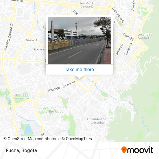
See Fucha, Antonio Nariño, on the map
Public Transit to Fucha in Antonio Nariño
Wondering how to get to Fucha in Antonio Nariño? Moovit helps you find the best way to get to Fucha with step-by-step directions from the nearest public transit station.
Moovit provides free maps and live directions to help you navigate through your city. View schedules, routes, timetables, and find out how long does it take to get to Fucha in real time.
Looking for the nearest stop or station to Fucha? Check out this list of stops closest to your destination: Restrepo; Estación Restrepo (Av. 1 De Mayo - Av. Caracas) (A); Br. San José Sur (Av. 1 De Mayo - Kr 12g) (B); Br. Olaya (Av. 1 De Mayo - Kr 16) (A); Br. Restrepo (Kr 18 - Cl 18 Sur) (A); Br. Restrepo (Kr 18 - Cl 17 Sur) (B); Estación Restrepo (Av. 1 De Mayo - Kr 13) (B); Br. Restrepo (Kr 19 - Cl 17 Sur); Avenida 1° De Mayo; Nariño; Fucha.
Bus: 60, A547, A620, L155, L205, L331, L533, L812, T12, P7, P24, 111, 117, 139, P24, L219, L312, 114A, F408, L602, P7, T30B, 111, 114A, 117, D205, D219, 614, A617.Cable Car: 3, B72, H72, H75, B13, H13, C17.
Want to see if there’s another route that gets you there at an earlier time? Moovit helps you find alternative routes or times. Get directions from and directions to Fucha easily from the Moovit App or Website.
We make riding to Fucha easy, which is why over 1.5 million users, including users in Antonio Nariño, trust Moovit as the best app for public transit. You don’t need to download an individual bus app or train app, Moovit is your all-in-one transit app that helps you find the best bus time or train time available.
For information on prices of bus and cable car, costs and ride fares to Fucha, please check the Moovit app.
Use the app to navigate to popular places including to the airport, hospital, stadium, grocery store, mall, coffee shop, school, college, and university.
Fucha Address: Avenida Carrera 14 street in Antonio Nariño
The simple station Fucha is part of the TransMilenio mass-transit system of Bogotá, Colombia, opened in the year 2000.Wiki

- Avenida Caracas # Calle 18 Sur,
- TransMilenio: Fucha,
- Danubio Azul,
- BANCO DAVIVIENDA S A,
- El Cielo Motel,
- Parque Central del Restrepo,
- Calle 10 Cra 22 Sur,
- Caracas 17-22 sur,
- Calle 17a Sur 12g - 21,
- Centro De Terapias Crea Y Recrea,
- Colegio Arteaga Muñoz,
- Droguería Colsubsidio Santa Librada,
- Calle 18a Sur # Carrera 12g,
- Calle 19 S / Avenida Carrera 14,
- Sol-Vidrios,
- Calle 19 Sur # Transmilenio,
- Importadora Sur Alpine,
- Calle 16AS 14-27 Sur,
- Musaraña Baby,
- Sur Alpine
Places Near Fucha (Antonio Nariño)
- Estacion Transmilenio Avenida Rojas,
- TransMilenio: Corferias, Teusaquillo,
- Titán Plaza, Engativá,
- Centro Comercial Parque La Colina, Suba,
- Hayuelos Centro Comercial, Fontibón,
- Terminal de Transportes - Salitre, Teusaquillo,
- Centro Comercial Mallplaza NQS, Los Mártires,
- TransMilenio: Museo del Oro, La Candelaria,
- Centro Comercial Plaza de las Américas, Kennedy,
- TransMilenio: Flores, Chapinero,
- Estacion Transmilenio Calle 76,
- Estacion Transmilenio Las Aguas,
- Estacion Transmilenio Los Heroes,
- Estacion Transmilenio Calle 92 Virrey,
- Estacion Transmilenio Calle 127,
- Estacion Transmilenio Calle 45,
- El Edén Centro Comercial, Kennedy,
- Estacion Transmilenio Calle 100 (Calle 103),
- Centro Mayor (Centro Comercial Centro Mayor), Antonio Nariño,
- Estacion Transmilenio Calle 85
How to get to popular places in Bogota with public transit
Get around Antonio Nariño by public transit!
Traveling around Antonio Nariño has never been so easy. See step by step directions as you travel to any attraction, street or major public transit station. View bus and train schedules, arrival times, service alerts and detailed routes on a map, so you know exactly how to get to anywhere in Antonio Nariño.
When traveling to any destination around Antonio Nariño use Moovit's Live Directions with Get Off Notifications to know exactly where and how far to walk, how long to wait for your line, and how many stops are left. Moovit will alert you when it's time to get off — no need to constantly re-check whether yours is the next stop.
Wondering how to use public transit in Antonio Nariño or how to pay for public transit in Antonio Nariño? Moovit public transit app can help you navigate your way with public transit easily, and at minimum cost. It includes public transit fees, ticket prices, and costs. Looking for a map of Antonio Nariño public transit lines? Moovit public transit app shows all public transit maps in Antonio Nariño with all Bus, Cable Car and Funicular routes and stops on an interactive map.
Bogota has 3 transit type(s), including: Bus, Cable Car and Funicular, operated by several transit agencies, including TransMiZonal, Buses Troncales, TransMiCable, Cerro de Monserrate, Aeropuerto El Dorado, Cootranscajicá Ltda., Flota Chia Ltda. and Auto Servicio Chía Ltda.