How to get to Fully Promoted by bus?
Click on the bus route to see step by step directions with maps, line arrival times and updated time schedules.
From Guinness Open Gate Brewery & Barrel House, Baltimore County
57 minFrom MVA Glen Burnie, Anne Arundel County
38 minFrom Reisterstown Road Plaza, Baltimore
63 minFrom Saint Agnes Hospital, Baltimore
33 minFrom I-695 @ Exit 17 (Security Blvd/MD 122), Baltimore County
39 minFrom Baltimore Polytechnic Institute, Baltimore
34 minFrom Walmart, Baltimore County
50 minFrom Pimlico Race Course, Baltimore
63 minFrom Bwi2 Employee Shuttles, Baltimore
16 minFrom NSA Friendship Annex (FANX), Anne Arundel County
77 min
How to get to Fully Promoted by train?
Click on the train route to see step by step directions with maps, line arrival times and updated time schedules.
How to get to Fully Promoted by metro?
Click on the metro route to see step by step directions with maps, line arrival times and updated time schedules.
Bus stops near Fully Promoted in Baltimore
Metro station near Fully Promoted in Baltimore
- Lexington Market Metro, 5 min walk,VIEW
Light Rail stations near Fully Promoted in Baltimore
- Lexington Market, 6 min walk,VIEW
Bus lines to Fully Promoted in Baltimore
- 120, Hopkins Hospital,VIEW
- 320, 320/7 Johns Hopkins,VIEW
- CITYLINK ORANGE, Essex - West Baltimore Marc,VIEW
- CITYLINK PURPLE, City Hall - Paradise/catonsville,VIEW
- CITYLINK RED, Downtown - Towson/lutherville,VIEW
- 71, Downtown - Patapsco Station,VIEW
- 78, Downtown - Cms,VIEW
- 105, Cedonia - Downtown,VIEW
- 150, Columbia - Downtown/harbor East,VIEW
- 40, Essex,VIEW
- 54, Clifton Park,VIEW
- 94, Fort Mchenry,VIEW
- 154, Hillendale,VIEW
- 163, W Baltimore Marc,VIEW
- CITYLINK NAVY, Baltimore Arena,VIEW
- 160, Johns Hopkins Hospital,VIEW
- 310, 310/4 Johns Hopkins,VIEW
What are the closest stations to Fully Promoted?
The closest stations to Fully Promoted are:
- Howard St & Lexington St Nb is 74 yards away, 1 min walk.
- Fayette St & Howard St is 107 yards away, 2 min walk.
- Fayette St & Eutaw St is 130 yards away, 2 min walk.
- Eutaw St & Fayette St Nb FS is 137 yards away, 2 min walk.
- Eutaw St & Lexington St FS Nb is 192 yards away, 3 min walk.
- Baltimore Arena Bay 1 is 278 yards away, 4 min walk.
- Baltimore St & Eutaw St FS Eb is 302 yards away, 4 min walk.
- Lexington Market Metro is 395 yards away, 5 min walk.
- Lexington Market is 468 yards away, 6 min walk.
Which bus lines stop near Fully Promoted?
These bus lines stop near Fully Promoted: 163, 51, 73, 76, 80, 94, CITYLINK BLUE, CITYLINK PURPLE, CITYLINK SILVER, CITYLINK YELLOW.
Which train line stops near Fully Promoted?
MARC (Inbound - Penn)
Which metro line stops near Fully Promoted?
METRO (Towards John Hopkins)
Which light rail line stops near Fully Promoted?
LIGHT RAILLINK (Northbound)
What’s the nearest light rail station to Fully Promoted in Baltimore?
The nearest light rail station to Fully Promoted in Baltimore is Lexington Market. It’s a 6 min walk away.
What’s the nearest metro station to Fully Promoted in Baltimore?
The nearest metro station to Fully Promoted in Baltimore is Lexington Market Metro. It’s a 5 min walk away.
What’s the nearest bus station to Fully Promoted in Baltimore?
The nearest bus station to Fully Promoted in Baltimore is Howard St & Lexington St Nb. It’s a 1 min walk away.
What time is the first light rail to Fully Promoted in Baltimore?
The LIGHT RAILLINK is the first light rail that goes to Fully Promoted in Baltimore. It stops nearby at 3:56 AM.
What time is the last light rail to Fully Promoted in Baltimore?
The LIGHT RAILLINK is the last light rail that goes to Fully Promoted in Baltimore. It stops nearby at 1:20 AM.
What time is the first metro to Fully Promoted in Baltimore?
The METRO is the first metro that goes to Fully Promoted in Baltimore. It stops nearby at 5:08 AM.
What time is the last metro to Fully Promoted in Baltimore?
The METRO is the last metro that goes to Fully Promoted in Baltimore. It stops nearby at 12:25 AM.
What time is the first bus to Fully Promoted in Baltimore?
The 163 is the first bus that goes to Fully Promoted in Baltimore. It stops nearby at 3:24 AM.
What time is the last bus to Fully Promoted in Baltimore?
The 54 is the last bus that goes to Fully Promoted in Baltimore. It stops nearby at 3:00 AM.
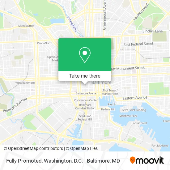
See Fully Promoted, Baltimore, on the map
Public Transit to Fully Promoted in Baltimore
Wondering how to get to Fully Promoted in Baltimore? Moovit helps you find the best way to get to Fully Promoted with step-by-step directions from the nearest public transit station.
Moovit provides free maps and live directions to help you navigate through your city. View schedules, routes, timetables, and find out how long does it take to get to Fully Promoted in real time.
Looking for the nearest stop or station to Fully Promoted? Check out this list of stops closest to your destination: Howard St & Lexington St Nb; Fayette St & Howard St; Fayette St & Eutaw St; Eutaw St & Fayette St Nb FS; Eutaw St & Lexington St FS Nb; Baltimore Arena Bay 1; Baltimore St & Eutaw St FS Eb; Lexington Market Metro; Lexington Market.
Bus: 163, 51, 73, 76, 80, 94, CITYLINK BLUE, CITYLINK PURPLE, CITYLINK SILVER, CITYLINK YELLOW, 120, 320, CITYLINK ORANGE, CITYLINK RED, 71, 78, 40, 54, 154.Train: MARC.Metro: METRO.Light Rail: LIGHT RAILLINK.
Want to see if there’s another route that gets you there at an earlier time? Moovit helps you find alternative routes or times. Get directions from and directions to Fully Promoted easily from the Moovit App or Website.
We make riding to Fully Promoted easy, which is why over 1.5 million users, including users in Baltimore, trust Moovit as the best app for public transit. You don’t need to download an individual bus app or train app, Moovit is your all-in-one transit app that helps you find the best bus time or train time available.
For information on prices of bus, light rail, metro and train, costs and ride fares to Fully Promoted, please check the Moovit app.
Use the app to navigate to popular places including to the airport, hospital, stadium, grocery store, mall, coffee shop, school, college, and university.
Fully Promoted Address: 114 N Howard St Baltimore, MD 21201 street in Baltimore
- Baltimore Cell Phone Repair by Forever Wireless,
- Global Jewelers,
- The Atrium Apartments,
- Rainbowshops,
- Howard St & Fayette St NB,
- Sawadogo,
- N Eutaw St (eutaw and fayette),
- Lexington Market Station Light RailLink,
- CRS Español,
- Dragon Bowl - Lex,
- Black Acres Roastery,
- Show Parking,
- Tossed Together,
- Harp Vision,
- Kokee Tea,
- Dosirock,
- Platinum Amala,
- Ovenbird Bakery,
- Lexington Market Metro Station,
- UPS
Places Near Fully Promoted (Baltimore)
- Museum Of The Bible, Washington,
- Marriott Marquis Washington, DC, Washington,
- Amazon Hq2, Arlington County,
- Warner Theatre, Washington,
- Sibley Memorial Hospital, Washington,
- Pennsylvania Ave NW (3rd st and pennsylvania), Washington,
- National Museum of African American History and Culture, Washington,
- Washington DC VA Medical Center, Washington,
- M&T Bank Stadium, Baltimore,
- Westfield Montgomery Mall, Montgomery County,
- Capital One Arena, Washington,
- PG Mall, Prince George's County,
- National Theatre, Washington,
- Basilica of the National Shrine, Washington,
- Washington National Cathedral, Washington,
- Rock Creek Tennis Center, Washington,
- The Anthem, Washington,
- Georgetown, Washington,
- National Zoo, Washington,
- Camden Yards, Baltimore
How to get to popular places in Washington, D.C. - Baltimore, MD with public transit
Get around Baltimore by public transit!
Traveling around Baltimore has never been so easy. See step by step directions as you travel to any attraction, street or major public transit station. View bus and train schedules, arrival times, service alerts and detailed routes on a map, so you know exactly how to get to anywhere in Baltimore.
When traveling to any destination around Baltimore use Moovit's Live Directions with Get Off Notifications to know exactly where and how far to walk, how long to wait for your line, and how many stops are left. Moovit will alert you when it's time to get off — no need to constantly re-check whether yours is the next stop.
Wondering how to use public transit in Baltimore or how to pay for public transit in Baltimore? Moovit public transit app can help you navigate your way with public transit easily, and at minimum cost. It includes public transit fees, ticket prices, and costs. Looking for a map of Baltimore public transit lines? Moovit public transit app shows all public transit maps in Baltimore with all Bus, Train, Metro, Light Rail and Ferry routes and stops on an interactive map.
Washington, D.C. - Baltimore, MD has 5 transit type(s), including: Bus, Train, Metro, Light Rail and Ferry, operated by several transit agencies, including WMATA, Montgomery County Ride On, Fairfax Connector, TheBus, PRTC, DASH - Alexandria, Arlington Transit (ART), RTA of Central Maryland, MDOT MTA, MDOT MTA Light RailLink, MDOT MTA Commuter Bus, MDOT MTA Local Bus, FXBGO!, Virginia Railway Express (VRE) and MARC