How to get to Fun+Cute by bus?
Click on the bus route to see step by step directions with maps, line arrival times and updated time schedules.
From Northern Blvd, Queens
58 minFrom Harlem Hospital, Manhattan
69 minFrom Queens Center Mall, Queens
49 minFrom Glendale, NY, Queens
69 minFrom Columbia University, Manhattan
79 minFrom American Museum of Natural History, Manhattan
52 minFrom Newport Mall Bus, Jersey City
81 minFrom Sojo Spa Club, Edgewater
58 minFrom Bergenline NJ, West New York
54 min
How to get to Fun+Cute by train?
Click on the train route to see step by step directions with maps, line arrival times and updated time schedules.
How to get to Fun+Cute by subway?
Click on the subway route to see step by step directions with maps, line arrival times and updated time schedules.
Bus stops near Fun+Cute in Manhattan
Subway station near Fun+Cute in Manhattan
- 14 St-Union Sq, 3 min walk,VIEW
Bus lines to Fun+Cute in Manhattan
- SIM7, Eltvlle Trans Ctr Via Hylan Via Richmond,VIEW
- SIM9, Eltingville Via F Cap Via Hylan Bl,VIEW
- SIM33, Mariners Harbor Via N Gannon Av,VIEW
- SIM33C, Mariners Harbor Via N Gannon Av,VIEW
- M1, Soho Centre St Via 5 Av/ Via Broadway,VIEW
- M55, South Ferry,VIEW
- M2, East Village 8 St Via 5 Av,VIEW
- M3, 125 St St. Nicholas Av,VIEW
- SIM1C, Eltngvlle Trans Ctr Via Hylan Via Rich,VIEW
- SIM3C, Pt Rchmnd Via Narrows Rd N Via Watchogue,VIEW
- SIM4C, Huguenot Via Richmond Av Via Arthur Kill,VIEW
- X27, Bay Ridge Shore Rd Via Broadway,VIEW
- X28, Coney Island Sea Gate Via Broadway,VIEW
- DOWNTOWN LOCAL, W Houston & Mercer St,VIEW
- M8, West St Crosstown,VIEW
- M101, Ft George Via 3 Av Via Amsterdam Av,VIEW
- M102, Harlem 147 St Via 3 Av Via Lenox Av,VIEW
What are the closest stations to Fun+Cute?
The closest stations to Fun+Cute are:
- Broadway/Waverly Pl is 108 yards away, 2 min walk.
- 4 Av/E 10 St is 137 yards away, 2 min walk.
- Broadway & Waverly Pl is 153 yards away, 3 min walk.
- E 9 St/4 Av is 238 yards away, 3 min walk.
- 14 St-Union Sq is 241 yards away, 3 min walk.
- Astor Pl/Cooper Sq East is 314 yards away, 4 min walk.
Which bus lines stop near Fun+Cute?
These bus lines stop near Fun+Cute: M1, M8.
Which train lines stop near Fun+Cute?
These train lines stop near Fun+Cute: 2, YEL.
Which subway lines stop near Fun+Cute?
These subway lines stop near Fun+Cute: L, R, W.
What’s the nearest subway station to Fun+Cute in Manhattan?
The nearest subway station to Fun+Cute in Manhattan is 14 St-Union Sq. It’s a 3 min walk away.
What’s the nearest bus station to Fun+Cute in Manhattan?
The nearest bus stations to Fun+Cute in Manhattan are Broadway/Waverly Pl and 4 Av/E 10 St. The closest one is a 2 min walk away.
What time is the first subway to Fun+Cute in Manhattan?
The 6 is the first subway that goes to Fun+Cute in Manhattan. It stops nearby at 3:00 AM.
What time is the last subway to Fun+Cute in Manhattan?
The N is the last subway that goes to Fun+Cute in Manhattan. It stops nearby at 3:55 AM.
What time is the first bus to Fun+Cute in Manhattan?
The M2 is the first bus that goes to Fun+Cute in Manhattan. It stops nearby at 3:00 AM.
What time is the last bus to Fun+Cute in Manhattan?
The M2 is the last bus that goes to Fun+Cute in Manhattan. It stops nearby at 3:01 AM.
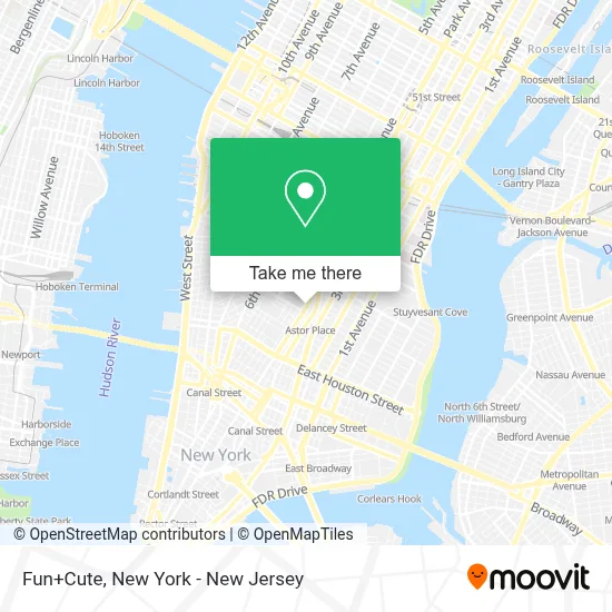
See Fun+Cute, Manhattan, on the map
Public Transit to Fun+Cute in Manhattan
Wondering how to get to Fun+Cute in Manhattan? Moovit helps you find the best way to get to Fun+Cute with step-by-step directions from the nearest public transit station.
Moovit provides free maps and live directions to help you navigate through your city. View schedules, routes, timetables, and find out how long does it take to get to Fun+Cute in real time.
Looking for the nearest stop or station to Fun+Cute? Check out this list of stops closest to your destination: Broadway/Waverly Pl; 4 Av/E 10 St; Broadway & Waverly Pl; E 9 St/4 Av; 14 St-Union Sq; Astor Pl/Cooper Sq East.
Bus: M1, M8, M2, M3, SIM7, SIM9, SIM33, SIM33C, M55, SIM1C, SIM3C, SIM4C, X27, X28.Train: 2, YEL.Subway: L, R, W, N, Q.
Want to see if there’s another route that gets you there at an earlier time? Moovit helps you find alternative routes or times. Get directions from and directions to Fun+Cute easily from the Moovit App or Website.
We make riding to Fun+Cute easy, which is why over 1.5 million users, including users in Manhattan, trust Moovit as the best app for public transit. You don’t need to download an individual bus app or train app, Moovit is your all-in-one transit app that helps you find the best bus time or train time available.
For information on prices of subway, bus and train, costs and ride fares to Fun+Cute, please check the Moovit app.
Use the app to navigate to popular places including to the airport, hospital, stadium, grocery store, mall, coffee shop, school, college, and university.
Fun+Cute Address: 769 Broadway street in Manhattan
- Broadway (broadway / E 9th St),
- Western Union,
- movie2k,
- Ups Alliance Shipping Partner,
- Hsbc Bank,
- Wells Fargo Bank,
- Dileadgen,
- Amazon Locker - Mah,
- Shefu Choice,
- Keyme Locksmiths,
- Brilliant Drinker - the Best Na Beer on Market,
- Wrap Dance Floor,
- Men Of Legends,
- Ups Access Point Location,
- Imd Insurance Agency Llc,
- J&C Tax Prep Services Llc,
- Party City,
- Love, Melissa,
- Podabela Tax Services,
- Instagram New York
Places Near Fun+Cute (Manhattan)
- 376 Hudson Street, Manhattan,
- Times Square, Manhattan,
- Chinatown, Manhattan,
- 1 Police Plaza, Manhattan,
- SoHo, Manhattan,
- 111 Centre New York City Supreme Court, Manhattan,
- 911 Memorial, Manhattan,
- Pier 83, Manhattan,
- 66 John Street, Manhattan,
- 26 Federal Plaza, Manhattan,
- Queens Center Mall, Queens,
- Wall Street, Manhattan,
- Bellevue Hospital, Manhattan,
- qqqq, Manhattan,
- Rockefeller Center, Manhattan,
- Mountainside Hospital, Glen Ridge,
- San Gennaro Feast, Manhattan,
- Katz's Deli, Manhattan,
- 3 Stone St, Manhattan,
- Hudson Yards, Manhattan
How to get to popular places in New York - New Jersey with public transit
Get around Manhattan by public transit!
Traveling around Manhattan has never been so easy. See step by step directions as you travel to any attraction, street or major public transit station. View bus and train schedules, arrival times, service alerts and detailed routes on a map, so you know exactly how to get to anywhere in Manhattan.
When traveling to any destination around Manhattan use Moovit's Live Directions with Get Off Notifications to know exactly where and how far to walk, how long to wait for your line, and how many stops are left. Moovit will alert you when it's time to get off — no need to constantly re-check whether yours is the next stop.
Wondering how to use public transit in Manhattan or how to pay for public transit in Manhattan? Moovit public transit app can help you navigate your way with public transit easily, and at minimum cost. It includes public transit fees, ticket prices, and costs. Looking for a map of Manhattan public transit lines? Moovit public transit app shows all public transit maps in Manhattan with all Bus, Train, Subway, Light Rail, Ferry and Cable Car routes and stops on an interactive map.
New York - New Jersey has 6 transit type(s), including: Bus, Train, Subway, Light Rail, Ferry and Cable Car, operated by several transit agencies, including MTA Subway, Metro-North Railroad, LIRR, PATH, MTA New York City Transit - Express routes, MTA Bus, NJ Transit, NYC Ferry, NICE bus, Bee-Line Bus, NJ Transit Rail, Norwalk Transit District, Hartford Line, River Valley Transit and HART