Directions to Funky do (Do Funky) (Frederick) with public transportation
The following transit lines have routes that pass near Funky do (Do Funky)
 Bus: 20, 60, EAST FREDERICK SHUTTLE.
- Train: MARC.
How to get to Funky do (Do Funky) by bus?
Click on the bus route to see step by step directions with maps, line arrival times and updated time schedules.
From Clarksburg Premium Outlets, Montgomery County
313 minFrom I-270 Exit 10 (Clopper Rd. / West Diamond Ave.), Montgomery County
127 minFrom Kaiser Permanente - Gaithersburg Medical Center, Montgomery County
162 minFrom Walmart Supercenter, Montgomery County
184 minFrom Kentlands, Montgomery County
135 minFrom Montgomery County Fairgrounds, Montgomery County
160 minFrom Astrazeneca HQ, Montgomery County
138 minFrom Clarksburg Premium Outlets, Montgomery County
356 minFrom Montgomery Village, Maryland, Montgomery County
142 minFrom Germantown, Maryland, Montgomery County
177 min
How to get to Funky do (Do Funky) by train?
Click on the train route to see step by step directions with maps, line arrival times and updated time schedules.
Bus stops near Funky do (Do Funky) in Frederick
Train station near Funky do (Do Funky) in Frederick
- Frederick Marc Eb, 21 min walk,VIEW
Bus lines to Funky do (Do Funky) in Frederick
What are the closest stations to Funky do (Do Funky)?
The closest stations to Funky do (Do Funky) are:
- East Patrick Street at East Gate Plaza (Roy Rogers) is 96 yards away, 2 min walk.
- Taco Bell is 394 yards away, 5 min walk.
- Frederick Marc Eb is 1730 yards away, 21 min walk.
Which bus line stops near Funky do (Do Funky)?
20 (Transit Center)
Which train line stops near Funky do (Do Funky)?
MARC (Inbound - Brunswick)
What’s the nearest train station to Funky do (Do Funky) in Frederick?
The nearest train station to Funky do (Do Funky) in Frederick is Frederick Marc Eb. It’s a 21 min walk away.
What’s the nearest bus station to Funky do (Do Funky) in Frederick?
The nearest bus station to Funky do (Do Funky) in Frederick is East Patrick Street at East Gate Plaza (Roy Rogers). It’s a 2 min walk away.
What time is the first train to Funky do (Do Funky) in Frederick?
The MARC is the first train that goes to Funky do (Do Funky) in Frederick. It stops nearby at 5:00 AM.
What time is the last train to Funky do (Do Funky) in Frederick?
The MARC is the last train that goes to Funky do (Do Funky) in Frederick. It stops nearby at 8:21 PM.
What time is the first bus to Funky do (Do Funky) in Frederick?
The 60 is the first bus that goes to Funky do (Do Funky) in Frederick. It stops nearby at 6:17 AM.
What time is the last bus to Funky do (Do Funky) in Frederick?
The 60 is the last bus that goes to Funky do (Do Funky) in Frederick. It stops nearby at 9:22 PM.
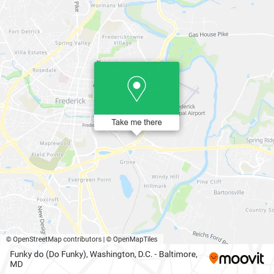
See Funky do (Do Funky), Frederick, on the map
Public Transit to Funky do (Do Funky) in Frederick
Wondering how to get to Funky do (Do Funky) in Frederick? Moovit helps you find the best way to get to Funky do (Do Funky) with step-by-step directions from the nearest public transit station.
Moovit provides free maps and live directions to help you navigate through your city. View schedules, routes, timetables, and find out how long does it take to get to Funky do (Do Funky) in real time.
Looking for the nearest stop or station to Funky do (Do Funky)? Check out this list of stops closest to your destination: East Patrick Street at East Gate Plaza (Roy Rogers); Taco Bell; Frederick Marc Eb.
Bus: 20, 60, EAST FREDERICK SHUTTLE.Train: MARC.
Want to see if there’s another route that gets you there at an earlier time? Moovit helps you find alternative routes or times. Get directions from and directions to Funky do (Do Funky) easily from the Moovit App or Website.
We make riding to Funky do (Do Funky) easy, which is why over 1.5 million users, including users in Frederick, trust Moovit as the best app for public transit. You don’t need to download an individual bus app or train app, Moovit is your all-in-one transit app that helps you find the best bus time or train time available.
For information on prices of bus and train, costs and ride fares to Funky do (Do Funky), please check the Moovit app.
Get to Funky do (Do Funky) with public transit and pay for the ride in the Moovit app. In addition to all info you may need for your trip to Funky do (Do Funky), including live directions, real-time arrivals and fare prices, you can also buy public transit passes for your rides. No need for cash or paper tickets to get to Funky do (Do Funky) - everything you need is accessible in the app with a click of the button.
Use the app to navigate to popular places including to the airport, hospital, stadium, grocery store, mall, coffee shop, school, college, and university.
Funky do (Do Funky) Address: 1202 E Patrick St street in Frederick
- Liberty Tax Service,
- Fredericktowne Eye Care,
- T-Mobile,
- 2a Guns & Ammo,
- Apex Motor and Garage,
- German American Bank Itm,
- McDonald's,
- Credit Union 1,
- Copy Systems,
- Whipsmart Marketing,
- Better Smiles Family,
- Sump & Sewage Systems MD VA DC,
- Preventative Maintenance,
- ROYAL FARMS,
- Coin Cloud Bitcoin ATM,
- Aqces International,
- Rocket Rooter Plumbing,
- Hard Times Cafe,
- Mark's Equipment Service,
- Penske Auto Center
Places Near Funky do (Do Funky) (Frederick)
- Georgetown, Washington,
- Capital One Arena, Washington,
- National Mall, Washington,
- Camden Yards, Baltimore,
- Amazon Hq2, Arlington County,
- Pennsylvania Ave NW (3rd st and pennsylvania), Washington,
- Rock Creek Tennis Center, Washington,
- M&T Bank Stadium, Baltimore,
- National Zoo, Washington,
- Westfield Montgomery Mall, Montgomery County,
- Museum Of The Bible, Washington,
- Sibley Memorial Hospital, Washington,
- Washington National Cathedral, Washington,
- Basilica of the National Shrine, Washington,
- Marriott Marquis Washington, DC, Washington,
- Washington DC VA Medical Center, Washington,
- Warner Theatre, Washington,
- PG Mall, Prince George's County,
- National Museum of African American History and Culture, Washington,
- The Anthem, Washington
How to get to popular places in Washington, D.C. - Baltimore, MD with public transit
Get around Frederick by public transit!
Traveling around Frederick has never been so easy. See step by step directions as you travel to any attraction, street or major public transit station. View bus and train schedules, arrival times, service alerts and detailed routes on a map, so you know exactly how to get to anywhere in Frederick.
When traveling to any destination around Frederick use Moovit's Live Directions with Get Off Notifications to know exactly where and how far to walk, how long to wait for your line, and how many stops are left. Moovit will alert you when it's time to get off — no need to constantly re-check whether yours is the next stop.
Wondering how to use public transit in Frederick or how to pay for public transit in Frederick? Moovit public transit app can help you navigate your way with public transit easily, and at minimum cost. It includes public transit fees, ticket prices, and costs. Looking for a map of Frederick public transit lines? Moovit public transit app shows all public transit maps in Frederick with all Bus, Train, Metro, Light Rail and Ferry routes and stops on an interactive map.
Washington, D.C. - Baltimore, MD has 5 transit type(s), including: Bus, Train, Metro, Light Rail and Ferry, operated by several transit agencies, including WMATA, Montgomery County Ride On, Fairfax Connector, TheBus, PRTC, DASH - Alexandria, Arlington Transit (ART), RTA of Central Maryland, MDOT MTA, MDOT MTA Light RailLink, MDOT MTA Commuter Bus, MDOT MTA Local Bus, FXBGO!, Virginia Railway Express (VRE) and MARC