Directions to Fusing Education (Queens) with public transportation
The following transit lines have routes that pass near Fusing Education
 Bus: Q101, Q32, Q63, Q102.
- Train: FAR ROCKAWAY BRANCH, LONG BEACH BRANCH, PORT WASHINGTON BRANCH.
- Subway: M, R, N, W, 7.
How to get to Fusing Education by bus?
Click on the bus route to see step by step directions with maps, line arrival times and updated time schedules.
From Parkchester, Bronx
83 minFrom Armory (Track), Manhattan
99 minFrom One Liberty Plaza, Manhattan
71 minFrom 391,E 149th St E 149th St, Bronx
75 minFrom W 72nd St / Broadway, Manhattan
46 minFrom Armory Track & Field, Manhattan
99 minFrom Bullpen Entrance Citi Field, Queens
51 minFrom The Shed, Manhattan
59 minFrom 961 E 174th St, Bronx
115 min
How to get to Fusing Education by train?
Click on the train route to see step by step directions with maps, line arrival times and updated time schedules.
How to get to Fusing Education by subway?
Click on the subway route to see step by step directions with maps, line arrival times and updated time schedules.
From Parkchester, Bronx
60 minFrom Armory (Track), Manhattan
57 minFrom One Liberty Plaza, Manhattan
42 minFrom 391,E 149th St E 149th St, Bronx
43 minFrom W 72nd St / Broadway, Manhattan
34 minFrom Armory Track & Field, Manhattan
57 minFrom Bullpen Entrance Citi Field, Queens
32 minFrom The Shed, Manhattan
34 minFrom 961 E 174th St, Bronx
67 min
Bus stops near Fusing Education in Queens
Subway stations near Fusing Education in Queens
Bus lines to Fusing Education in Queens
What are the closest stations to Fusing Education?
The closest stations to Fusing Education are:
- Northern Blvd/37 St is 223 yards away, 3 min walk.
- 31 St/39 Av is 401 yards away, 5 min walk.
- 35 Av/35 St is 412 yards away, 5 min walk.
- 39 Av-Dutch Kills is 839 yards away, 10 min walk.
- 33 St-Rawson St is 875 yards away, 11 min walk.
- Queens Plaza is 1246 yards away, 15 min walk.
- 36 St is 1890 yards away, 23 min walk.
Which bus lines stop near Fusing Education?
These bus lines stop near Fusing Education: Q101, Q32, Q63.
Which train lines stop near Fusing Education?
These train lines stop near Fusing Education: FAR ROCKAWAY BRANCH, LONG BEACH BRANCH, PORT WASHINGTON BRANCH.
Which subway lines stop near Fusing Education?
These subway lines stop near Fusing Education: M, R.
What’s the nearest subway station to Fusing Education in Queens?
The nearest subway station to Fusing Education in Queens is 39 Av-Dutch Kills. It’s a 10 min walk away.
What’s the nearest bus station to Fusing Education in Queens?
The nearest bus station to Fusing Education in Queens is Northern Blvd/37 St. It’s a 3 min walk away.
What time is the first subway to Fusing Education in Queens?
The E is the first subway that goes to Fusing Education in Queens. It stops nearby at 3:00 AM.
What time is the last subway to Fusing Education in Queens?
The F is the last subway that goes to Fusing Education in Queens. It stops nearby at 3:45 AM.
What time is the first bus to Fusing Education in Queens?
The Q101 is the first bus that goes to Fusing Education in Queens. It stops nearby at 3:09 AM.
What time is the last bus to Fusing Education in Queens?
The Q66 is the last bus that goes to Fusing Education in Queens. It stops nearby at 3:17 AM.
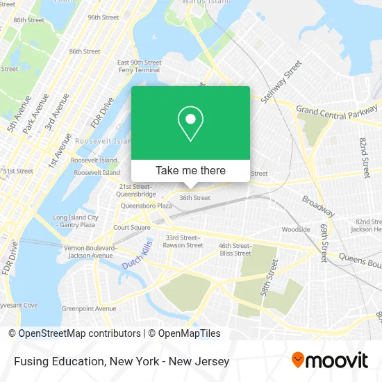
See Fusing Education, Queens, on the map
Public Transit to Fusing Education in Queens
Wondering how to get to Fusing Education in Queens? Moovit helps you find the best way to get to Fusing Education with step-by-step directions from the nearest public transit station.
Moovit provides free maps and live directions to help you navigate through your city. View schedules, routes, timetables, and find out how long does it take to get to Fusing Education in real time.
Looking for the nearest stop or station to Fusing Education? Check out this list of stops closest to your destination: Northern Blvd/37 St; 31 St/39 Av; 35 Av/35 St; 39 Av-Dutch Kills; 33 St-Rawson St; Queens Plaza; 36 St.
Bus: Q101, Q32, Q63, Q102.Train: FAR ROCKAWAY BRANCH, LONG BEACH BRANCH, PORT WASHINGTON BRANCH.Subway: M, R, N, W, 7, 7X, E, F, FX.
Want to see if there’s another route that gets you there at an earlier time? Moovit helps you find alternative routes or times. Get directions from and directions to Fusing Education easily from the Moovit App or Website.
We make riding to Fusing Education easy, which is why over 1.5 million users, including users in Queens, trust Moovit as the best app for public transit. You don’t need to download an individual bus app or train app, Moovit is your all-in-one transit app that helps you find the best bus time or train time available.
For information on prices of subway, bus, train and ferry, costs and ride fares to Fusing Education, please check the Moovit app.
Use the app to navigate to popular places including to the airport, hospital, stadium, grocery store, mall, coffee shop, school, college, and university.
Fusing Education Address: 34-18 Northern Blvd street in Queens
- Olliver Law Firm,
- Masarwings,
- Blue Box Moving,
- N E International Realty,
- Sync Construction,
- Trice Building Restoration,
- Lingo,
- Vava Info,
- Lw Lettering & Wraps,
- Sanacion Sobrenatural,
- Vitality Counseling Services,
- Law Office Of Ibrahim B. Shatara,
- Constructive Realty,
- Absolute Private Services,
- Primcast,
- Taxsmartny,
- Bowery Bay Creative,
- Desvarieux Law Group,
- Nycp Realty,
- Triumph Electrical Contracting
Places Near Fusing Education (Queens)
- 1 Police Plaza, Manhattan,
- Pier 83, Manhattan,
- 111 Centre New York City Supreme Court, Manhattan,
- 376 Hudson Street, Manhattan,
- Times Square, Manhattan,
- San Gennaro Feast, Manhattan,
- Queens Center Mall, Queens,
- Wall Street, Manhattan,
- Hudson Yards, Manhattan,
- Katz's Deli, Manhattan,
- qqqq, Manhattan,
- Chinatown, Manhattan,
- Bellevue Hospital, Manhattan,
- 911 Memorial, Manhattan,
- Rockefeller Center, Manhattan,
- 26 Federal Plaza, Manhattan,
- SoHo, Manhattan,
- 66 John Street, Manhattan,
- Mountainside Hospital, Glen Ridge,
- 3 Stone St, Manhattan
How to get to popular places in New York - New Jersey with public transit
Get around Queens by public transit!
Traveling around Queens has never been so easy. See step by step directions as you travel to any attraction, street or major public transit station. View bus and train schedules, arrival times, service alerts and detailed routes on a map, so you know exactly how to get to anywhere in Queens.
When traveling to any destination around Queens use Moovit's Live Directions with Get Off Notifications to know exactly where and how far to walk, how long to wait for your line, and how many stops are left. Moovit will alert you when it's time to get off — no need to constantly re-check whether yours is the next stop.
Wondering how to use public transit in Queens or how to pay for public transit in Queens? Moovit public transit app can help you navigate your way with public transit easily, and at minimum cost. It includes public transit fees, ticket prices, and costs. Looking for a map of Queens public transit lines? Moovit public transit app shows all public transit maps in Queens with all Bus, Train, Subway, Light Rail, Ferry and Cable Car routes and stops on an interactive map.
New York - New Jersey has 6 transit type(s), including: Bus, Train, Subway, Light Rail, Ferry and Cable Car, operated by several transit agencies, including MTA Subway, Metro-North Railroad, LIRR, PATH, MTA New York City Transit - Express routes, MTA Bus, NJ Transit, NYC Ferry, NICE bus, Bee-Line Bus, NJ Transit Rail, Norwalk Transit District, Hartford Line, River Valley Transit and HART