How to get to Fusion Tech by bus?
Click on the bus route to see step by step directions with maps, line arrival times and updated time schedules.
From Oakton, Virginia, Fairfax County
101 minFrom Centreville, VA, Fairfax County
89 minFrom National Reconnaissance Office, Fairfax County
61 minFrom Spa World, Fairfax County
93 minFrom Vienna, Virginia, Fairfax County
97 minFrom Fair Oaks Mall, Fairfax County
45 minFrom Inova Fair Oaks Hospital, Fairfax County
32 minFrom Ashby Ponds, Loudoun County
98 minFrom Northern Virginia Community College - Loudoun Campus, Loudoun County
56 minFrom Hollywood Casino at Charles Town Races, Fairfax County
37 min
Bus stops near Fusion Tech in Fairfax County
Metro station near Fusion Tech in Fairfax County
- Herndon, 13 min walk,VIEW
Bus lines to Fusion Tech in Fairfax County
What are the closest stations to Fusion Tech?
The closest stations to Fusion Tech are:
- Fox Mill Rd & Mill Heights Dr is 785 yards away, 10 min walk.
- Monroe St @ Monroe Manor Dr is 855 yards away, 11 min walk.
- Herndon is 1113 yards away, 13 min walk.
Which bus lines stop near Fusion Tech?
These bus lines stop near Fusion Tech: 553, 901, 924.
What’s the nearest metro station to Fusion Tech in Fairfax County?
The nearest metro station to Fusion Tech in Fairfax County is Herndon. It’s a 13 min walk away.
What’s the nearest bus station to Fusion Tech in Fairfax County?
The nearest bus station to Fusion Tech in Fairfax County is Fox Mill Rd & Mill Heights Dr. It’s a 10 min walk away.
What time is the first metro to Fusion Tech in Fairfax County?
The SILVER is the first metro that goes to Fusion Tech in Fairfax County. It stops nearby at 5:04 AM.
What time is the last metro to Fusion Tech in Fairfax County?
The SILVER is the last metro that goes to Fusion Tech in Fairfax County. It stops nearby at 12:58 AM.
What time is the first bus to Fusion Tech in Fairfax County?
The 924 is the first bus that goes to Fusion Tech in Fairfax County. It stops nearby at 5:32 AM.
What time is the last bus to Fusion Tech in Fairfax County?
The 924 is the last bus that goes to Fusion Tech in Fairfax County. It stops nearby at 9:35 PM.
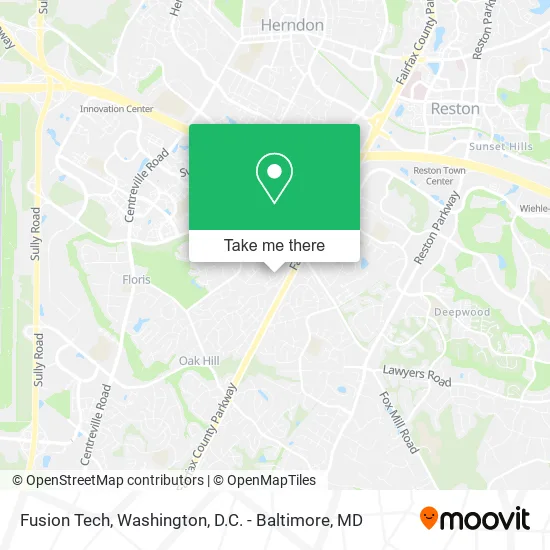
See Fusion Tech, Fairfax County, on the map
Public Transit to Fusion Tech in Fairfax County
Wondering how to get to Fusion Tech in Fairfax County? Moovit helps you find the best way to get to Fusion Tech with step-by-step directions from the nearest public transit station.
Moovit provides free maps and live directions to help you navigate through your city. View schedules, routes, timetables, and find out how long does it take to get to Fusion Tech in real time.
Looking for the nearest stop or station to Fusion Tech? Check out this list of stops closest to your destination: Fox Mill Rd & Mill Heights Dr; Monroe St @ Monroe Manor Dr; Herndon.
Bus: 553, 901, 924.Metro: SILVER.
Want to see if there’s another route that gets you there at an earlier time? Moovit helps you find alternative routes or times. Get directions from and directions to Fusion Tech easily from the Moovit App or Website.
We make riding to Fusion Tech easy, which is why over 1.5 million users, including users in Fairfax County, trust Moovit as the best app for public transit. You don’t need to download an individual bus app or train app, Moovit is your all-in-one transit app that helps you find the best bus time or train time available.
For information on prices of bus and metro, costs and ride fares to Fusion Tech, please check the Moovit app.
Use the app to navigate to popular places including to the airport, hospital, stadium, grocery store, mall, coffee shop, school, college, and university.
Fusion Tech Address: 2506 Camberwell Ct Herndon, VA 20171 street in Fairfax County
- Polytopia,
- AAA Quality Home Improvement,
- U.S. Patent and Trademark Office,
- Lereche,
- Cullen Painting & Sandblasting,
- Sonies, J M, Attorney,
- Healing Hands Reiki,
- Northern Virginia Real Estate,
- Eleven Point Two,
- Krystal Long,
- Plumbing Water Filtration Systems Plumbers,
- Kavitech,
- Delta4 Consulting,
- Sprout Montessori,
- Fairfax County Parkway Trail,
- McNair Upper Elementary,
- Art in Hand,
- My Nova Contractor,
- Waldo Gutierrez,
- Flat Rate Computer Solutions
Places Near Fusion Tech (Fairfax County)
- The Anthem, Washington,
- National Zoo, Washington,
- Rock Creek Tennis Center, Washington,
- Westfield Montgomery Mall, Montgomery County,
- Warner Theatre, Washington,
- Marriott Marquis Washington, DC, Washington,
- Camden Yards, Baltimore,
- PG Mall, Prince George's County,
- National Mall, Washington,
- Amazon Hq2, Arlington County,
- Sibley Memorial Hospital, Washington,
- Georgetown, Washington,
- Pennsylvania Ave NW (3rd st and pennsylvania), Washington,
- Basilica of the National Shrine, Washington,
- M&T Bank Stadium, Baltimore,
- Museum Of The Bible, Washington,
- Capital One Arena, Washington,
- Washington National Cathedral, Washington,
- Washington DC VA Medical Center, Washington,
- National Museum of African American History and Culture, Washington
How to get to popular places in Washington, D.C. - Baltimore, MD with public transit
Get around Fairfax County by public transit!
Traveling around Fairfax County has never been so easy. See step by step directions as you travel to any attraction, street or major public transit station. View bus and train schedules, arrival times, service alerts and detailed routes on a map, so you know exactly how to get to anywhere in Fairfax County.
When traveling to any destination around Fairfax County use Moovit's Live Directions with Get Off Notifications to know exactly where and how far to walk, how long to wait for your line, and how many stops are left. Moovit will alert you when it's time to get off — no need to constantly re-check whether yours is the next stop.
Wondering how to use public transit in Fairfax County or how to pay for public transit in Fairfax County? Moovit public transit app can help you navigate your way with public transit easily, and at minimum cost. It includes public transit fees, ticket prices, and costs. Looking for a map of Fairfax County public transit lines? Moovit public transit app shows all public transit maps in Fairfax County with all Bus, Train, Metro, Light Rail and Ferry routes and stops on an interactive map.
Washington, D.C. - Baltimore, MD has 5 transit type(s), including: Bus, Train, Metro, Light Rail and Ferry, operated by several transit agencies, including WMATA, Montgomery County Ride On, Fairfax Connector, TheBus, PRTC, DASH - Alexandria, Arlington Transit (ART), RTA of Central Maryland, MDOT MTA, MDOT MTA Light RailLink, MDOT MTA Commuter Bus, MDOT MTA Local Bus, FXBGO!, Virginia Railway Express (VRE) and MARC