How to get to Future Tech by bus?
Click on the bus route to see step by step directions with maps, line arrival times and updated time schedules.
From Chateau Lacombe Hotel, Edmonton
23 minFrom Tamarack, Edmonton
29 minFrom Northlands, Edmonton
46 minFrom Meadows Community Recreation Centre, Edmonton
39 minFrom Krista Lindstrom, Edmonton
52 minFrom Larga, Edmonton
40 minFrom MC College, Edmonton
30 minFrom Coliseum Transit Centre, Edmonton
40 minFrom Edmonton EXPO Centre, Edmonton
46 minFrom CIBC, Edmonton
53 min
Bus stops near Future Tech in Edmonton
Light Rail stations near Future Tech in Edmonton
- South Camputs Ft. Edmonton Station, 33 min walk,VIEW
Bus lines to Future Tech in Edmonton
- 006, Davies - Southgate,VIEW
- 009, Southgate - Eaux Claires,VIEW
- 055, Meadows - Southgate - West Edmonton Mall,VIEW
- 507, Tamarack - Southgate,VIEW
- 651, Avalon - Southgate,VIEW
- 652, Strathcona - Southgate,VIEW
- 701, Southgate - Kingsway,VIEW
- 702, Southgate - South Campus,VIEW
- 704, Southgate - Southpark,VIEW
- 705, Century Park - Southgate,VIEW
- 706, Leger - Southgate,VIEW
- 707, Century Park - Southgate,VIEW
- 708, Century Park - Southgate,VIEW
- 709, Century Park - Southgate,VIEW
- 660, Century Park - Harry Ainlay,VIEW
- 662, Harry Ainlay - Louis St. Laurent - Century Park,VIEW
What are the closest stations to Future Tech?
The closest stations to Future Tech are:
- Southgate Transit Centre is 95 meters away, 2 min walk.
- Harry Ainlay Loop is 1011 meters away, 13 min walk.
- South Camputs Ft. Edmonton Station is 2595 meters away, 33 min walk.
Which bus lines stop near Future Tech?
These bus lines stop near Future Tech: 009, 055, 701.
Which light rail line stops near Future Tech?
METRO (Century Park)
What’s the nearest bus station to Future Tech in Edmonton?
The nearest bus station to Future Tech in Edmonton is Southgate Transit Centre. It’s a 2 min walk away.
What time is the first light rail to Future Tech in Edmonton?
The METRO is the first light rail that goes to Future Tech in Edmonton. It stops nearby at 5:40 AM.
What time is the last light rail to Future Tech in Edmonton?
The METRO is the last light rail that goes to Future Tech in Edmonton. It stops nearby at 12:19 AM.
What time is the first bus to Future Tech in Edmonton?
The 009 is the first bus that goes to Future Tech in Edmonton. It stops nearby at 3:16 AM.
What time is the last bus to Future Tech in Edmonton?
The 009 is the last bus that goes to Future Tech in Edmonton. It stops nearby at 3:18 AM.
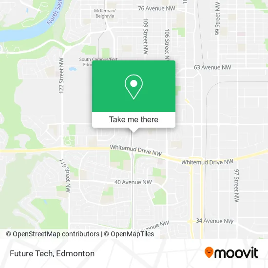
See Future Tech, Edmonton, on the map
Public Transit to Future Tech in Edmonton
Wondering how to get to Future Tech in Edmonton? Moovit helps you find the best way to get to Future Tech with step-by-step directions from the nearest public transit station.
Moovit provides free maps and live directions to help you navigate through your city. View schedules, routes, timetables, and find out how long does it take to get to Future Tech in real time.
Looking for the nearest stop or station to Future Tech? Check out this list of stops closest to your destination: Southgate Transit Centre; Harry Ainlay Loop; South Camputs Ft. Edmonton Station.
Bus: 009, 055, 701, 006, 507, 651, 660, 662.Light Rail: METRO.
Want to see if there’s another route that gets you there at an earlier time? Moovit helps you find alternative routes or times. Get directions from and directions to Future Tech easily from the Moovit App or Website.
We make riding to Future Tech easy, which is why over 1.5 million users, including users in Edmonton, trust Moovit as the best app for public transit. You don’t need to download an individual bus app or train app, Moovit is your all-in-one transit app that helps you find the best bus time or train time available.
For information on prices of bus and light rail, costs and ride fares to Future Tech, please check the Moovit app.
Use the app to navigate to popular places including to the airport, hospital, stadium, grocery store, mall, coffee shop, school, college, and university.
Future Tech Address: 5015 111 St NW Edmonton, AB T6H 4M6 street in Edmonton
- Dollarama,
- HMV,
- Samsung Experience Sto,
- BENTLEY,
- Edo of Japan,
- Unique Bunny,
- Rexall Drug Store,
- Ghost by Medium Rare,
- Santa and Me,
- Tip Top,
- H&R Block,
- Sangsters Health Centres,
- DHL,
- Amazon Locker-Chairman,
- Legit Kicks,
- Tesla Inc,
- Beauty Department of London Drugs,
- Make-Up Art Cosmetics,
- Charlotte Tilbury,
- Benefit Cosmetics Brow Bar
Places Near Future Tech (Edmonton)
- Grey Nuns Community Hospital, Edmonton,
- University of Alberta, Edmonton,
- West Edmonton Mall, Edmonton,
- Kaye Edmonton Clinic, Edmonton,
- Edmonton Valley Zoo, Edmonton,
- Whyte Avenue, Edmonton,
- Northgate Centre, Edmonton,
- Londonderry Mall, Edmonton,
- Edmonton VIA Rail Station, Edmonton,
- Fort Edmonton Park, Edmonton,
- Edmonton EXPO Centre, Edmonton,
- Borden Park, Edmonton,
- Cross Cancer Institute, Edmonton,
- Royal Alexandra Hospital, Edmonton,
- Kingsway Mall, Edmonton,
- Rogers Place, Edmonton,
- Canada Place Service Canada Centre, Edmonton,
- Edmonton Commonwealth Stadium, Edmonton,
- MacEwan University, Edmonton,
- Alberta Legislature Building, Edmonton
How to get to popular places in Edmonton with public transit
Get around Edmonton by public transit!
Traveling around Edmonton has never been so easy. See step by step directions as you travel to any attraction, street or major public transit station. View bus and train schedules, arrival times, service alerts and detailed routes on a map, so you know exactly how to get to anywhere in Edmonton.
When traveling to any destination around Edmonton use Moovit's Live Directions with Get Off Notifications to know exactly where and how far to walk, how long to wait for your line, and how many stops are left. Moovit will alert you when it's time to get off — no need to constantly re-check whether yours is the next stop.
Wondering how to use public transit in Edmonton or how to pay for public transit in Edmonton? Moovit public transit app can help you navigate your way with public transit easily, and at minimum cost. It includes public transit fees, ticket prices, and costs. Looking for a map of Edmonton public transit lines? Moovit public transit app shows all public transit maps in Edmonton with all Bus and Light Rail routes and stops on an interactive map.
Edmonton has 2 transit type(s), including: Bus and Light Rail, operated by several transit agencies, including ETS LRT, ETS, Strathcona County Transit, St. Albert Transit, Spruce Grove Transit, Fort Saskatchewan Transit, Beaumont Transit and Leduc Transit