Directions to Fynshav (Denmark) with public transportation
The following transit lines have routes that pass near Fynshav
 Bus: 225, 226, 735, 811.
- Ferry: ÆRØFÆRGERNE.
How to get to Fynshav by bus?
Click on the bus route to see step by step directions with maps, line arrival times and updated time schedules.
Bus stops near Fynshav in Denmark
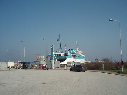
- Fynshav Færgehavn, 9 min walk,
- Fynshav Toftevej, 11 min walk,
Ferry station near Fynshav in Denmark
- Fynshav Havn (Færge), 43 min walk,
Bus lines to Fynshav in Denmark
- 225, Fynshav Færgehavn,
- 226, Fynshav Færgehavn (Bus),
- 735, Augustenborg Skole,
- 811, Sønderborg Busstation,
What are the closest stations to Fynshav?
The closest stations to Fynshav are:
- Fynshav Færgehavn stop is 638 meters away, 9 min walk.
- Fynshav Toftevej stop is 835 meters away, 11 min walk.
- Fynshav Havn (Færge) station is 3391 meters away, 43 min walk.
Which bus line stops near Fynshav?
225 (Fynshav Færgehavn (Bus))
Which ferry line stops near Fynshav?
ÆRØFÆRGERNE (Fynshav Havn (Færge))
What’s the nearest bus station to Fynshav in Denmark?
The nearest bus station to Fynshav in Denmark is Fynshav Færgehavn. It’s a 9 min walk away.
What time is the first bus to Fynshav in Denmark?
The 811 is the first bus that goes to Fynshav in Denmark. It stops nearby at 4:00 AM.
What time is the last bus to Fynshav in Denmark?
The 226 is the last bus that goes to Fynshav in Denmark. It stops nearby at 9:55 PM.
What time is the first ferry to Fynshav in Denmark?
The ÆRØFÆRGERNE is the first ferry that goes to Fynshav in Denmark. It stops nearby at 10:05 AM.
What time is the last ferry to Fynshav in Denmark?
The ÆRØFÆRGERNE is the last ferry that goes to Fynshav in Denmark. It stops nearby at 9:40 PM.
See Fynshav, Denmark, on the map
Public Transit to Fynshav in Denmark
Wondering how to get to Fynshav in Denmark? Moovit helps you find the best way to get to Fynshav with step-by-step directions from the nearest public transit station.
Moovit provides free maps and live directions to help you navigate through your city. View schedules, routes, timetables, and find out how long does it take to get to Fynshav in real time.
Looking for the nearest stop or station to Fynshav? Check out this list of stops closest to your destination: Fynshav Færgehavn; Fynshav Toftevej; Fynshav Havn (Færge).
Bus: 225, 226, 735, 811.Ferry: ÆRØFÆRGERNE.
Want to see if there’s another route that gets you there at an earlier time? Moovit helps you find alternative routes or times. Get directions from and directions to Fynshav easily from the Moovit App or Website.
We make riding to Fynshav easy, which is why over 1.7 billion users, including users in Denmark, trust Moovit as the best app for public transit. You don’t need to download an individual bus app or train app, Moovit is your all-in-one transit app that helps you find the best bus time or train time available.
For information on prices of bus and ferry, costs and ride fares to Fynshav, please check the Moovit app.
Use the app to navigate to popular places including to the airport, hospital, stadium, grocery store, mall, coffee shop, school, college, and university.
Location: Denmark
Popular routes to Fynshav, Denmark
- From Tarup Center (Odense Letbane),
- From Agtrup Midtskovvej,
- From Campus Odense (Odense Letbane),
- From Sohngårdsholmsparken (Sohngårdsholmsvej / Aalborg),
- From Ølby St.,
- From Sdu Syd / Hospital Nord (Odense Letbane),
- From Højemarksvej (Odense Kommune),
- From Fgu Nordvest (Elsøvej / Nykøbing Mors),
- From Stenløse St.,
- From Vanløse St.
- Bøjden-Fynshav,
- Fynshav,
- Helleved,
- Als,
- Notmark Kirke,
- Asserballe,
- Loddenhøj,
- Hundslev,
- Vertemine,
- Asserballe Station Juletræer,
- Alsmic Produktionsværksted,
- Guderup,
- Tandslet,
- Mommark Marina,
- Guderup Lænken,
- Linak,
- Business College Syd Mommark Handelskostskole,
- Netto,
- Mommark,
- Augustenborg
Places Near Fynshav (Denmark)
- Seduction Girls, Rødovre,
- Ikea, Århus,
- Reffen, København,
- Refshaleøen, København,
- Bispebjerg Hospital, København,
- Field's, København,
- Christiania, København,
- Eventyrpigerne, Sorø,
- Dampfærgevej 30, København,
- Marmorkirken, København,
- Grundtvigs Kirke, København,
- Dr Koncerthuset, København,
- Fisketorvet, København,
- Rigshospitalet, København,
- Operaen, København,
- Carlsberg Byen, København,
- Nyhavn, København,
- Royal Arena, København,
- Valbyparken, København,
- Aalborg Universitetshospital, Aalborg
How to get to popular places in Denmark with public transit
Get around Denmark by public transit!
Traveling around Denmark has never been so easy. See step by step directions as you travel to any attraction, street or major public transit station. View bus and train schedules, arrival times, service alerts and detailed routes on a map, so you know exactly how to get to anywhere in Denmark.
When traveling to any destination around Denmark use Moovit's Live Directions with Get Off Notifications to know exactly where and how far to walk, how long to wait for your line, and how many stops are left. Moovit will alert you when it's time to get off — no need to constantly re-check whether yours is the next stop.
Wondering how to use public transit in Denmark or how to pay for public transit in Denmark? Moovit public transit app can help you navigate your way with public transit easily, and at minimum cost. It includes public transit fees, ticket prices, and costs. Looking for a map of Denmark public transit lines? Moovit public transit app shows all public transit maps in Denmark with all Bus, Train, Metro, Light Rail and Ferry routes and stops on an interactive map.
Denmark has 5 transit type(s), including: Bus, Train, Metro, Light Rail and Ferry, operated by several transit agencies, including Metroselskabet, DSB S-tog, Lokaltog A/S, Midttrafik, Odense Letbane, DSB, NT, GoCollective, Skånetrafiken, Movia, FYNBUS, Sydtrafik, Bornholms Trafik, Samsø Bus and Citybus