How to get to G@R@J K@YN@RC@ by bus?
Click on the bus route to see step by step directions with maps, line arrival times and updated time schedules.
From Kurtköy, Pendik
72 minFrom Soğanlık, Kartal
49 minFrom Şekerpınar / Kocaeli, Gebze
99 minFrom Kefken Cebeci Plajı, Gebze
53 minFrom Kartal Sahil, Kartal
38 minFrom Anadolu Adliyesi, Kartal
65 minFrom Kartal Adliyesi, Kartal
46 minFrom Aydınlı Mahallesi, Tuzla
51 minFrom Maltepe Park Avm, Maltepe
74 minFrom Maltepe Piazza, Maltepe
67 min
How to get to G@R@J K@YN@RC@ by train?
Click on the train route to see step by step directions with maps, line arrival times and updated time schedules.
How to get to G@R@J K@YN@RC@ by metro?
Click on the metro route to see step by step directions with maps, line arrival times and updated time schedules.
Bus stops near G@R@J K@YN@RC@ in Pendik
Dolmus & Minibus station near G@R@J K@YN@RC@ in Pendik
- Yemek Sitesi - Kavakpınar 133k Yönü, 3 min walk,VIEW
Bus lines to G@R@J K@YN@RC@ in Pendik
- C89, Esenler Mahallesi,VIEW
- C89, Kavakpınar,VIEW
- C89, Ramazanoğlu,VIEW
- C89, Pendik,VIEW
- 132F, Pendik Mesleki Ve Teknik Anadolu Lisesi-Kartal,VIEW
- 133K, Kurtköy Garajı-Kartal,VIEW
- C319, Gebze,VIEW
- KM2, Kavakpınar-Tavşantepe Metro / Ring,VIEW
- KM17, Cemil Meriç İlkokulu-Tavşantepe Metro,VIEW
- KM24, Pendik Mesleki Ve Teknik Anadolu Lisesi-Pendik,VIEW
- KM10, Aydınlı Toki Peronlar-Kartal,VIEW
- KM14, Sultanbeyli Peronlar-Cemil Meriç İlkokulu,VIEW
- 16D, Kadıköy-Kaynarca Sondurak,VIEW
- 133AK, Tepeören Merkez-Kartal,VIEW
- 133KT, Kartal-Aydınlı Toki Peronlar,VIEW
- 133T, Pendik-Deniz Harp Okulu,VIEW
- 133Ş, Çağdaşkent Sağlık Ocağı-Kartal,VIEW
- C72, Tuzla,VIEW
- C109, Şifa Mahallesi,VIEW
What are the closest stations to G@R@J K@YN@RC@?
The closest stations to G@R@J K@YN@RC@ are:
- Çamçeşme - Parseller Yönü is 165 meters away, 3 min walk.
- Pendik Ağız Ve Diş Sağlığı Hastanesi - Pendik 133k Yönü is 211 meters away, 3 min walk.
- Yemek Sitesi - Kavakpınar 133k Yönü is 218 meters away, 3 min walk.
- Kaynarca Alt Geçit - Esenyalı 133 Yönü is 233 meters away, 4 min walk.
- Kaynarca Alt Geçit - Pendik 133 Yönü is 239 meters away, 4 min walk.
Which bus lines stop near G@R@J K@YN@RC@?
These bus lines stop near G@R@J K@YN@RC@: 133AK, 16D, 200, KM24.
Which metro line stops near G@R@J K@YN@RC@?
M4 (Sabiha Gökçen Havalimanı→Kadıköy)
Which train line stops near G@R@J K@YN@RC@?
B1 (Gebze)
Which Dolmus & Minibus lines stop near G@R@J K@YN@RC@?
These Dolmus & Minibus lines stop near G@R@J K@YN@RC@: C319, C84, C89.
What’s the nearest bus station to G@R@J K@YN@RC@ in Pendik?
The nearest bus stations to G@R@J K@YN@RC@ in Pendik are Çamçeşme - Parseller Yönü and Pendik Ağız Ve Diş Sağlığı Hastanesi - Pendik 133k Yönü. The closest one is a 3 min walk away.
What’s the nearest Dolmus & Minibus station to G@R@J K@YN@RC@ in Pendik?
The nearest Dolmus & Minibus station to G@R@J K@YN@RC@ in Pendik is Yemek Sitesi - Kavakpınar 133k Yönü. It’s a 3 min walk away.
What time is the first bus to G@R@J K@YN@RC@ in Pendik?
The 16D is the first bus that goes to G@R@J K@YN@RC@ in Pendik. It stops nearby at 5:51 AM.
What time is the last bus to G@R@J K@YN@RC@ in Pendik?
The 16D is the last bus that goes to G@R@J K@YN@RC@ in Pendik. It stops nearby at 1:32 AM.
What time is the first Dolmus & Minibus to G@R@J K@YN@RC@ in Pendik?
The C319 is the first Dolmus & Minibus that goes to G@R@J K@YN@RC@ in Pendik. It stops nearby at 6:00 AM.
What time is the last Dolmus & Minibus to G@R@J K@YN@RC@ in Pendik?
The C319 is the last Dolmus & Minibus that goes to G@R@J K@YN@RC@ in Pendik. It stops nearby at 1:32 AM.
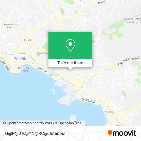
See G@R@J K@YN@RC@, Pendik, on the map
Public Transit to G@R@J K@YN@RC@ in Pendik
Wondering how to get to G@R@J K@YN@RC@ in Pendik? Moovit helps you find the best way to get to G@R@J K@YN@RC@ with step-by-step directions from the nearest public transit station.
Moovit provides free maps and live directions to help you navigate through your city. View schedules, routes, timetables, and find out how long does it take to get to G@R@J K@YN@RC@ in real time.
Looking for the nearest stop or station to G@R@J K@YN@RC@? Check out this list of stops closest to your destination: Çamçeşme - Parseller Yönü; Pendik Ağız Ve Diş Sağlığı Hastanesi - Pendik 133k Yönü; Yemek Sitesi - Kavakpınar 133k Yönü; Kaynarca Alt Geçit - Esenyalı 133 Yönü; Kaynarca Alt Geçit - Pendik 133 Yönü.
Bus: 133AK, 16D, 200, KM24, C89, C89, C89, C89, 132F, C319, KM2, KM17, KM10, KM14, 133KT, C72, C109.Metro: M4.Train: B1.Dolmus & Minibus: C319, C84, C89.
Want to see if there’s another route that gets you there at an earlier time? Moovit helps you find alternative routes or times. Get directions from and directions to G@R@J K@YN@RC@ easily from the Moovit App or Website.
We make riding to G@R@J K@YN@RC@ easy, which is why over 1.7 million users, including users in Pendik, trust Moovit as the best app for public transit. You don’t need to download an individual bus app or train app, Moovit is your all-in-one transit app that helps you find the best bus time or train time available.
For information on prices of bus, Dolmus & Minibus, metro and train, costs and ride fares to G@R@J K@YN@RC@, please check the Moovit app.
Use the app to navigate to popular places including to the airport, hospital, stadium, grocery store, mall, coffee shop, school, college, and university.
Location: Pendik, Istanbul
- kaynarca ispir düzköy derneği,
- 133Ş Kartal - Şekerpınar,
- SsangYong,
- Altkaynarca,
- Hakmar,
- Yemek Sitesi Durağı,
- Durak Pansiyon 2,
- Lc Waikiki Üç'A Tekstil Sanayi ve Ticaret A.Ş,
- Fevzi Çakmak Caddesi / Cemal Gürsel Caddesi,
- Pendik Ağız Ve Diş Sağlığı Hastanesi,
- Karadeniz Makina,
- Vital Fitness & Boks Club,
- 16 D Otobüs Durakları,
- E-5 Yan Yolu / Aydınlı Yolu Caddesi,
- Favori Gıda SAN. TİC. A.Ş,
- Vizyon Tekstil,
- cakaldere son durak,
- Türkiye İş Bankası - Kaynarca Şb.,
- HAT200 Kartal-Pendik-İzmit,
- Classes Boutique Hotel
Places Near G@R@J K@YN@RC@ (Pendik)
- Tersane İstanbul, Beyoğlu,
- 212 AVM, Bagcilar,
- Hz. Yuşa Tepesi, Beykoz,
- Topkule Kışlası 47.Komando Tugay Komutanlığı, Esenler,
- Gebze-Harem Minibüs Hattı, Gebze,
- Mehmet Emin Tokadî Hz. Türbesi, Fatih,
- 41 Burda AVM, Kocaeli Merkezi,
- METROPOL IsTaNBuL, Ataşehir,
- Bakırköy Sosyete Pazarı, Bakirköy,
- İstinye Park, Sariyer,
- Şehit Prof. Dr. İlhan Varank Eğitim Ve Araştırma Hastanesi, Sancaktepe,
- Karaköy Genelevi, Karaköy, Beyoğlu,
- Gebze Koop Durağı, Gebze,
- Hilltown AVM, Maltepe,
- VİALAND AVM, Eyüp,
- Beylikdüzü - 4 Nolu Minibüs Hattı, Beylikduzu,
- İstanbul,
- Mall Of İstanbul, Basaksehir,
- Başakşehir Çam Ve Sakura Şehir Hastanesi, Basaksehir,
- 2 Nolu Minibüss, Beylikduzu
How to get to popular places in Istanbul with public transit
Get around Pendik by public transit!
Traveling around Pendik has never been so easy. See step by step directions as you travel to any attraction, street or major public transit station. View bus and train schedules, arrival times, service alerts and detailed routes on a map, so you know exactly how to get to anywhere in Pendik.
When traveling to any destination around Pendik use Moovit's Live Directions with Get Off Notifications to know exactly where and how far to walk, how long to wait for your line, and how many stops are left. Moovit will alert you when it's time to get off — no need to constantly re-check whether yours is the next stop.
Wondering how to use public transit in Pendik or how to pay for public transit in Pendik? Moovit public transit app can help you navigate your way with public transit easily, and at minimum cost. It includes public transit fees, ticket prices, and costs. Looking for a map of Pendik public transit lines? Moovit public transit app shows all public transit maps in Pendik with all Bus, Train, Metro, Tram, Ferry, Metrobus and Dolmus & Minibus routes and stops on an interactive map.
Istanbul has 7 transit type(s), including: Bus, Train, Metro, Tram, Ferry, Metrobus and Dolmus & Minibus, operated by several transit agencies, including Marmaray, Metro İstanbul, Metrobüs, UAB, İETT, İETT ÇIFT KATLI HATLAR, İETT BÖLGESEL HATLAR, TCDD, Şehir Hatları, Dentur Avrasya, Beyden, Turyol, Mavi Marmara, Havaist and Prenstur
