How to get to GCNet Services Limited by bus?
Click on the bus route to see step by step directions with maps, line arrival times and updated time schedules.
From Vodafone Office, Accra
51 minFrom St. John's General Hospital, Accra
69 minFrom Santa Maria, Accra
62 minFrom China Mall, Tema
57 minFrom Tarkwa Ford station (kaneshie), Accra
45 minFrom UPSA LBC Auditorium, Accra
63 minFrom Dansoman Last Stop, Accra
60 minFrom Getfund offices,Airport Residential Area, Accra
29 minFrom Upsa, Accra
56 minFrom Erata Hotel, Accra
49 min
Bus stops near GCNet Services Limited in Accra
Bus lines to GCNet Services Limited in Accra
- 221, Madina,VIEW
- 241, Bawaleshie,VIEW
- 255, East Legon,VIEW
- 256, Accra New Tema Station,VIEW
- 275, Kaneshie,VIEW
- 383, Ashaiman Main Station,VIEW
- 422, Circle Odorna,VIEW
- 55, Osu ↔ Abeka Lapaz,VIEW
- 205, Osu RE ↔ Circle,VIEW
- 206, Osu RE ↔ Circle,VIEW
- 419, Odorna ↔ Agblezah,VIEW
- 424, Odorna ↔ Nungua,VIEW
- 425, Nungua ↔ Circle Odorna,VIEW
- 428, Tsui Bleoo ↔ Circle Odorna,VIEW
- 454, Circle ↔ Osu,VIEW
- 455, Osu ↔ Kaneshie,VIEW
- 2, Osu (37 Station),VIEW
- 173, Accra Bishop,VIEW
- 416, Cantonments,VIEW
- 456, Madina,VIEW
What are the closest stations to GCNet Services Limited?
The closest stations to GCNet Services Limited are:
- Flagstaff House is 392 meters away, 6 min walk.
- Police Headquarters is 656 meters away, 9 min walk.
- Prisons is 1234 meters away, 16 min walk.
Which bus lines stop near GCNet Services Limited?
These bus lines stop near GCNet Services Limited: 221, 241, 275, 383.
What’s the nearest bus station to GCNet Services Limited in Accra?
The nearest bus station to GCNet Services Limited in Accra is Flagstaff House. It’s a 6 min walk away.
What time is the first bus to GCNet Services Limited in Accra?
The 383 is the first bus that goes to GCNet Services Limited in Accra. It stops nearby at 5:05 AM.
What time is the last bus to GCNet Services Limited in Accra?
The 456 is the last bus that goes to GCNet Services Limited in Accra. It stops nearby at 11:21 PM.
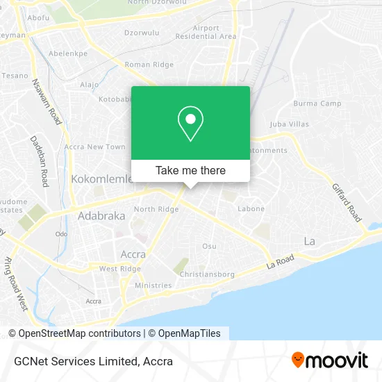
See GCNet Services Limited, Accra, on the map
Public Transit to GCNet Services Limited in Accra
Wondering how to get to GCNet Services Limited in Accra? Moovit helps you find the best way to get to GCNet Services Limited with step-by-step directions from the nearest public transit station.
Moovit provides free maps and live directions to help you navigate through your city. View schedules, routes, timetables, and find out how long does it take to get to GCNet Services Limited in real time.
Looking for the nearest stop or station to GCNet Services Limited? Check out this list of stops closest to your destination: Flagstaff House; Police Headquarters; Prisons.
Bus: 221, 241, 275, 383, 255, 256, 55, 205, 206, 419, 424, 2, 173, 416, 456.
Want to see if there’s another route that gets you there at an earlier time? Moovit helps you find alternative routes or times. Get directions from and directions to GCNet Services Limited easily from the Moovit App or Website.
We make riding to GCNet Services Limited easy, which is why over 1.5 million users, including users in Accra, trust Moovit as the best app for public transit. You don’t need to download an individual bus app or train app, Moovit is your all-in-one transit app that helps you find the best bus time or train time available.
For information on prices of bus, costs and ride fares to GCNet Services Limited, please check the Moovit app.
Use the app to navigate to popular places including to the airport, hospital, stadium, grocery store, mall, coffee shop, school, college, and university.
GCNet Services Limited Address: The 5th Avenue Corporate Offices street in Accra
- The 5th Avenue Corporate Offices,
- Reggie Rockstone's Office (Django Bar),
- Chicken & Beer,
- Gold Coast Restaurant,
- The Grasscutters Return,
- Club Onyx,
- Koyo's Penthouse,
- Camp David Bar,
- Accra Tourist Information Centre,
- Papa's Pizza,
- Mulungushi Gardens,
- Abu's Art & Music,
- Afrikiko Restaurant,
- Afrikiko,
- Afrikiko Leisure Centre,
- Southafrica Wines,
- Grasscutters Bar, British High Commission, Ghana,
- Terasu Japanese Restaurant,
- Thai Express,
- Gemini Apartments
Places Near GCNet Services Limited (Accra)
- El Wak Sports Stadium, Accra,
- British Council Ghana, Accra,
- Prisons Training School, Accra,
- Ministry of Defence: The Square, Accra,
- GNAT Hall, Accra,
- Dansoman Keep Fit Club, Accra,
- WAEC Examination Hall, Accra,
- Santa Maria, Accra,
- National Service Scheme (Greater-Accra Regional Office), Accra,
- El-Wak Stadium, Accra,
- Ridge Hospital (Ghana Health Services), Accra,
- Regional Coordinating Council(RCC), Accra,
- Kantamanto Market, Accra,
- Cid Headquarters, Accra,
- American House. East Legon, Accra,
- Shield - ashawo joint, Accra,
- The Grand Oyeeman, Accra,
- 2m Express, Accra,
- National Service Secretariat HQ, Accra,
- Abelemkpe, Accra
How to get to popular places in Accra with public transit
Get around Accra by public transit!
Traveling around Accra has never been so easy. See step by step directions as you travel to any attraction, street or major public transit station. View bus and train schedules, arrival times, service alerts and detailed routes on a map, so you know exactly how to get to anywhere in Accra.
When traveling to any destination around Accra use Moovit's Live Directions with Get Off Notifications to know exactly where and how far to walk, how long to wait for your line, and how many stops are left. Moovit will alert you when it's time to get off — no need to constantly re-check whether yours is the next stop.
Wondering how to use public transit in Accra or how to pay for public transit in Accra? Moovit public transit app can help you navigate your way with public transit easily, and at minimum cost. It includes public transit fees, ticket prices, and costs. Looking for a map of Accra public transit lines? Moovit public transit app shows all public transit maps in Accra with all bus routes and stops on an interactive map.
Accra has 1 transit type(s), including: bus, operated by several transit agencies, including AMA Department of Transport