How to get to GCS by bus?
Click on the bus route to see step by step directions with maps, line arrival times and updated time schedules.
How to get to GCS by train?
Click on the train route to see step by step directions with maps, line arrival times and updated time schedules.
How to get to GCS by subway?
Click on the subway route to see step by step directions with maps, line arrival times and updated time schedules.
Bus stops near GCS in Manhattan
Subway stations near GCS in Manhattan
Train station near GCS in Manhattan
- 34 St-Penn Station, 9 min walk,VIEW
Bus lines to GCS in Manhattan
- M20, Lincoln Center 66 St Via 8 Av,VIEW
- GREENWICH, Midtown / W 39th Street - Midtown / W 39th Street,VIEW
- 34TH ST, 34th St,VIEW
- SIM23, Annadale Via Arden Av,VIEW
- SIM24, Midtown Via 34 St Via Madison Av,VIEW
- M34-SBS, Select Bus East Side Fdr Dr Crosstown,VIEW
- M34A-SBS, Select Bus Pa Bus Trm Via 34 St Via 8 Av,VIEW
- Q32, Penn Station,VIEW
- M7, 14 St Via Columbus Via 7 Av,VIEW
- GREYHOUND US0305, New York Port Authority,VIEW
What are the closest stations to GCS?
The closest stations to GCS are:
- 8 Av/W 39 St is 70 yards away, 1 min walk.
- W 34th St & 7th Ave (Westbound) is 94 yards away, 2 min walk.
- W 34 St/7 Av is 127 yards away, 2 min walk.
- 42 St-Port Authority Bus Terminal is 138 yards away, 2 min walk.
- 7 Av/ W 36 St is 203 yards away, 3 min walk.
- 7 Av/W 37 St is 240 yards away, 3 min walk.
- New York Midtown West is 344 yards away, 5 min walk.
- Times Sq-42 St is 404 yards away, 5 min walk.
- 34 St-Herald Sq is 430 yards away, 6 min walk.
- 34 St-Penn Station is 671 yards away, 9 min walk.
Which bus lines stop near GCS?
These bus lines stop near GCS: 119, 158, BM2, M20, M34-SBS, M34A-SBS, Q100, Q32, QM24.
Which train lines stop near GCS?
These train lines stop near GCS: 1, RONKONKOMA BRANCH, YEL.
Which subway lines stop near GCS?
These subway lines stop near GCS: 1, A, F, M, Q.
What’s the nearest subway station to GCS in Manhattan?
The nearest subway station to GCS in Manhattan is 42 St-Port Authority Bus Terminal. It’s a 2 min walk away.
What’s the nearest train station to GCS in Manhattan?
The nearest train station to GCS in Manhattan is 34 St-Penn Station. It’s a 9 min walk away.
What’s the nearest bus station to GCS in Manhattan?
The nearest bus station to GCS in Manhattan is 8 Av/W 39 St. It’s a 1 min walk away.
What time is the first subway to GCS in Manhattan?
The E is the first subway that goes to GCS in Manhattan. It stops nearby at 3:01 AM.
What time is the last subway to GCS in Manhattan?
The N is the last subway that goes to GCS in Manhattan. It stops nearby at 4:01 AM.
What time is the first train to GCS in Manhattan?
The PORT JEFFERSON BRANCH is the first train that goes to GCS in Manhattan. It stops nearby at 3:01 AM.
What time is the last train to GCS in Manhattan?
The RONKONKOMA BRANCH is the last train that goes to GCS in Manhattan. It stops nearby at 3:15 AM.
What time is the first bus to GCS in Manhattan?
The M7 is the first bus that goes to GCS in Manhattan. It stops nearby at 3:13 AM.
What time is the last bus to GCS in Manhattan?
The M7 is the last bus that goes to GCS in Manhattan. It stops nearby at 3:13 AM.
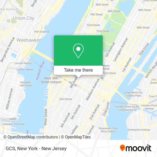
See GCS, Manhattan, on the map
Public Transit to GCS in Manhattan
Wondering how to get to GCS in Manhattan? Moovit helps you find the best way to get to GCS with step-by-step directions from the nearest public transit station.
Moovit provides free maps and live directions to help you navigate through your city. View schedules, routes, timetables, and find out how long does it take to get to GCS in real time.
Looking for the nearest stop or station to GCS? Check out this list of stops closest to your destination: 8 Av/W 39 St; W 34th St & 7th Ave (Westbound); W 34 St/7 Av; 42 St-Port Authority Bus Terminal; 7 Av/ W 36 St; 7 Av/W 37 St; New York Midtown West; Times Sq-42 St; 34 St-Herald Sq; 34 St-Penn Station.
Bus: 119, 158, BM2, M20, M34-SBS, M34A-SBS, Q100, Q32, QM24, GREENWICH, 34TH ST.Train: 1, RONKONKOMA BRANCH, YEL, ACELA, ADIRONDACK, BERKSHIRE FLYER, CARDINAL, CAROLINIAN.Subway: 1, A, F, M, Q, C, E, N, R, S, W, B, D, FX.
Want to see if there’s another route that gets you there at an earlier time? Moovit helps you find alternative routes or times. Get directions from and directions to GCS easily from the Moovit App or Website.
We make riding to GCS easy, which is why over 1.5 million users, including users in Manhattan, trust Moovit as the best app for public transit. You don’t need to download an individual bus app or train app, Moovit is your all-in-one transit app that helps you find the best bus time or train time available.
For information on prices of bus, subway, train, light rail and ferry, costs and ride fares to GCS, please check the Moovit app.
Use the app to navigate to popular places including to the airport, hospital, stadium, grocery store, mall, coffee shop, school, college, and university.
Location: Manhattan, New York - New Jersey
- Garment District,
- To Healthy Feet Podiatry,
- Inhala,
- The Organic Foot,
- A Votre Service Events,
- NY Local Movers,
- Xcelerated Adventures,
- Saxx,
- Ae Grading and Marking,
- Lizardos Engineering,
- Mirrorme3d,
- Refined Glow,
- Liberty Coca-Cola,
- Regal Originals Inc,
- Mood Designer Fabrics,
- Mood Fabrics,
- Likeable Business,
- Skinology Medspa,
- Healtheazy Trim,
- Midtown Swings
Places Near GCS (Manhattan)
- 911 Memorial, Manhattan,
- Times Square, Manhattan,
- Pier 83, Manhattan,
- 66 John Street, Manhattan,
- qqqq, Manhattan,
- Mountainside Hospital, Glen Ridge,
- Bellevue Hospital, Manhattan,
- 3 Stone St, Manhattan,
- 111 Centre New York City Supreme Court, Manhattan,
- Wall Street, Manhattan,
- 26 Federal Plaza, Manhattan,
- SoHo, Manhattan,
- Rockefeller Center, Manhattan,
- 1 Police Plaza, Manhattan,
- San Gennaro Feast, Manhattan,
- Katz's Deli, Manhattan,
- 376 Hudson Street, Manhattan,
- Queens Center Mall, Queens,
- Hudson Yards, Manhattan,
- Chinatown, Manhattan
How to get to popular places in New York - New Jersey with public transit
Get around Manhattan by public transit!
Traveling around Manhattan has never been so easy. See step by step directions as you travel to any attraction, street or major public transit station. View bus and train schedules, arrival times, service alerts and detailed routes on a map, so you know exactly how to get to anywhere in Manhattan.
When traveling to any destination around Manhattan use Moovit's Live Directions with Get Off Notifications to know exactly where and how far to walk, how long to wait for your line, and how many stops are left. Moovit will alert you when it's time to get off — no need to constantly re-check whether yours is the next stop.
Wondering how to use public transit in Manhattan or how to pay for public transit in Manhattan? Moovit public transit app can help you navigate your way with public transit easily, and at minimum cost. It includes public transit fees, ticket prices, and costs. Looking for a map of Manhattan public transit lines? Moovit public transit app shows all public transit maps in Manhattan with all Bus, Train, Subway, Light Rail, Ferry and Cable Car routes and stops on an interactive map.
New York - New Jersey has 6 transit type(s), including: Bus, Train, Subway, Light Rail, Ferry and Cable Car, operated by several transit agencies, including MTA Subway, Metro-North Railroad, LIRR, PATH, MTA New York City Transit - Express routes, MTA Bus, NJ Transit, NYC Ferry, NICE bus, Bee-Line Bus, NJ Transit Rail, Norwalk Transit District, Hartford Line, River Valley Transit and HART