How to get to GCS by bus?
Click on the bus route to see step by step directions with maps, line arrival times and updated time schedules.
From U.S. Naval Research Laboratory - NRL, Washington
103 minFrom Walmart Supercenter Fort Totten - Riggs Rd NE, Washington
63 minFrom Pentagon City Mall, Arlington County
45 minFrom The Mall at Prince Georges, Prince George's County
84 minFrom Eden Center, Falls Church
66 minFrom Hyattsville, MD, Prince George's County
68 minFrom St Elizabeths Hospital, Washington
57 minFrom Walmart, Arlington County
53 minFrom Prince George's Plaza Metro Station, Prince George's County
81 minFrom PG Mall, Prince George's County
74 min
How to get to GCS by train?
Click on the train route to see step by step directions with maps, line arrival times and updated time schedules.
How to get to GCS by metro?
Click on the metro route to see step by step directions with maps, line arrival times and updated time schedules.
From Walmart Supercenter Fort Totten - Riggs Rd NE, Washington
33 minFrom Pentagon City Mall, Arlington County
27 minFrom The Mall at Prince Georges, Prince George's County
44 minFrom Eden Center, Falls Church
43 minFrom Hyattsville, MD, Prince George's County
54 minFrom St Elizabeths Hospital, Washington
42 minFrom Walmart, Arlington County
27 minFrom Prince George's Plaza Metro Station, Prince George's County
32 minFrom PG Mall, Prince George's County
38 min
Bus stops near GCS in Washington
- Connecticut Av Nw+N St NW, 1 min walk,VIEW
- 19 St Nw+N Stnw, 2 min walk,VIEW
- 19th St & M St NW Sb, 3 min walk,VIEW
- 18th St & M St NW Nb, 4 min walk,VIEW
- Nw 20th St & Nw M St, 5 min walk,VIEW
- K St Nw+18 St NW, 5 min walk,VIEW
- K St & 18th St NW Wb, 5 min walk,VIEW
- K St Nw & 18th St Nw (Main), 6 min walk,VIEW
- K St & 19th St NW Wb, 7 min walk,VIEW
Metro stations near GCS in Washington
Bus lines to GCS in Washington
- D70, South To Farragut Sq,VIEW
- D72, North To Mt Pleasant,VIEW
- D96, South To Potomac Park,VIEW
- 305, 305/6 Columbia,VIEW
- 325, 325/6 Columbia,VIEW
- 335, 335/1 Washington Dc,VIEW
- 345, 345/2 Washington Dc,VIEW
- D94, West To Sibley Hospital,VIEW
- A58, East To Farragut Sq,VIEW
- 220, 220/5 Washington Dc,VIEW
- 240, 240/2 Washington Dc,VIEW
- 260, 260/1 Washington Dc,VIEW
- 620, 620/6 Washington Dc,VIEW
- 640, 640/5 Washington Dc,VIEW
- 650, 650/2 Washington Dc,VIEW
- A49, West To Culmore,VIEW
- 725, 725/2 Washington Dc,VIEW
- 810, 810/2 Washington Dc,VIEW
- 820, 820/2 Washington Dc,VIEW
- 830, 830/3 Washington Dc,VIEW
What are the closest stations to GCS?
The closest stations to GCS are:
- Connecticut Av Nw+N St NW is 58 yards away, 1 min walk.
- 19 St Nw+N Stnw is 121 yards away, 2 min walk.
- 19th St & M St NW Sb is 234 yards away, 3 min walk.
- 18th St & M St NW Nb is 261 yards away, 4 min walk.
- Nw 20th St & Nw M St is 342 yards away, 5 min walk.
- K St Nw+18 St NW is 348 yards away, 5 min walk.
- K St & 18th St NW Wb is 355 yards away, 5 min walk.
- K St Nw & 18th St Nw (Main) is 395 yards away, 6 min walk.
- Mcpherson Sq Metro Station is 460 yards away, 6 min walk.
- K St & 19th St NW Wb is 490 yards away, 7 min walk.
- Farragut North is 676 yards away, 9 min walk.
Which bus lines stop near GCS?
These bus lines stop near GCS: 305, 325, 981, A58, D10, D70, D94.
Which train lines stop near GCS?
These train lines stop near GCS: MARC, NORTHEAST REGIONAL.
Which metro lines stop near GCS?
These metro lines stop near GCS: BLUE, RED, SILVER.
What’s the nearest metro station to GCS in Washington?
The nearest metro station to GCS in Washington is Mcpherson Sq Metro Station. It’s a 6 min walk away.
What’s the nearest bus station to GCS in Washington?
The nearest bus station to GCS in Washington is Connecticut Av Nw+N St NW. It’s a 1 min walk away.
What time is the first metro to GCS in Washington?
The BLUE is the first metro that goes to GCS in Washington. It stops nearby at 5:23 AM.
What time is the last metro to GCS in Washington?
The RED is the last metro that goes to GCS in Washington. It stops nearby at 12:10 AM.
What time is the first bus to GCS in Washington?
The D72 is the first bus that goes to GCS in Washington. It stops nearby at 4:21 AM.
What time is the last bus to GCS in Washington?
The A58 is the last bus that goes to GCS in Washington. It stops nearby at 2:27 AM.
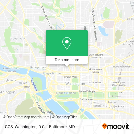
See GCS, Washington, on the map
Public Transit to GCS in Washington
Wondering how to get to GCS in Washington? Moovit helps you find the best way to get to GCS with step-by-step directions from the nearest public transit station.
Moovit provides free maps and live directions to help you navigate through your city. View schedules, routes, timetables, and find out how long does it take to get to GCS in real time.
Looking for the nearest stop or station to GCS? Check out this list of stops closest to your destination: Connecticut Av Nw+N St NW; 19 St Nw+N Stnw; 19th St & M St NW Sb; 18th St & M St NW Nb; Nw 20th St & Nw M St; K St Nw+18 St NW; K St & 18th St NW Wb; K St Nw & 18th St Nw (Main); Mcpherson Sq Metro Station; K St & 19th St NW Wb; Farragut North.
Bus: 305, 325, 981, A58, D10, D70, D94, D72, D96, 335, 345.Train: MARC, NORTHEAST REGIONAL.Metro: BLUE, RED, SILVER, ORANGE.
Want to see if there’s another route that gets you there at an earlier time? Moovit helps you find alternative routes or times. Get directions from and directions to GCS easily from the Moovit App or Website.
We make riding to GCS easy, which is why over 1.5 million users, including users in Washington, trust Moovit as the best app for public transit. You don’t need to download an individual bus app or train app, Moovit is your all-in-one transit app that helps you find the best bus time or train time available.
For information on prices of metro, bus and train, costs and ride fares to GCS, please check the Moovit app.
Use the app to navigate to popular places including to the airport, hospital, stadium, grocery store, mall, coffee shop, school, college, and university.
GCS Address: 1800 M St NW Washington, DC 20036 street in Washington
- USDA,
- Ozio Martini & Cigar Lounge,
- medical faculty associates,
- The Camelot Showbar,
- M St & 18th St,
- Oki Bowl DC & Sake,
- Roti,
- GW Imaging,
- Eugene Miknowski,
- The Feldman Hearing Studio (Feldman Enterprise Group PC - Seth F Oringher MD),
- Rehabilitation Center,
- 301,
- Mpire Club,
- Counterpart International (Audubon's International Alliances Program),
- Otterbein Jennifer L,
- Daily Grill (Grill Concepts),
- Daily Grill,
- Boqueria,
- 1831 Bar & Lounge,
- Rtca
Places Near GCS (Washington)
- Pennsylvania Ave NW (3rd st and pennsylvania), Washington,
- Museum Of The Bible, Washington,
- Basilica of the National Shrine, Washington,
- Sibley Memorial Hospital, Washington,
- Washington National Cathedral, Washington,
- PG Mall, Prince George's County,
- Westfield Montgomery Mall, Montgomery County,
- Warner Theatre, Washington,
- Capital One Arena, Washington,
- The Anthem, Washington,
- Amazon Hq2, Arlington County,
- National Museum of African American History and Culture, Washington,
- M&T Bank Stadium, Baltimore,
- Georgetown, Washington,
- Rock Creek Tennis Center, Washington,
- Camden Yards, Baltimore,
- National Theatre, Washington,
- Washington DC VA Medical Center, Washington,
- Marriott Marquis Washington, DC, Washington,
- National Zoo, Washington
How to get to popular places in Washington, D.C. - Baltimore, MD with public transit
Get around Washington by public transit!
Traveling around Washington has never been so easy. See step by step directions as you travel to any attraction, street or major public transit station. View bus and train schedules, arrival times, service alerts and detailed routes on a map, so you know exactly how to get to anywhere in Washington.
When traveling to any destination around Washington use Moovit's Live Directions with Get Off Notifications to know exactly where and how far to walk, how long to wait for your line, and how many stops are left. Moovit will alert you when it's time to get off — no need to constantly re-check whether yours is the next stop.
Wondering how to use public transit in Washington or how to pay for public transit in Washington? Moovit public transit app can help you navigate your way with public transit easily, and at minimum cost. It includes public transit fees, ticket prices, and costs. Looking for a map of Washington public transit lines? Moovit public transit app shows all public transit maps in Washington with all Bus, Train, Metro, Light Rail and Ferry routes and stops on an interactive map.
Washington, D.C. - Baltimore, MD has 5 transit type(s), including: Bus, Train, Metro, Light Rail and Ferry, operated by several transit agencies, including WMATA, Montgomery County Ride On, Fairfax Connector, TheBus, PRTC, DASH - Alexandria, Arlington Transit (ART), RTA of Central Maryland, MDOT MTA, MDOT MTA Light RailLink, MDOT MTA Commuter Bus, MDOT MTA Local Bus, FXBGO!, Virginia Railway Express (VRE) and MARC