How to get to GIF by bus?
Click on the bus route to see step by step directions with maps, line arrival times and updated time schedules.
From POCO Einrichtungsmärkte, Böckingen
86 minFrom Antalya Pizza & Kebaphaus, Verwaltungsgemeinschaft Eppingen
106 minFrom Gaffenberg, Heilbronn
105 minFrom Karl-Wüst-Brücke, Heilbronn
51 minFrom Heilbronner Straße 86, Verwaltungsgemeinschaft Brackenheim
106 minFrom Knorr Fabrikverkauf, Heilbronn
72 minFrom Eroscenter Heilbronn, Heilbronn
83 minFrom Kölle-Zoo, Heilbronn
59 minFrom Pflanzen Mauk, Verwaltungsgemeinschaft Lauffen am Neckar
91 minFrom Kaufland, Mosbach
59 min
How to get to GIF by train?
Click on the train route to see step by step directions with maps, line arrival times and updated time schedules.
Bus stops near GIF in Verwaltungsgemeinschaft Bad Friedrichshall
Train stations near GIF in Verwaltungsgemeinschaft Bad Friedrichshall
Bus lines to GIF in Verwaltungsgemeinschaft Bad Friedrichshall
- 625, Neckarsulm, Audi Werk A13/A15,VIEW
- SEV S41/S42, Neckarsulm,VIEW
- 691, Neckarsulm, Kaufland,VIEW
- 602R, Bad Friedrichshall-Kochendorf - Bad Friedrichshall-Kochendorf,VIEW
- 691R, Bad Friedrichshall-Kochendorf - Bad Friedrichshall-Kochendorf,VIEW
- MEX 12, Bietigheim Gleis 10 - Heilbronn Hauptbahnhof Gleis 4,VIEW
- MEX 18, Tübingen Hauptbahnhof - Osterburken, Bahnhof,VIEW
- S41, Heilbronn Hbf/Willy-Brandt-Pl. - Mosbach, Bahnhof,VIEW
- S42, Sinsheim, Hauptbahnhof - Heilbronn Hbf/Willy-Brandt-Pl.,VIEW
What are the closest stations to GIF?
The closest stations to GIF are:
- Kochendorf, Gif is 21 meters away, 1 min walk.
- Kochendorf Bergstraße is 666 meters away, 9 min walk.
- Kochendorf, Bergstraße is 744 meters away, 10 min walk.
- Bad Friedrichshall-Kochendorf is 889 meters away, 12 min walk.
- Neckarsulm Nord Gleis 2 is 1718 meters away, 22 min walk.
Which bus lines stop near GIF?
These bus lines stop near GIF: 625, 691, 694.
Which train lines stop near GIF?
These train lines stop near GIF: S41, S42.
Which light rail line stops near GIF?
S42 (Heilbronn Hbf/Willy-Brandt-Pl.)
What’s the nearest train station to GIF in Verwaltungsgemeinschaft Bad Friedrichshall?
The nearest train station to GIF in Verwaltungsgemeinschaft Bad Friedrichshall is Bad Friedrichshall-Kochendorf. It’s a 12 min walk away.
What’s the nearest bus station to GIF in Verwaltungsgemeinschaft Bad Friedrichshall?
The nearest bus station to GIF in Verwaltungsgemeinschaft Bad Friedrichshall is Kochendorf, Gif. It’s a 1 min walk away.
What time is the first light rail to GIF in Verwaltungsgemeinschaft Bad Friedrichshall?
The S42 is the first light rail that goes to GIF in Verwaltungsgemeinschaft Bad Friedrichshall. It stops nearby at 4:53 AM.
What time is the last light rail to GIF in Verwaltungsgemeinschaft Bad Friedrichshall?
The S41 is the last light rail that goes to GIF in Verwaltungsgemeinschaft Bad Friedrichshall. It stops nearby at 12:53 AM.
What time is the first train to GIF in Verwaltungsgemeinschaft Bad Friedrichshall?
The S42 is the first train that goes to GIF in Verwaltungsgemeinschaft Bad Friedrichshall. It stops nearby at 4:53 AM.
What time is the last train to GIF in Verwaltungsgemeinschaft Bad Friedrichshall?
The S41 is the last train that goes to GIF in Verwaltungsgemeinschaft Bad Friedrichshall. It stops nearby at 12:51 AM.
What time is the first bus to GIF in Verwaltungsgemeinschaft Bad Friedrichshall?
The 691 is the first bus that goes to GIF in Verwaltungsgemeinschaft Bad Friedrichshall. It stops nearby at 5:21 AM.
What time is the last bus to GIF in Verwaltungsgemeinschaft Bad Friedrichshall?
The 691 is the last bus that goes to GIF in Verwaltungsgemeinschaft Bad Friedrichshall. It stops nearby at 12:05 AM.
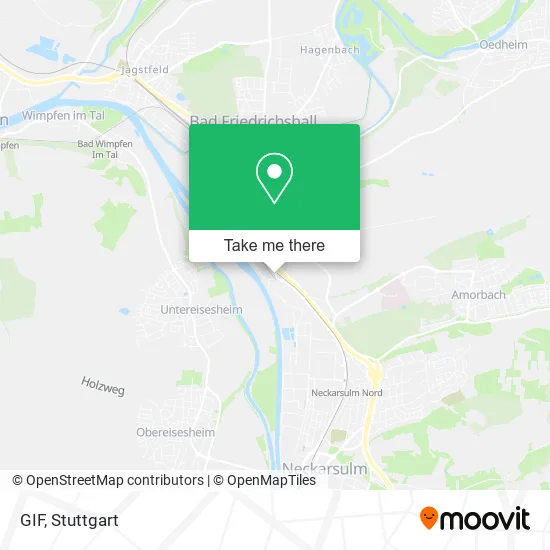
See GIF, Verwaltungsgemeinschaft Bad Friedrichshall, on the map
Public Transit to GIF in Verwaltungsgemeinschaft Bad Friedrichshall
Wondering how to get to GIF in Verwaltungsgemeinschaft Bad Friedrichshall? Moovit helps you find the best way to get to GIF with step-by-step directions from the nearest public transit station.
Moovit provides free maps and live directions to help you navigate through your city. View schedules, routes, timetables, and find out how long does it take to get to GIF in real time.
Looking for the nearest stop or station to GIF? Check out this list of stops closest to your destination: Kochendorf; Kochendorf Bergstraße; Kochendorf; Bad Friedrichshall-Kochendorf; Neckarsulm Nord Gleis 2.
Bus: 625, 691, 694, SEV S41/S42.Train: S41, S42, MEX12, MEX18, MEX12, MEX18, RE 10A.Light Rail: S42.
Want to see if there’s another route that gets you there at an earlier time? Moovit helps you find alternative routes or times. Get directions from and directions to GIF easily from the Moovit App or Website.
We make riding to GIF easy, which is why over 1.5 million users, including users in Verwaltungsgemeinschaft Bad Friedrichshall, trust Moovit as the best app for public transit. You don’t need to download an individual bus app or train app, Moovit is your all-in-one transit app that helps you find the best bus time or train time available.
For information on prices of bus, train and light rail, costs and ride fares to GIF, please check the Moovit app.
Use the app to navigate to popular places including to the airport, hospital, stadium, grocery store, mall, coffee shop, school, college, and university.
GIF Address: K2000 74177 Bad Friedrichshall street in Verwaltungsgemeinschaft Bad Friedrichshall
- Stadtplan Bad Freidrichshall,
- Carcenter Klaiber,
- Autohaus Klaiber GmbH Car Center,
- Ford Klaiber Bad Friedrichshall,
- ALDI,
- Rolands Zweiradladen,
- Gewerbe- Und Industriepark Bad Friedrichshall,
- Gif1,
- Andy´S Imbiss,
- Ra Ingenieurbüro,
- Adecco Personaldienstleistungen,
- Faurecia Innenraum Systeme,
- Gif Gewerbe- und Industriepark Bad Friedrichshall,
- Rhenus Automotive Se,
- International Automotive Components Group,
- Friedauer Getränke,
- Fidus Personal,
- Gabriel's Neckar Stüble,
- Aquarin Getränkewelt,
- Obere Fundel (Geplantes Gewerbegebiet)
Places Near GIF (Verwaltungsgemeinschaft Bad Friedrichshall)
- Geilhaus Haus 33a, Reutlingen-Betzingen,
- Porsche-Arena, Bad Cannstatt,
- Marmorsaal Im Weissenburgpark, Stuttgart-Süd,
- Gasometer Pforzheim, Pforzheim,
- Hanns-Martin-Schleyer-Halle, Bad Cannstatt,
- Wilhelma (U-Bahn Wilhelma), Bad Cannstatt,
- Schleyerhalle, Bad Cannstatt,
- Mercedes-Benz Museum (Mercedes Museum Stuttgart), Bad Cannstatt,
- Mettingen Eros-Center Puff Laufhaus, Esslingen Am Neckar,
- Klinikum Stuttgart - Katharinenhospital, Stuttgart-Mitte,
- Pariser Platz Stuttgart, Stuttgart-Mitte,
- Porsche Museum, Zuffenhausen,
- FlixBus Haltestelle, Stuttgart,
- Im Wizemann (Halle), Bad Cannstatt,
- Gleis 101/102 (tief), Stuttgart-Mitte,
- Mercedes-Benz Museum, Bad Cannstatt,
- SI-Centrum, Möhringen,
- Waldfriedhof, Degerloch,
- Hanns-Martin-Schleyer-Halle (Stuttgart Hans-Martin-Schleyerhalle), Bad Cannstatt,
- Hauptbahnhof Stuttgart, Stuttgart-Mitte
How to get to popular places in Stuttgart with public transit
Get around Verwaltungsgemeinschaft Bad Friedrichshall by public transit!
Traveling around Verwaltungsgemeinschaft Bad Friedrichshall has never been so easy. See step by step directions as you travel to any attraction, street or major public transit station. View bus and train schedules, arrival times, service alerts and detailed routes on a map, so you know exactly how to get to anywhere in Verwaltungsgemeinschaft Bad Friedrichshall.
When traveling to any destination around Verwaltungsgemeinschaft Bad Friedrichshall use Moovit's Live Directions with Get Off Notifications to know exactly where and how far to walk, how long to wait for your line, and how many stops are left. Moovit will alert you when it's time to get off — no need to constantly re-check whether yours is the next stop.
Wondering how to use public transit in Verwaltungsgemeinschaft Bad Friedrichshall or how to pay for public transit in Verwaltungsgemeinschaft Bad Friedrichshall? Moovit public transit app can help you navigate your way with public transit easily, and at minimum cost. It includes public transit fees, ticket prices, and costs. Looking for a map of Verwaltungsgemeinschaft Bad Friedrichshall public transit lines? Moovit public transit app shows all public transit maps in Verwaltungsgemeinschaft Bad Friedrichshall with all Bus, Train, Subway, Light Rail, Ferry, S-Bahn and Funicular routes and stops on an interactive map.
Stuttgart has 7 transit type(s), including: Bus, Train, Subway, Light Rail, Ferry, S-Bahn and Funicular, operated by several transit agencies, including SSB - Stadtbahn, SSB, SSB - Seilbahn / Zacke, S-Bahn Stuttgart, Rhein-Neckar-Verkehr GmbH (rnv), Karlsruher Verkehrsverbund, DB AG, DB Regiobus BW, Arverio Baden-Württemberg GmbH, DB RegioNetz Verkehrs GmbH Westfrankenbahn, DB Regio AG Baden-Württemberg, Südwestdeutsche Verkehrs-AG, DB Regio AG Mitte Region Hessen, DB and Bodensee-Oberschwaben-Bahn