Directions to GWB Insurance Group (Baltimore) with public transportation
The following transit lines have routes that pass near GWB Insurance Group
 Bus: 33, CITYLINK BROWN, 115, 36, 54.
How to get to GWB Insurance Group by bus?
Click on the bus route to see step by step directions with maps, line arrival times and updated time schedules.
From Fells Point, Baltimore
58 minFrom Patterson Park, Baltimore
54 minFrom Eastern Ave (eastern avenue and dundalk av), Baltimore
63 minFrom Joseph Meyerhoff Symphony Hall, Baltimore
62 minFrom Johns Hopkins University, Baltimore
60 minFrom City Hall Fields, Baltimore
57 minFrom Mercy Medical Center, Baltimore
55 minFrom The Johns Hopkins Hospital, Baltimore
45 minFrom Canton, Baltimore
63 minFrom Medstar Union Memorial Hospital, Baltimore
60 min
Bus stops near GWB Insurance Group in Baltimore
Bus lines to GWB Insurance Group in Baltimore
What are the closest stations to GWB Insurance Group?
The closest stations to GWB Insurance Group are:
- Belair Rd & Fullerton Ave FS Nb is 171 yards away, 3 min walk.
- Fullerton Ave & Belair Rd Wb is 178 yards away, 3 min walk.
- Due Moyer Ave is 1476 yards away, 18 min walk.
Which bus lines stop near GWB Insurance Group?
These bus lines stop near GWB Insurance Group: 33, CITYLINK BROWN.
What’s the nearest bus station to GWB Insurance Group in Baltimore?
The nearest bus stations to GWB Insurance Group in Baltimore are Belair Rd & Fullerton Ave FS Nb and Fullerton Ave & Belair Rd Wb. The closest one is a 3 min walk away.
What time is the first bus to GWB Insurance Group in Baltimore?
The 36 is the first bus that goes to GWB Insurance Group in Baltimore. It stops nearby at 5:14 AM.
What time is the last bus to GWB Insurance Group in Baltimore?
The 33 is the last bus that goes to GWB Insurance Group in Baltimore. It stops nearby at 12:10 AM.
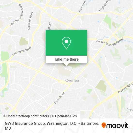
See GWB Insurance Group, Baltimore, on the map
Public Transit to GWB Insurance Group in Baltimore
Wondering how to get to GWB Insurance Group in Baltimore? Moovit helps you find the best way to get to GWB Insurance Group with step-by-step directions from the nearest public transit station.
Moovit provides free maps and live directions to help you navigate through your city. View schedules, routes, timetables, and find out how long does it take to get to GWB Insurance Group in real time.
Looking for the nearest stop or station to GWB Insurance Group? Check out this list of stops closest to your destination: Belair Rd & Fullerton Ave FS Nb; Fullerton Ave & Belair Rd Wb; Due Moyer Ave.
Bus: 33, CITYLINK BROWN, 115, 36, 54.
Want to see if there’s another route that gets you there at an earlier time? Moovit helps you find alternative routes or times. Get directions from and directions to GWB Insurance Group easily from the Moovit App or Website.
We make riding to GWB Insurance Group easy, which is why over 1.5 million users, including users in Baltimore, trust Moovit as the best app for public transit. You don’t need to download an individual bus app or train app, Moovit is your all-in-one transit app that helps you find the best bus time or train time available.
For information on prices of bus, costs and ride fares to GWB Insurance Group, please check the Moovit app.
Use the app to navigate to popular places including to the airport, hospital, stadium, grocery store, mall, coffee shop, school, college, and university.
GWB Insurance Group Address: 7711 Everall Ave Nottingham, MD 21236 street in Baltimore
- Decisive Covenant Care Consulting,
- J & G Hooves & Paws,
- RJ Heating & Cooli,
- Baltimore Birth and Bodywork About Me,
- Woodhome Elementary Middle School,
- Baltimore City,
- Southern Baptist Convention,
- Nepali Speaking Church of Baltimore, USA,
- Larry's Moving and Storage,
- H.U.R Stories Outreach,
- Greg Prouty & Associates,
- Tots R US Early Learning Center,
- C - Mart,
- Otoman Halal Spot,
- C Mart,
- Haley S Smith,
- Sushi & Thai Cuisine,
- Davis Sons Painting Wallcovering,
- Raymond Geddes Co.,
- Just Carpet Cleaning Carpet Cleaning
Places Near GWB Insurance Group (Baltimore)
- National Museum of African American History and Culture, Washington,
- Washington National Cathedral, Washington,
- Westfield Montgomery Mall, Montgomery County,
- Washington DC VA Medical Center, Washington,
- M&T Bank Stadium, Baltimore,
- Sibley Memorial Hospital, Washington,
- The Anthem, Washington,
- Amazon Hq2, Arlington County,
- Basilica of the National Shrine, Washington,
- Pennsylvania Ave NW (3rd st and pennsylvania), Washington,
- Museum Of The Bible, Washington,
- Marriott Marquis Washington, DC, Washington,
- National Theatre, Washington,
- Capital One Arena, Washington,
- National Zoo, Washington,
- PG Mall, Prince George's County,
- Rock Creek Tennis Center, Washington,
- Camden Yards, Baltimore,
- Warner Theatre, Washington,
- Georgetown, Washington
How to get to popular places in Washington, D.C. - Baltimore, MD with public transit
Get around Baltimore by public transit!
Traveling around Baltimore has never been so easy. See step by step directions as you travel to any attraction, street or major public transit station. View bus and train schedules, arrival times, service alerts and detailed routes on a map, so you know exactly how to get to anywhere in Baltimore.
When traveling to any destination around Baltimore use Moovit's Live Directions with Get Off Notifications to know exactly where and how far to walk, how long to wait for your line, and how many stops are left. Moovit will alert you when it's time to get off — no need to constantly re-check whether yours is the next stop.
Wondering how to use public transit in Baltimore or how to pay for public transit in Baltimore? Moovit public transit app can help you navigate your way with public transit easily, and at minimum cost. It includes public transit fees, ticket prices, and costs. Looking for a map of Baltimore public transit lines? Moovit public transit app shows all public transit maps in Baltimore with all Bus, Train, Metro, Light Rail and Ferry routes and stops on an interactive map.
Washington, D.C. - Baltimore, MD has 5 transit type(s), including: Bus, Train, Metro, Light Rail and Ferry, operated by several transit agencies, including WMATA, Montgomery County Ride On, Fairfax Connector, TheBus, PRTC, DASH - Alexandria, Arlington Transit (ART), RTA of Central Maryland, MDOT MTA, MDOT MTA Light RailLink, MDOT MTA Commuter Bus, MDOT MTA Local Bus, FXBGO!, Virginia Railway Express (VRE) and MARC