Directions to G Cnc (Steinen) with public transportation
The following transit lines have routes that pass near G Cnc
 Bus: 7305.
How to get to G Cnc by bus?
Click on the bus route to see step by step directions with maps, line arrival times and updated time schedules.
Bus stop near G Cnc in Steinen
- Schlächtenhaus, 1 min walk,VIEW
Bus lines to G Cnc in Steinen
- 7305, Steinen Bahnhof,VIEW
What are the closest stations to G Cnc?
The closest stations to G Cnc are:
- Schlächtenhaus is 21 meters away, 1 min walk.
Which bus line stops near G Cnc?
7305 (Endenburg Rathaus)
What’s the nearest bus station to G Cnc in Steinen?
The nearest bus station to G Cnc in Steinen is Schlächtenhaus. It’s a 1 min walk away.
What time is the first bus to G Cnc in Steinen?
The 7305 is the first bus that goes to G Cnc in Steinen. It stops nearby at 6:30 AM.
What time is the last bus to G Cnc in Steinen?
The 7305 is the last bus that goes to G Cnc in Steinen. It stops nearby at 6:38 PM.
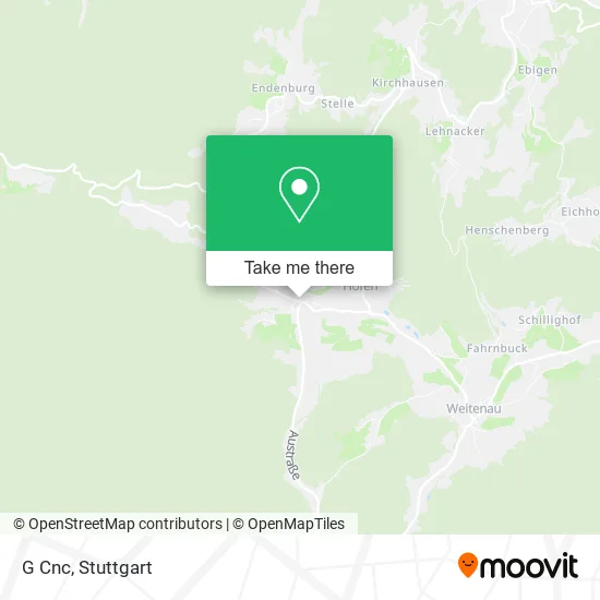
See G Cnc, Steinen, on the map
Public Transit to G Cnc in Steinen
Wondering how to get to G Cnc in Steinen? Moovit helps you find the best way to get to G Cnc with step-by-step directions from the nearest public transit station.
Moovit provides free maps and live directions to help you navigate through your city. View schedules, routes, timetables, and find out how long does it take to get to G Cnc in real time.
Looking for the nearest stop or station to G Cnc? Check out this list of stops closest to your destination: Schlächtenhaus.
Bus: 7305.
Want to see if there’s another route that gets you there at an earlier time? Moovit helps you find alternative routes or times. Get directions from and directions to G Cnc easily from the Moovit App or Website.
We make riding to G Cnc easy, which is why over 1.5 million users, including users in Steinen, trust Moovit as the best app for public transit. You don’t need to download an individual bus app or train app, Moovit is your all-in-one transit app that helps you find the best bus time or train time available.
For information on prices of bus and light rail, costs and ride fares to G Cnc, please check the Moovit app.
Use the app to navigate to popular places including to the airport, hospital, stadium, grocery store, mall, coffee shop, school, college, and university.
G Cnc Address: Austraße 28 Schlächtenhaus, 79585 Steinen street in Steinen
- Glaser Maschinenbau-Mechanik,
- Garni Zerspanungstechnik,
- Schlächtenhaus Linde,
- Ferienwohnung Familie Röder,
- Würger Harald Schreinermeister,
- Musikverein Schlächtenhaus,
- Brunnen,
- Steinbildhauer Raschendorfer,
- Walter Läuger Jun. Schreinerei,
- Petra Haberer,
- Hanspeter Schleith,
- Kis Kontor im Schwarzwald,
- Ingo Forsthuber,
- Brendle-Baumontagen,
- Zwergenhüsli,
- Schule,
- Ev. Kindergarten Spielstube,
- Ortsverwaltung,
- Steinenberghalle,
- Freiwillige Feuerwehr Steinen Abteilung Schlächtenhaus
Places Near G Cnc (Steinen)
- Klinikum Stuttgart - Katharinenhospital, Stuttgart-Mitte,
- Pariser Platz Stuttgart, Stuttgart-Mitte,
- Gasometer Pforzheim, Pforzheim,
- FlixBus Haltestelle, Stuttgart,
- Mercedes-Benz Museum (Mercedes Museum Stuttgart), Bad Cannstatt,
- Mettingen Eros-Center Puff Laufhaus, Esslingen Am Neckar,
- Geilhaus Haus 33a, Reutlingen-Betzingen,
- Marmorsaal Im Weissenburgpark, Stuttgart-Süd,
- Porsche Museum, Zuffenhausen,
- Hanns-Martin-Schleyer-Halle (Stuttgart Hans-Martin-Schleyerhalle), Bad Cannstatt,
- Wilhelma (U-Bahn Wilhelma), Bad Cannstatt,
- Hanns-Martin-Schleyer-Halle, Bad Cannstatt,
- Waldfriedhof, Degerloch,
- SI-Centrum, Möhringen,
- Mercedes-Benz Museum, Bad Cannstatt,
- Porsche-Arena, Bad Cannstatt,
- Hauptbahnhof Stuttgart, Stuttgart-Mitte,
- Schleyerhalle, Bad Cannstatt,
- Gleis 101/102 (tief), Stuttgart-Mitte,
- Im Wizemann (Halle), Bad Cannstatt
How to get to popular places in Stuttgart with public transit
Get around Steinen by public transit!
Traveling around Steinen has never been so easy. See step by step directions as you travel to any attraction, street or major public transit station. View bus and train schedules, arrival times, service alerts and detailed routes on a map, so you know exactly how to get to anywhere in Steinen.
When traveling to any destination around Steinen use Moovit's Live Directions with Get Off Notifications to know exactly where and how far to walk, how long to wait for your line, and how many stops are left. Moovit will alert you when it's time to get off — no need to constantly re-check whether yours is the next stop.
Wondering how to use public transit in Steinen or how to pay for public transit in Steinen? Moovit public transit app can help you navigate your way with public transit easily, and at minimum cost. It includes public transit fees, ticket prices, and costs. Looking for a map of Steinen public transit lines? Moovit public transit app shows all public transit maps in Steinen with all Bus, Train, Subway, Light Rail, Ferry, S-Bahn and Funicular routes and stops on an interactive map.
Stuttgart has 7 transit type(s), including: Bus, Train, Subway, Light Rail, Ferry, S-Bahn and Funicular, operated by several transit agencies, including SSB - Stadtbahn, SSB, SSB - Seilbahn / Zacke, S-Bahn Stuttgart, Rhein-Neckar-Verkehr GmbH (rnv), Karlsruher Verkehrsverbund, DB AG, DB Regiobus BW, Arverio Baden-Württemberg GmbH, DB RegioNetz Verkehrs GmbH Westfrankenbahn, DB Regio AG Baden-Württemberg, Südwestdeutsche Verkehrs-AG, DB Regio AG Mitte Region Hessen, DB and Bodensee-Oberschwaben-Bahn