How to get to G-das by bus?
Click on the bus route to see step by step directions with maps, line arrival times and updated time schedules.
From SAP Campus, Walldorf
41 minFrom Agaplesion Bethanien Krankenhaus Heidelberg, Südstadt
106 minFrom Möbel Höffner, Schwetzingen
75 minFrom SAP Headquarters, Walldorf
46 minFrom SAP Walldorf P18, Walldorf
46 minFrom Globus Restaurant Waghäusel, Waghäusel
104 minFrom Luxor Filmpalast, Bahnstadt
94 minFrom GRN-Klinik Schwetzingen, Schwetzingen
47 minFrom Marie-Baum-Schule Heidelberg, Wieblingen
101 min
How to get to G-das by train?
Click on the train route to see step by step directions with maps, line arrival times and updated time schedules.
Bus stops near G-das in Hockenheim
Train station near G-das in Hockenheim
- Hockenheim, Bahnhof, 29 min walk,VIEW
What are the closest stations to G-das?
The closest stations to G-das are:
- Hockenheim, Waldstr./Friedhof is 146 meters away, 3 min walk.
- Hockenheim, Rathaus is 950 meters away, 13 min walk.
- Hockenheim, Bahnhof is 2230 meters away, 29 min walk.
Which train lines stop near G-das?
These train lines stop near G-das: S6, S9.
Which bus lines stop near G-das?
These bus lines stop near G-das: 717, 731.
What’s the nearest train station to G-das in Hockenheim?
The nearest train station to G-das in Hockenheim is Hockenheim, Bahnhof. It’s a 29 min walk away.
What’s the nearest bus station to G-das in Hockenheim?
The nearest bus station to G-das in Hockenheim is Hockenheim, Waldstr./Friedhof. It’s a 3 min walk away.
What time is the first train to G-das in Hockenheim?
The S6 is the first train that goes to G-das in Hockenheim. It stops nearby at 3:54 AM.
What time is the last train to G-das in Hockenheim?
The S9 is the last train that goes to G-das in Hockenheim. It stops nearby at 1:17 AM.
What time is the first bus to G-das in Hockenheim?
The 717 is the first bus that goes to G-das in Hockenheim. It stops nearby at 5:06 AM.
What time is the last bus to G-das in Hockenheim?
The 717 is the last bus that goes to G-das in Hockenheim. It stops nearby at 1:05 AM.
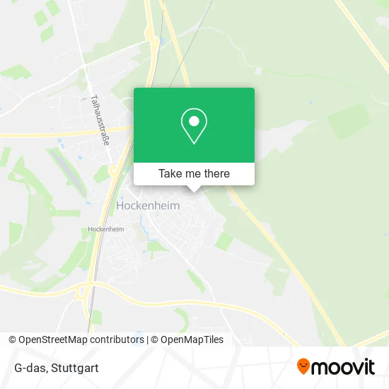
See G-das, Hockenheim, on the map
Public Transit to G-das in Hockenheim
Wondering how to get to G-das in Hockenheim? Moovit helps you find the best way to get to G-das with step-by-step directions from the nearest public transit station.
Moovit provides free maps and live directions to help you navigate through your city. View schedules, routes, timetables, and find out how long does it take to get to G-das in real time.
Looking for the nearest stop or station to G-das? Check out this list of stops closest to your destination: Hockenheim, Waldstr./Friedhof; Hockenheim, Rathaus; Hockenheim, Bahnhof.
Train: S6, S9, RE9, S12.Bus: 717, 731.
Want to see if there’s another route that gets you there at an earlier time? Moovit helps you find alternative routes or times. Get directions from and directions to G-das easily from the Moovit App or Website.
We make riding to G-das easy, which is why over 1.5 million users, including users in Hockenheim, trust Moovit as the best app for public transit. You don’t need to download an individual bus app or train app, Moovit is your all-in-one transit app that helps you find the best bus time or train time available.
For information on prices of bus, train and light rail, costs and ride fares to G-das, please check the Moovit app.
Use the app to navigate to popular places including to the airport, hospital, stadium, grocery store, mall, coffee shop, school, college, and university.
G-das Address: In der Clamm 32 68766 Hockenheim street in Hockenheim
- Gisela Krämer,
- Beerdigungsinstitut Hockenheim,
- Bestattungsinstitut Jäckle,
- D-Tec,
- SV Sparkassenversicherung: Generalagentur Nicole Träutlein,
- Eks-Verlag Erika Kübeck-Seidel,
- Pflegeportal Süd,
- Cieslik,
- Baumann Hockenheim,
- Spargel Hof Schmitt,
- Der Hoggemer Laden- Gemüsehof Schmitt,
- Hofladen-Automat,
- Elmar Reiche,
- Ulrik Kronauer Baggerarbeiten,
- Sandra Pfertner-Berg,
- Waldstraße/Friedhof,
- Getraenke GAA,
- Mensch und Maschine Hirsch,
- Babau Dienstleistungen Bekteshi,
- Evangelische Kindertagesstätte
Places Near G-das (Hockenheim)
- Wilhelma (U-Bahn Wilhelma), Bad Cannstatt,
- Pariser Platz Stuttgart, Stuttgart-Mitte,
- Klinikum Stuttgart - Katharinenhospital, Stuttgart-Mitte,
- Marmorsaal Im Weissenburgpark, Stuttgart-Süd,
- FlixBus Haltestelle, Stuttgart,
- Geilhaus Haus 33a, Reutlingen-Betzingen,
- Hanns-Martin-Schleyer-Halle, Bad Cannstatt,
- Gleis 101/102 (tief), Stuttgart-Mitte,
- Hauptbahnhof Stuttgart, Stuttgart-Mitte,
- SI-Centrum, Möhringen,
- Gasometer Pforzheim, Pforzheim,
- Mercedes-Benz Museum (Mercedes Museum Stuttgart), Bad Cannstatt,
- Schleyerhalle, Bad Cannstatt,
- Porsche-Arena, Bad Cannstatt,
- Im Wizemann (Halle), Bad Cannstatt,
- Mercedes-Benz Museum, Bad Cannstatt,
- Mettingen Eros-Center Puff Laufhaus, Esslingen Am Neckar,
- Porsche Museum, Zuffenhausen,
- Hanns-Martin-Schleyer-Halle (Stuttgart Hans-Martin-Schleyerhalle), Bad Cannstatt,
- Waldfriedhof, Degerloch
How to get to popular places in Stuttgart with public transit
Get around Hockenheim by public transit!
Traveling around Hockenheim has never been so easy. See step by step directions as you travel to any attraction, street or major public transit station. View bus and train schedules, arrival times, service alerts and detailed routes on a map, so you know exactly how to get to anywhere in Hockenheim.
When traveling to any destination around Hockenheim use Moovit's Live Directions with Get Off Notifications to know exactly where and how far to walk, how long to wait for your line, and how many stops are left. Moovit will alert you when it's time to get off — no need to constantly re-check whether yours is the next stop.
Wondering how to use public transit in Hockenheim or how to pay for public transit in Hockenheim? Moovit public transit app can help you navigate your way with public transit easily, and at minimum cost. It includes public transit fees, ticket prices, and costs. Looking for a map of Hockenheim public transit lines? Moovit public transit app shows all public transit maps in Hockenheim with all Bus, Train, Subway, Light Rail, Ferry, S-Bahn and Funicular routes and stops on an interactive map.
Stuttgart has 7 transit type(s), including: Bus, Train, Subway, Light Rail, Ferry, S-Bahn and Funicular, operated by several transit agencies, including SSB - Stadtbahn, SSB, SSB - Seilbahn / Zacke, S-Bahn Stuttgart, Rhein-Neckar-Verkehr GmbH (rnv), Karlsruher Verkehrsverbund, DB AG, DB Regiobus BW, Arverio Baden-Württemberg GmbH, DB RegioNetz Verkehrs GmbH Westfrankenbahn, DB Regio AG Baden-Württemberg, Südwestdeutsche Verkehrs-AG, DB Regio AG Mitte Region Hessen, DB and Bodensee-Oberschwaben-Bahn