Directions to Gaflenz with public transportation
The following transit lines have routes that pass near Gaflenz
 Train: R5, R58.
- Bus: 630, SV130, SV130.
How to get to Gaflenz by bus?
Click on the bus route to see step by step directions with maps, line arrival times and updated time schedules.
How to get to Gaflenz by train?
Click on the train route to see step by step directions with maps, line arrival times and updated time schedules.
Bus stops near Gaflenz
- Gaflenz Volksschule, 6 min walk,
Train station near Gaflenz
- Oberland Oö Bhf, 27 min walk,
Bus lines to Gaflenz
- 630, Gaflenz Volksschule,
- SV130, Amstetten Bahnhof,
- SV130, Waidhofen/Ybbs Bahnhof,
What are the closest stations to Gaflenz?
The closest stations to Gaflenz are:
- Gaflenz Volksschule is 421 meters away, 6 min walk.
- Oberland Oö Bhf is 2063 meters away, 27 min walk.
Which train lines stop near Gaflenz?
These train lines stop near Gaflenz: R5, R58.
Which bus line stops near Gaflenz?
630 (Waidhofen/Ybbs Landesklinikum)
What’s the nearest train station to Gaflenz?
The nearest train station to Gaflenz is Oberland Oö Bhf. It’s a 27 min walk away.
What’s the nearest bus station to Gaflenz?
The nearest bus station to Gaflenz is Gaflenz Volksschule. It’s a 6 min walk away.
What time is the first train to Gaflenz?
The R58 is the first train that goes to Gaflenz. It stops nearby at 6:17 AM.
What time is the last train to Gaflenz?
The R58 is the last train that goes to Gaflenz. It stops nearby at 8:43 PM.
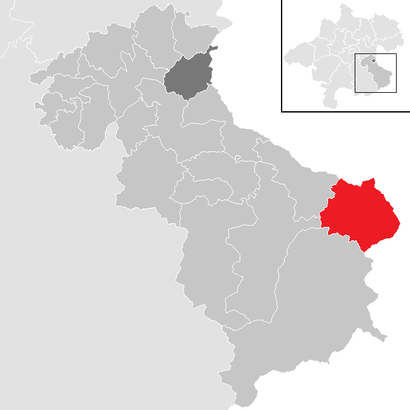
See Gaflenz on the map
Public Transportation to Gaflenz
Wondering how to get to Gaflenz? Moovit helps you find the best way to get to Gaflenz with step-by-step directions from the nearest public transit station.
Moovit provides free maps and live directions to help you navigate through your city. View schedules, routes, timetables, and find out how long does it take to get to Gaflenz in real time.
Looking for the nearest stop or station to Gaflenz? Check out this list of stops closest to your destination: Gaflenz Volksschule; Oberland Oö Bhf.
Train: R5, R58.Bus: 630, SV130, SV130.
Want to see if there’s another route that gets you there at an earlier time? Moovit helps you find alternative routes or times. Get directions from and directions to Gaflenz easily from the Moovit App or Website.
We make riding to Gaflenz easy, which is why over 1.5 million users, including users in Austria, trust Moovit as the best app for public transit. You don’t need to download an individual bus app or train app, Moovit is your all-in-one transit app that helps you find the best bus time or train time available.
For information on prices of train, bus and light rail, costs and ride fares to Gaflenz, please check the Moovit app.
Use the app to navigate to popular places including to the airport, hospital, stadium, grocery store, mall, coffee shop, school, college, and university.
Location: Austria
Gaflenz is a market town in the Steyr-Land district of the Austrian state of Upper Austria. It is known for its saws and its gothic-style St. Andreas Parish Church, established in 1494.Wiki
Popular routes to Gaflenz
Popular routes from Gaflenz
- Opponitz,
- Gemeinde Waidhofen An Der Ybbs,
- Weyer,
- Maria Neustift,
- Gemeinde Hollenstein An Der Ybbs,
- Gemeinde Ybbsitz,
- Ertl,
- Gemeinde Sonntagberg,
- Großraming,
- Gemeinde St. Georgen am Reith,
- Gemeinde Seitenstetten,
- Gemeinde Allhartsberg,
- Gemeinde Kematen An Der Ybbs,
- Gemeinde Biberbach,
- Gemeinde Göstling An Der Ybbs,
- Gemeinde Sankt Peter In Der Au,
- Laussa,
- Reichraming,
- Gemeinde Aschbach-Markt,
- Weistrach
Places Near Gaflenz
- Schweizerhaus (Karl Kolariks Schweizerhaus), Leopoldstadt,
- Leopoldauer Alm, Floridsdorf,
- Klinik Floridsdorf (Krankenhaus Nord), Floridsdorf,
- Mariahilfer Strasse, Mariahilf,
- Setagayapark, Döbling,
- Raimund-Theater, Mariahilf,
- Feuerhalle Simmering, Simmering,
- Türkenschanzpark, Währing,
- Donauzentrum, Donaustadt,
- Ikea Wien Nord, Donaustadt,
- Lugner City, Rudolfsheim-Fünfhaus,
- 10er Marie, Ottakring,
- Auhof-Center, Penzing,
- Ghegastraße 3, Landstraße,
- Strandbad Gänsehäufel, Donaustadt,
- Zentralfriedhof Halle 3, Simmering,
- Kabarett Simpl, 1., Innere Stadt,
- Schiffsanleger Wien-Nussdorf, Döbling,
- Thomas-Klestil-Platz, Landstraße,
- Ronacher, 1., Innere Stadt
How to get to popular places in Austria with public transit
Get around Austria by public transit!
Traveling around Austria has never been so easy. See step by step directions as you travel to any attraction, street or major public transit station. View bus and train schedules, arrival times, service alerts and detailed routes on a map, so you know exactly how to get to anywhere in Austria.
When traveling to any destination around Austria use Moovit's Live Directions with Get Off Notifications to know exactly where and how far to walk, how long to wait for your line, and how many stops are left. Moovit will alert you when it's time to get off — no need to constantly re-check whether yours is the next stop.
Wondering how to use public transit in Austria or how to pay for public transit in Austria? Moovit public transit app can help you navigate your way with public transit easily, and at minimum cost. It includes public transit fees, ticket prices, and costs. Looking for a map of Austria public transit lines? Moovit public transit app shows all public transit maps in Austria with all Bus, Train, Subway, Light Rail, Ferry and Funicular routes and stops on an interactive map.
Austria has 6 transit type(s), including: Bus, Train, Subway, Light Rail, Ferry and Funicular, operated by several transit agencies, including Wiener Linien GmbH & Co KG, Vienna Airport Lines, OEBB Personenverkehr AG Kundenservice, Wiener Lokalbahnen GmbH, City Air Terminal Betriebsgesellschaft m.b.H., CAT, Österreichische Postbus AG, VOR GmbH, Graz Linien, Graz-Köflacher Bahn und Busbetrieb GmbH, Steiermarkbahn und Bus GmbH, Linz Linien GmbH, Salzburg AG (Salzburger Lokalbahn), Salzburg AG (OBus) and KMG Klagenfurt Mobil GmbH