How to get to Galion by bus?
Click on the bus route to see step by step directions with maps, line arrival times and updated time schedules.
From Yprema, Reims
40 minFrom Musée Du Fort De La Pompelle, Puisieulx
48 minFrom Spirit S Art, Sillery
39 minFrom Shengda, Thillois
26 minFrom Aquamoovprunay, Prunay
62 minFrom FedEx, Reims
38 minFrom La Logia, Taissy
28 minFrom Tours in Champagne - Stéphane Demissy, Sillery
37 minFrom Le Relais de, Sillery
45 minFrom Relais Nautique, Sillery
37 min
Light Rail stations near Galion in Reims
- Langlet, 4 min walk,VIEW
Bus stops near Galion in Reims
Bus lines to Galion in Reims
- C, Gare Centre,VIEW
- O1, Moulin Housse,VIEW
- U1, C.C. Cernay,VIEW
- U8, La Couturelle,VIEW
- U9, C.C. Cormontreuil,VIEW
- 20, Gare Clairmarais,VIEW
- U3, Maurencienne,VIEW
- U4, Orgeval,VIEW
- U6, Croix Blandin,VIEW
- U7, Hopital Debre,VIEW
- U2, Route De Witry,VIEW
- 22, U22-NEUVILETTE MAIRIE <> ROYALE,VIEW
- 23, U23-ODILE MADELIN <> ROYALE,VIEW
- E1, Cormicy,VIEW
- E6, Gueux,VIEW
- E7, Gare Clairmarais,VIEW
- E5, Cathedrale,VIEW
What are the closest stations to Galion?
The closest stations to Galion are:
- Langlet is 232 meters away, 4 min walk.
- Etape is 269 meters away, 4 min walk.
- Gare De Reims - Centre is 320 meters away, 5 min walk.
- Loges Coquault is 392 meters away, 6 min walk.
- Royale is 610 meters away, 8 min walk.
- Gare Clairmarais is 626 meters away, 9 min walk.
- Cathedrale is 669 meters away, 9 min walk.
Which bus lines stop near Galion?
These bus lines stop near Galion: E5, E6, O1.
What’s the nearest light rail station to Galion in Reims?
The nearest light rail station to Galion in Reims is Langlet. It’s a 4 min walk away.
What’s the nearest bus station to Galion in Reims?
The nearest bus station to Galion in Reims is Etape. It’s a 4 min walk away.
What time is the first light rail to Galion in Reims?
The TRAM is the first light rail that goes to Galion in Reims. It stops nearby at 5:14 AM.
What time is the last light rail to Galion in Reims?
The TRAM is the last light rail that goes to Galion in Reims. It stops nearby at 12:57 AM.
What time is the first bus to Galion in Reims?
The U9 is the first bus that goes to Galion in Reims. It stops nearby at 5:21 AM.
What time is the last bus to Galion in Reims?
The O1 is the last bus that goes to Galion in Reims. It stops nearby at 12:43 AM.
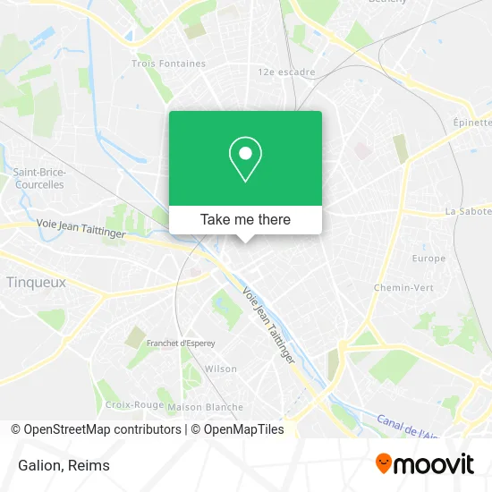
See Galion, Reims, on the map
Public Transit to Galion in Reims
Wondering how to get to Galion in Reims? Moovit helps you find the best way to get to Galion with step-by-step directions from the nearest public transit station.
Moovit provides free maps and live directions to help you navigate through your city. View schedules, routes, timetables, and find out how long does it take to get to Galion in real time.
Looking for the nearest stop or station to Galion? Check out this list of stops closest to your destination: Langlet; Etape; Gare De Reims - Centre; Loges Coquault; Royale; Gare Clairmarais; Cathedrale.
Bus: E5, E6, O1, C, U1, U8, U9, 20, U3, U4, U6, U7, U2, 22, 23, E1, E7.
Want to see if there’s another route that gets you there at an earlier time? Moovit helps you find alternative routes or times. Get directions from and directions to Galion easily from the Moovit App or Website.
We make riding to Galion easy, which is why over 1.5 million users, including users in Reims, trust Moovit as the best app for public transit. You don’t need to download an individual bus app or train app, Moovit is your all-in-one transit app that helps you find the best bus time or train time available.
For information on prices of bus, costs and ride fares to Galion, please check the Moovit app.
Use the app to navigate to popular places including to the airport, hospital, stadium, grocery store, mall, coffee shop, school, college, and university.
Galion Address: 27 Rue de Thillois 51100 Reims street in Reims
- Barrem,
- Claudie Pierlot,
- Ei Loeuillet Aga,
- L'Indochine,
- Allianz,
- Espace Canin,
- Les Petites,
- Notshy,
- Not Shy Reims,
- Amine Sellamna I Avocat,
- Sarl Ouk,
- Hôtel au Bon Accueil,
- La Réf Barber Shop,
- Miss Afrika,
- Dessous Entendu,
- Ekyog,
- Chicha Access Reims,
- Groupe Victor Hugo,
- Madame Peucheret Agnès,
- Le New Thaï
Places Near Galion (Reims)
- Tinqueux, Tinqueux,
- Campus Croix Rouge, Reims,
- Ikea, Thillois,
- Bezannes, Bezannes,
- E. Leclerc Champfleury, Champfleury,
- Hôpital Maison Blanche, Reims,
- Polyclinique Reims Bezannes, Bezannes,
- La Neuvillette, Reims,
- Leclerc, Saint-Brice-Courcelles,
- Croix Blandin, Reims,
- Cormontreuil, Reims,
- Hôpital Debré, Reims,
- CHU, Reims,
- Parc Des Expositions, Reims,
- Parc de Champagne, Reims,
- Carrefour, Tinqueux,
- Gare Tgv, Bezannes,
- Centre Commercial Cernay, Reims,
- Bétheny, Bétheny,
- St Remi, Reims
How to get to popular places in Reims with public transit
Get around Reims by public transit!
Traveling around Reims has never been so easy. See step by step directions as you travel to any attraction, street or major public transit station. View bus and train schedules, arrival times, service alerts and detailed routes on a map, so you know exactly how to get to anywhere in Reims.
When traveling to any destination around Reims use Moovit's Live Directions with Get Off Notifications to know exactly where and how far to walk, how long to wait for your line, and how many stops are left. Moovit will alert you when it's time to get off — no need to constantly re-check whether yours is the next stop.
Wondering how to use public transit in Reims or how to pay for public transit in Reims? Moovit public transit app can help you navigate your way with public transit easily, and at minimum cost. It includes public transit fees, ticket prices, and costs. Looking for a map of Reims public transit lines? Moovit public transit app shows all public transit maps in Reims with all Bus and Light Rail routes and stops on an interactive map.
Reims has 2 transit type(s), including: Bus and Light Rail, operated by several transit agencies, including Transdev Reims