How to get to Game Point Miami by bus?
Click on the bus route to see step by step directions with maps, line arrival times and updated time schedules.
From W 49th St / NW 103rd St, Hialeah
62 minFrom Walmart, Miami
75 minFrom NW 163rd St / NW 57th Ave, Miami
94 minFrom Walmart Doral Offices, North Westside
91 minFrom Walmart (Walmart Supercenter Miami - NW 79th Street), Miami
75 minFrom Best Western Plus Miami-Doral/Dolphin Mall, North Westside
144 minFrom NW 37th Ave, Miami
77 minFrom Turnpike Exit @ Doral Blvd. (NW 41 Street), North Westside
132 minFrom Hialeah Park Casino, Hialeah
60 minFrom Le Jeune Rd / E 49th St, Hialeah
67 min
Bus stops near Game Point Miami in Hialeah
Bus lines to Game Point Miami in Hialeah
What are the closest stations to Game Point Miami?
The closest stations to Game Point Miami are:
- W 28 Av & W 76 St is 539 yards away, 7 min walk.
- W 28 Av & W 73 St is 848 yards away, 11 min walk.
Which bus lines stop near Game Point Miami?
These bus lines stop near Game Point Miami: 54, HIAFLA, HIAMAR.
What’s the nearest bus station to Game Point Miami in Hialeah?
The nearest bus station to Game Point Miami in Hialeah is W 28 Av & W 76 St. It’s a 7 min walk away.
What time is the first bus to Game Point Miami in Hialeah?
The 54 is the first bus that goes to Game Point Miami in Hialeah. It stops nearby at 5:38 AM.
What time is the last bus to Game Point Miami in Hialeah?
The 54 is the last bus that goes to Game Point Miami in Hialeah. It stops nearby at 8:15 PM.
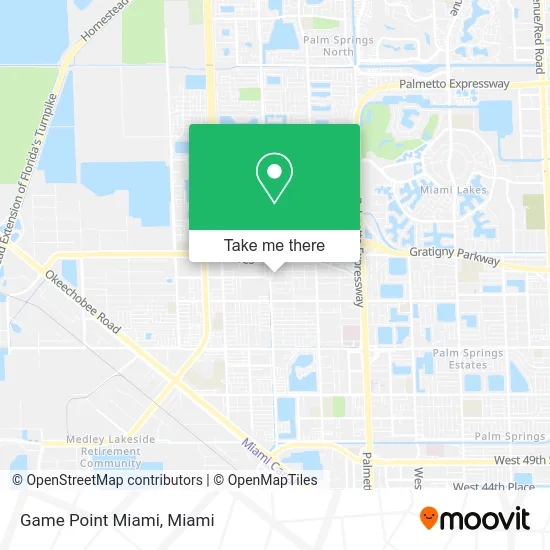
See Game Point Miami, Hialeah, on the map
Public Transit to Game Point Miami in Hialeah
Wondering how to get to Game Point Miami in Hialeah? Moovit helps you find the best way to get to Game Point Miami with step-by-step directions from the nearest public transit station.
Moovit provides free maps and live directions to help you navigate through your city. View schedules, routes, timetables, and find out how long does it take to get to Game Point Miami in real time.
Looking for the nearest stop or station to Game Point Miami? Check out this list of stops closest to your destination: W 28 Av & W 76 St; W 28 Av & W 73 St.
Bus: 54, HIAFLA, HIAMAR.
Want to see if there’s another route that gets you there at an earlier time? Moovit helps you find alternative routes or times. Get directions from and directions to Game Point Miami easily from the Moovit App or Website.
We make riding to Game Point Miami easy, which is why over 1.5 million users, including users in Hialeah, trust Moovit as the best app for public transit. You don’t need to download an individual bus app or train app, Moovit is your all-in-one transit app that helps you find the best bus time or train time available.
For information on prices of bus and train, costs and ride fares to Game Point Miami, please check the Moovit app.
Use the app to navigate to popular places including to the airport, hospital, stadium, grocery store, mall, coffee shop, school, college, and university.
Game Point Miami Address: 8081 W 28th Ave Hialeah, FL 33016 street in Hialeah
- Hialeah School of Boxing,
- Simple Airsoft,
- Aircraft Technicians,
- Ice Cream Shop,
- Kidworks USA (Kid Works USA),
- Chiropractic Slipped Discs,
- Rumba Balloons,
- Kidworks Therapy Inc.,
- Medical Training Specialists,
- BRS Pool Spa & Fountain,
- Coffee Delivery Service Miami,
- Decor by Heidy,
- Medical Billing V & L,
- Mia Persiane,
- Doors and Plus,
- Advanced Multi Sign Corp.,
- Dna Performance Inc.,
- West Hialeah U-Gas,
- Fabri-Equipment Corp.,
- MVP Batting Cages
Places Near Game Point Miami (Hialeah)
- Port of Miami Cruise Terminal, Miami,
- Hard Rock Stadium, Miami Gardens,
- Zoo Miami, Miami,
- Sawgrass mall ( FL ), Miami Beach,
- Keiser University Flagship Campus, West Palm Beach,
- Aventura Mall, Miami,
- Aventura Mall, Miami Beach,
- Dolphin Mall Bus, Miami,
- Sawgrass Mall, Miami,
- Miami Design District, Miami,
- Wynwood, Miami,
- Miami VA Hospital, Miami,
- Little Havana, Miami,
- Bayside Marketplace, Miami,
- Brickell City Centre, Miami,
- Miami Freedom Park, Miami,
- Miami-Dade County Courthouse, Miami,
- Richard E. Gerstein Justice Building, Miami,
- Marlins Park, Miami,
- Dolphin Mall, Miami
How to get to popular places in Miami with public transit
Get around Hialeah by public transit!
Traveling around Hialeah has never been so easy. See step by step directions as you travel to any attraction, street or major public transit station. View bus and train schedules, arrival times, service alerts and detailed routes on a map, so you know exactly how to get to anywhere in Hialeah.
When traveling to any destination around Hialeah use Moovit's Live Directions with Get Off Notifications to know exactly where and how far to walk, how long to wait for your line, and how many stops are left. Moovit will alert you when it's time to get off — no need to constantly re-check whether yours is the next stop.
Wondering how to use public transit in Hialeah or how to pay for public transit in Hialeah? Moovit public transit app can help you navigate your way with public transit easily, and at minimum cost. It includes public transit fees, ticket prices, and costs. Looking for a map of Hialeah public transit lines? Moovit public transit app shows all public transit maps in Hialeah with all Bus, Train, Light Rail and Ferry routes and stops on an interactive map.
Miami has 4 transit type(s), including: Bus, Train, Light Rail and Ferry, operated by several transit agencies, including Broward County Transit, Miami-Dade Transit, Metrorail, Palm Tran, Tri-Rail, Brightline, MARTY, City of Homestead Trolley, Key West Transit, Treasure Coast Connector, GoLine IRT, Amtrak, Greyhound-us, FlixBus-us and Aventura Express Shuttle Bus