How to get to Gap by bus?
Click on the bus route to see step by step directions with maps, line arrival times and updated time schedules.
From Malcolm X Park, Washington
95 minFrom Tidal Basin, Washington
63 minFrom Saint Elizabeth's West Campus (DHS/USCG), Washington
84 minFrom National Children’S Museum, Washington
56 minFrom Qsa, Arlington County
97 minFrom US department of state SA 4 E, Washington
57 minFrom Rayburn House Office Building, Washington
56 minFrom Headquarters - U.S. Coast Guard, Washington
116 minFrom The Westin Crystal City Hotel, Arlington County
98 minFrom Foggy Bottom, Washington
47 min
How to get to Gap by metro?
Click on the metro route to see step by step directions with maps, line arrival times and updated time schedules.
From Malcolm X Park, Washington
59 minFrom Tidal Basin, Washington
52 minFrom Saint Elizabeth's West Campus (DHS/USCG), Washington
59 minFrom National Children’S Museum, Washington
32 minFrom Qsa, Arlington County
45 minFrom US department of state SA 4 E, Washington
57 minFrom Rayburn House Office Building, Washington
46 minFrom The Westin Crystal City Hotel, Arlington County
43 minFrom Foggy Bottom, Washington
44 min
Bus stops near Gap in Washington
Metro stations near Gap in Washington
What are the closest stations to Gap?
The closest stations to Gap are:
- Rock Creek Church Rd Nw+Webster St NW is 297 yards away, 4 min walk.
- Grant Cir Nw+Varnum St NW is 462 yards away, 6 min walk.
- Georgia Ave - Petworth is 1632 yards away, 20 min walk.
- Brookland-Cua is 1819 yards away, 22 min walk.
Which bus lines stop near Gap?
These bus lines stop near Gap: D44, D74.
Which metro lines stop near Gap?
These metro lines stop near Gap: GREEN, YELLOW.
What’s the nearest metro station to Gap in Washington?
The nearest metro station to Gap in Washington is Georgia Ave - Petworth. It’s a 20 min walk away.
What’s the nearest bus station to Gap in Washington?
The nearest bus station to Gap in Washington is Rock Creek Church Rd Nw+Webster St NW. It’s a 4 min walk away.
What time is the first metro to Gap in Washington?
The GREEN is the first metro that goes to Gap in Washington. It stops nearby at 5:11 AM.
What time is the last metro to Gap in Washington?
The GREEN is the last metro that goes to Gap in Washington. It stops nearby at 12:30 AM.
What time is the first bus to Gap in Washington?
The D74 is the first bus that goes to Gap in Washington. It stops nearby at 5:03 AM.
What time is the last bus to Gap in Washington?
The D74 is the last bus that goes to Gap in Washington. It stops nearby at 12:58 AM.
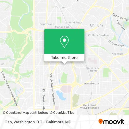
See Gap, Washington, on the map
Public Transit to Gap in Washington
Wondering how to get to Gap in Washington? Moovit helps you find the best way to get to Gap with step-by-step directions from the nearest public transit station.
Moovit provides free maps and live directions to help you navigate through your city. View schedules, routes, timetables, and find out how long does it take to get to Gap in real time.
Looking for the nearest stop or station to Gap? Check out this list of stops closest to your destination: Rock Creek Church Rd Nw+Webster St NW; Grant Cir Nw+Varnum St NW; Georgia Ave - Petworth; Brookland-Cua.
Bus: D44, D74.Metro: GREEN, YELLOW, RED.
Want to see if there’s another route that gets you there at an earlier time? Moovit helps you find alternative routes or times. Get directions from and directions to Gap easily from the Moovit App or Website.
We make riding to Gap easy, which is why over 1.5 million users, including users in Washington, trust Moovit as the best app for public transit. You don’t need to download an individual bus app or train app, Moovit is your all-in-one transit app that helps you find the best bus time or train time available.
For information on prices of bus and metro, costs and ride fares to Gap, please check the Moovit app.
Use the app to navigate to popular places including to the airport, hospital, stadium, grocery store, mall, coffee shop, school, college, and university.
Gap Address: 209 Upshur St NW Washington, DC 20011 street in Washington
- Preparatory School of DC (Prep School),
- Hitching Post Restaurant,
- Slash Run,
- Hitching Post,
- Varnum St NW (2nd and varnum),
- Rock Creek Church Rd and Upshur,
- President Lincoln's Cottage,
- Creative Minds International Pcs,
- President Lincoln s Cottage at the Soldiers Home,
- Rock Creek Cemetery,
- Ifc,
- Afrh,
- St. Paul's Episcopal Church, Rock Creek Parish,
- United States Soldiers' and Airmen's Home National Cemetery,
- President Lincoln's Cottage,
- United States Soldiers' and Airmen's Home National Cemetery (Soldiers Home Cemetery),
- Rock Creek Church Yard & Cemetery,
- Grant Circle,
- New Hampshire Ave NW (new hampshire ave buchanan),
- New Hampshire Ave NW and Upshur
Places Near Gap (Washington)
- Amazon Hq2, Arlington County,
- Basilica of the National Shrine, Washington,
- M&T Bank Stadium, Baltimore,
- Georgetown, Washington,
- Washington National Cathedral, Washington,
- Museum Of The Bible, Washington,
- Pennsylvania Ave NW (3rd st and pennsylvania), Washington,
- National Museum of African American History and Culture, Washington,
- National Theatre, Washington,
- Washington DC VA Medical Center, Washington,
- Warner Theatre, Washington,
- Camden Yards, Baltimore,
- PG Mall, Prince George's County,
- Capital One Arena, Washington,
- Marriott Marquis Washington, DC, Washington,
- The Anthem, Washington,
- National Zoo, Washington,
- Rock Creek Tennis Center, Washington,
- Sibley Memorial Hospital, Washington,
- Westfield Montgomery Mall, Montgomery County
How to get to popular places in Washington, D.C. - Baltimore, MD with public transit
Get around Washington by public transit!
Traveling around Washington has never been so easy. See step by step directions as you travel to any attraction, street or major public transit station. View bus and train schedules, arrival times, service alerts and detailed routes on a map, so you know exactly how to get to anywhere in Washington.
When traveling to any destination around Washington use Moovit's Live Directions with Get Off Notifications to know exactly where and how far to walk, how long to wait for your line, and how many stops are left. Moovit will alert you when it's time to get off — no need to constantly re-check whether yours is the next stop.
Wondering how to use public transit in Washington or how to pay for public transit in Washington? Moovit public transit app can help you navigate your way with public transit easily, and at minimum cost. It includes public transit fees, ticket prices, and costs. Looking for a map of Washington public transit lines? Moovit public transit app shows all public transit maps in Washington with all Bus, Train, Metro, Light Rail and Ferry routes and stops on an interactive map.
Washington, D.C. - Baltimore, MD has 5 transit type(s), including: Bus, Train, Metro, Light Rail and Ferry, operated by several transit agencies, including WMATA, Montgomery County Ride On, Fairfax Connector, TheBus, PRTC, DASH - Alexandria, Arlington Transit (ART), RTA of Central Maryland, MDOT MTA, MDOT MTA Light RailLink, MDOT MTA Commuter Bus, MDOT MTA Local Bus, FXBGO!, Virginia Railway Express (VRE) and MARC