
Directions to Gaston, Oregon (Portland, OR) with public transportation
The following transit lines have routes that pass near Gaston, Oregon
 Bus: 33.
How to get to Gaston, Oregon by bus?
Click on the bus route to see step by step directions with maps, line arrival times and updated time schedules.
Bus stop near Gaston, Oregon in Portland, OR
- Gaston - SB Hwy 47 & Main, 2 min walk,
Bus lines to Gaston, Oregon in Portland, OR
- 33, Hillsboro Central,
What are the closest stations to Gaston, Oregon?
The closest stations to Gaston, Oregon are:
- Gaston - SB Hwy 47 & Main stop is 142 yards away, 2 min walk.
Which bus line stops near Gaston, Oregon?
33 (Mcminnville Transit Center)
What’s the nearest bus station to Gaston, Oregon in Portland, OR?
The nearest bus station to Gaston, Oregon in Portland, OR is Gaston - SB Hwy 47 & Main. It’s a 2 min walk away.
What time is the first bus to Gaston, Oregon in Portland, OR?
The 33 is the first bus that goes to Gaston, Oregon in Portland, OR. It stops nearby at 6:13 AM.
What time is the last bus to Gaston, Oregon in Portland, OR?
The 33 is the last bus that goes to Gaston, Oregon in Portland, OR. It stops nearby at 6:37 PM.
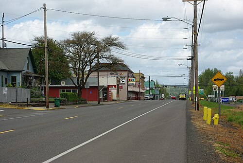
See Gaston, Oregon, Portland, OR, on the map
Public Transit to Gaston, Oregon in Portland, OR
Wondering how to get to Gaston, Oregon in Portland, OR? Moovit helps you find the best way to get to Gaston, Oregon with step-by-step directions from the nearest public transit station.
Moovit provides free maps and live directions to help you navigate through your city. View schedules, routes, timetables, and find out how long does it take to get to Gaston, Oregon in real time.
Looking for the nearest stop or station to Gaston, Oregon? Check out this list of stops closest to your destination: Gaston - SB Hwy 47 & Main.
Bus: 33.
Want to see if there’s another route that gets you there at an earlier time? Moovit helps you find alternative routes or times. Get directions from and directions to Gaston, Oregon easily from the Moovit App or Website.
We make riding to Gaston, Oregon easy, which is why over 1.7 billion users, including users in Portland, OR, trust Moovit as the best app for public transit. You don’t need to download an individual bus app or train app, Moovit is your all-in-one transit app that helps you find the best bus time or train time available.
For information on prices of bus, costs and ride fares to Gaston, Oregon, please check the Moovit app.
Use the app to navigate to popular places including to the airport, hospital, stadium, grocery store, mall, coffee shop, school, college, and university.
Gaston, Oregon Address: Washington, OR street in Portland, OR
- Iglesia De Restauracion Mision Cristiana Elim,
- Grande Event-B250,
- Pacific University,
- Amazon Locker - Oklahoma,
- Hawthorne House Memory Care, Forest Grove or,
- Amazon Locker - Washburne,
- Grand Lodge Concerts,
- McMenamins Grand Lodge (Grand Lodge Theater),
- Mcmenamins Grand Lodge,
- Maxx Glass,
- Kingwood Commons,
- Jehovah's Witnesses Forest Grove Congregation,
- Heidi's Trash to Treasures,
- Forest Grove, Or,
- Walmart Supercenter,
- Yamhill Carlton School District,
- Forest Grove High School,
- Duck Pond,
- Cornelius OR USA,
- Rick Spiering Inc
Places Near Gaston, Oregon (Portland, OR)
- Embassy Suites, Portland,
- Hilton Portland Downtown, Portland,
- Portland Art Museum, Portland,
- Hillsboro Hops Shuttle, Hillsboro,
- Oregon Museum of Science & Industry (OMSI), Portland,
- Powell's City of Books, Portland,
- The Benson Hotel, Portland,
- Veterans Memorial Coliseum, Portland,
- Oaks Amusement Park, Portland,
- Intel Shuttle - Orenco MAX, Hillsboro,
- OMSI Science Store, Portland,
- Crystal Ballroom, Portland,
- The Grotto, Portland,
- Oregon Convention Center, Portland,
- Lincoln High School, Portland,
- Roseland Theater, Portland,
- Legacy Emanuel Medical Center, Portland,
- Pearl District, Portland,
- Keller Auditorium, Portland,
- Portland Saturday Market, Portland