How to get to Gate Entry Systems by bus?
Click on the bus route to see step by step directions with maps, line arrival times and updated time schedules.
From Fort Lauderdale-Hollywood International Airport (FLL) (Fort Lauderdale-Hollywood International Airpo, Hollywood
67 minFrom State Road 7 & West Sunrise Boulevard, Plantation
60 minFrom Amazon Fulfillment Center-DMF3, Pompano Beach
78 minFrom South Plantation High School, Plantation
59 minFrom Las Olas, Fort Lauderdale
25 minFrom Florida Turnpike Sunrise Blvd. Toll Plaza, Plantation
81 minFrom Margate, FL, Coral Springs-Margate
81 minFrom St. Thomas Aquinas High School, Fort Lauderdale
46 minFrom Walmart, Fort Lauderdale
36 minFrom Sawgrass Recreation Park / Airboat Rides, Plantation
82 min
Bus stops near Gate Entry Systems in Fort Lauderdale
Train station near Gate Entry Systems in Fort Lauderdale
- Cypress Creek Station, 62 min walk,VIEW
Bus lines to Gate Entry Systems in Fort Lauderdale
What are the closest stations to Gate Entry Systems?
The closest stations to Gate Entry Systems are:
- Oakland Park Boulevard/Northeast 2nd Avenue is 376 yards away, 5 min walk.
- Andrews Avenue/Northwest 35th Street is 384 yards away, 5 min walk.
- Cypress Creek Station is 5307 yards away, 62 min walk.
Which bus lines stop near Gate Entry Systems?
These bus lines stop near Gate Entry Systems: 14, 60, 72.
What’s the nearest bus station to Gate Entry Systems in Fort Lauderdale?
The nearest bus stations to Gate Entry Systems in Fort Lauderdale are Oakland Park Boulevard/Northeast 2nd Avenue and Andrews Avenue/Northwest 35th Street. The closest one is a 5 min walk away.
What time is the first train to Gate Entry Systems in Fort Lauderdale?
The TRIRAIL is the first train that goes to Gate Entry Systems in Fort Lauderdale. It stops nearby at 4:38 AM.
What time is the last train to Gate Entry Systems in Fort Lauderdale?
The TRIRAIL is the last train that goes to Gate Entry Systems in Fort Lauderdale. It stops nearby at 10:43 PM.
What time is the first bus to Gate Entry Systems in Fort Lauderdale?
The 72 is the first bus that goes to Gate Entry Systems in Fort Lauderdale. It stops nearby at 5:13 AM.
What time is the last bus to Gate Entry Systems in Fort Lauderdale?
The 72 is the last bus that goes to Gate Entry Systems in Fort Lauderdale. It stops nearby at 1:21 AM.
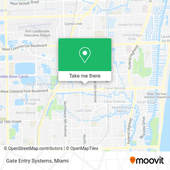
See Gate Entry Systems, Fort Lauderdale, on the map
Public Transit to Gate Entry Systems in Fort Lauderdale
Wondering how to get to Gate Entry Systems in Fort Lauderdale? Moovit helps you find the best way to get to Gate Entry Systems with step-by-step directions from the nearest public transit station.
Moovit provides free maps and live directions to help you navigate through your city. View schedules, routes, timetables, and find out how long does it take to get to Gate Entry Systems in real time.
Looking for the nearest stop or station to Gate Entry Systems? Check out this list of stops closest to your destination: Oakland Park Boulevard/Northeast 2nd Avenue; Andrews Avenue/Northwest 35th Street; Cypress Creek Station.
Bus: 14, 60, 72.Train: TRIRAIL.
Want to see if there’s another route that gets you there at an earlier time? Moovit helps you find alternative routes or times. Get directions from and directions to Gate Entry Systems easily from the Moovit App or Website.
We make riding to Gate Entry Systems easy, which is why over 1.5 million users, including users in Fort Lauderdale, trust Moovit as the best app for public transit. You don’t need to download an individual bus app or train app, Moovit is your all-in-one transit app that helps you find the best bus time or train time available.
For information on prices of bus and train, costs and ride fares to Gate Entry Systems, please check the Moovit app.
Use the app to navigate to popular places including to the airport, hospital, stadium, grocery store, mall, coffee shop, school, college, and university.
Gate Entry Systems Address: 212 NE 33rd St Fort Lauderdale, FL 33334 street in Fort Lauderdale
- US Bullnosing Inc.,
- Jerry Flores Custom Creations,
- Level Up Moving and Storage Services,
- Shipping To Hungary,
- Freedom Christian Tabernacle,
- Advanced Cabinetry,
- Konack Restoration,
- Modern Motions,
- All Choice Auto Sales,
- Otra Motos,
- Scurvy Few Motorcycle Club - Stateside Chapter,
- Dicars Autosales,
- Iwd Windows & Doors,
- Broward Hurricane Shutters,
- Whatever Wholesale,
- Florida Sailcraft,
- Xquisite Stone Design,
- Diamond Beauty Supply & 99 Cents Plus,
- Save-A-Lot,
- Enterprise
Places Near Gate Entry Systems (Fort Lauderdale)
- Miami VA Hospital, Miami,
- Miami-Dade County Courthouse, Miami,
- Dolphin Mall, Miami,
- Miami Freedom Park, Miami,
- Bayside Marketplace, Miami,
- Hard Rock Stadium, Miami Gardens,
- Richard E. Gerstein Justice Building, Miami,
- Zoo Miami, Miami,
- Marlins Park, Miami,
- Brickell City Centre, Miami,
- Sawgrass Mall, Miami,
- Keiser University Flagship Campus, West Palm Beach,
- Aventura Mall, Miami,
- Aventura Mall, Miami Beach,
- Dolphin Mall Bus, Miami,
- Sawgrass mall ( FL ), Miami Beach,
- Little Havana, Miami,
- Port of Miami Cruise Terminal, Miami,
- Miami Design District, Miami,
- Wynwood, Miami
How to get to popular places in Miami with public transit
Get around Fort Lauderdale by public transit!
Traveling around Fort Lauderdale has never been so easy. See step by step directions as you travel to any attraction, street or major public transit station. View bus and train schedules, arrival times, service alerts and detailed routes on a map, so you know exactly how to get to anywhere in Fort Lauderdale.
When traveling to any destination around Fort Lauderdale use Moovit's Live Directions with Get Off Notifications to know exactly where and how far to walk, how long to wait for your line, and how many stops are left. Moovit will alert you when it's time to get off — no need to constantly re-check whether yours is the next stop.
Wondering how to use public transit in Fort Lauderdale or how to pay for public transit in Fort Lauderdale? Moovit public transit app can help you navigate your way with public transit easily, and at minimum cost. It includes public transit fees, ticket prices, and costs. Looking for a map of Fort Lauderdale public transit lines? Moovit public transit app shows all public transit maps in Fort Lauderdale with all Bus, Train, Light Rail and Ferry routes and stops on an interactive map.
Miami has 4 transit type(s), including: Bus, Train, Light Rail and Ferry, operated by several transit agencies, including Broward County Transit, Miami-Dade Transit, Metrorail, Palm Tran, Tri-Rail, Brightline, MARTY, City of Homestead Trolley, Key West Transit, Treasure Coast Connector, GoLine IRT, Amtrak, Greyhound-us, FlixBus-us and Aventura Express Shuttle Bus