Gattamelata/Lauricella stop - Monday schedule
| Line | Direction | Time |
|---|---|---|
| NMC | Piazza Venezia | 3:21 AM |
| NMC | Piazza Venezia | 3:21 AM |
| NMC | Piazza Venezia | 3:57 AM |
| NMC | Piazza Venezia | 3:57 AM |
| NMC | Piazza Venezia | 4:33 AM |
| NMC | Piazza Venezia | 5:15 AM |
| NMC | Piazza Venezia | 5:15 AM |
| 81 | Crescenzio/Risorgimento | 5:32 AM |
| 81 | Crescenzio/Risorgimento | 5:46 AM |
| NMC | Piazza Venezia | 5:51 AM |
| NMC | Piazza Venezia | 5:51 AM |
| 81 | Crescenzio/Risorgimento | 6:01 AM |
| 81 | Crescenzio/Risorgimento | 6:14 AM |
| 104 | Parco Di Centocelle (Mc) | 6:17 AM |
| 81 | Crescenzio/Risorgimento | 6:27 AM |
| 412 | Adria | 6:27 AM |
| 104 | Parco Di Centocelle (Mc) | 6:32 AM |
| 81 | Crescenzio/Risorgimento | 6:40 AM |
| 104 | Parco Di Centocelle (Mc) | 6:47 AM |
| 81 | Crescenzio/Risorgimento | 6:54 AM |
| 412 | Adria | 6:57 AM |
| 104 | Parco Di Centocelle (Mc) | 7:03 AM |
| 81 | Crescenzio/Risorgimento | 7:07 AM |
| 81 | Crescenzio/Risorgimento | 7:21 AM |
| 104 | Parco Di Centocelle (Mc) | 7:21 AM |
Directions to Gattamelata/Lauricella stop (Roma) with public transit
The following transit lines have routes that pass near Gattamelata/Lauricella
 Bus: 104, 150F, 412, 514, 81.
- Train: FL1, FL3, R, RV, FL2.
- Metro: C.
How to get to Gattamelata/Lauricella stop by bus?
Click on the bus route to see step by step directions with maps, line arrival times and updated time schedules.
How to get to Gattamelata/Lauricella stop by train?
Click on the train route to see step by step directions with maps, line arrival times and updated time schedules.
How to get to Gattamelata/Lauricella stop by metro?
Click on the metro route to see step by step directions with maps, line arrival times and updated time schedules.
Bus stops near Gattamelata/Lauricella stop in Roma
- Gattamelata/Di Bastelica, 2 min walk,
- Prenestina/Gattamelata, 3 min walk,
- Gattamelata/Cane, 5 min walk,
- Prenestina/Conti, 6 min walk,
Light Rail stations near Gattamelata/Lauricella station in Roma
- San Lorenzo/Sardi Station, 4 min walk,
Metro stations near Gattamelata/Lauricella station in Roma
- Malatesta, 11 min walk,
Train stations near Gattamelata/Lauricella station in Roma
- Roma Prenestina, 29 min walk,
Bus lines to Gattamelata/Lauricella stop in Roma
- NMC, Piazza Venezia,
- 81, Crescenzio/Risorgimento,
- 104, Parco Di Centocelle (Mc),
- 412, Adria,
- 514, Largo Preneste,
- N5, Piazza Venezia,
- N543, Vertunni,
- 545, Verano,
- 541, Fillia,
- A01, Termini (Metro A-Metro B-Railway),
- A10, Togliatti/Prenestina,
What are the closest stations to Gattamelata/Lauricella?
The closest stations to Gattamelata/Lauricella are:
- Gattamelata/Di Bastelica stop is 136 meters away, 2 min walk.
- Prenestina/Gattamelata stop is 159 meters away, 3 min walk.
- San Lorenzo/Sardi Station is 255 meters away, 4 min walk.
- Gattamelata/Cane stop is 323 meters away, 5 min walk.
- Prenestina/Conti stop is 428 meters away, 6 min walk.
- Malatesta station is 786 meters away, 11 min walk.
- Roma Prenestina station is 2257 meters away, 29 min walk.
Which bus lines stop near Gattamelata/Lauricella?
These bus lines stop near Gattamelata/Lauricella: 104, 150F, 412, 514, 81.
Which train lines stop near Gattamelata/Lauricella?
These train lines stop near Gattamelata/Lauricella: FL1, FL3, R.
Which metro line stops near Gattamelata/Lauricella?
C (Monte Compatri-Pantano)
What’s the nearest light rail station to Gattamelata/Lauricella in Roma?
The nearest light rail station to Gattamelata/Lauricella in Roma is San Lorenzo/Sardi Station. It’s a 4 min walk away.
What’s the nearest metro station to Gattamelata/Lauricella in Roma?
The nearest metro station to Gattamelata/Lauricella in Roma is Malatesta. It’s a 11 min walk away.
What’s the nearest train station to Gattamelata/Lauricella in Roma?
The nearest train station to Gattamelata/Lauricella in Roma is Roma Prenestina. It’s a 29 min walk away.
What’s the nearest bus station to Gattamelata/Lauricella in Roma?
The nearest bus station to Gattamelata/Lauricella in Roma is Gattamelata/Di Bastelica. It’s a 2 min walk away.
What time is the first light rail to Gattamelata/Lauricella in Roma?
The 2 is the first light rail that goes to Gattamelata/Lauricella in Roma. It stops nearby at 4:42 AM.
What time is the last light rail to Gattamelata/Lauricella in Roma?
The 3 is the last light rail that goes to Gattamelata/Lauricella in Roma. It stops nearby at 1:08 AM.
What time is the first metro to Gattamelata/Lauricella in Roma?
The C is the first metro that goes to Gattamelata/Lauricella in Roma. It stops nearby at 5:36 AM.
What time is the last metro to Gattamelata/Lauricella in Roma?
The C is the last metro that goes to Gattamelata/Lauricella in Roma. It stops nearby at 12:00 AM.
What time is the first train to Gattamelata/Lauricella in Roma?
The FL2 is the first train that goes to Gattamelata/Lauricella in Roma. It stops nearby at 6:45 AM.
What time is the last train to Gattamelata/Lauricella in Roma?
The FL2 is the last train that goes to Gattamelata/Lauricella in Roma. It stops nearby at 10:05 PM.
What time is the first bus to Gattamelata/Lauricella in Roma?
The N5 is the first bus that goes to Gattamelata/Lauricella in Roma. It stops nearby at 3:00 AM.
What time is the last bus to Gattamelata/Lauricella in Roma?
The N543 is the last bus that goes to Gattamelata/Lauricella in Roma. It stops nearby at 3:26 AM.
Gattamelata/Lauricella station
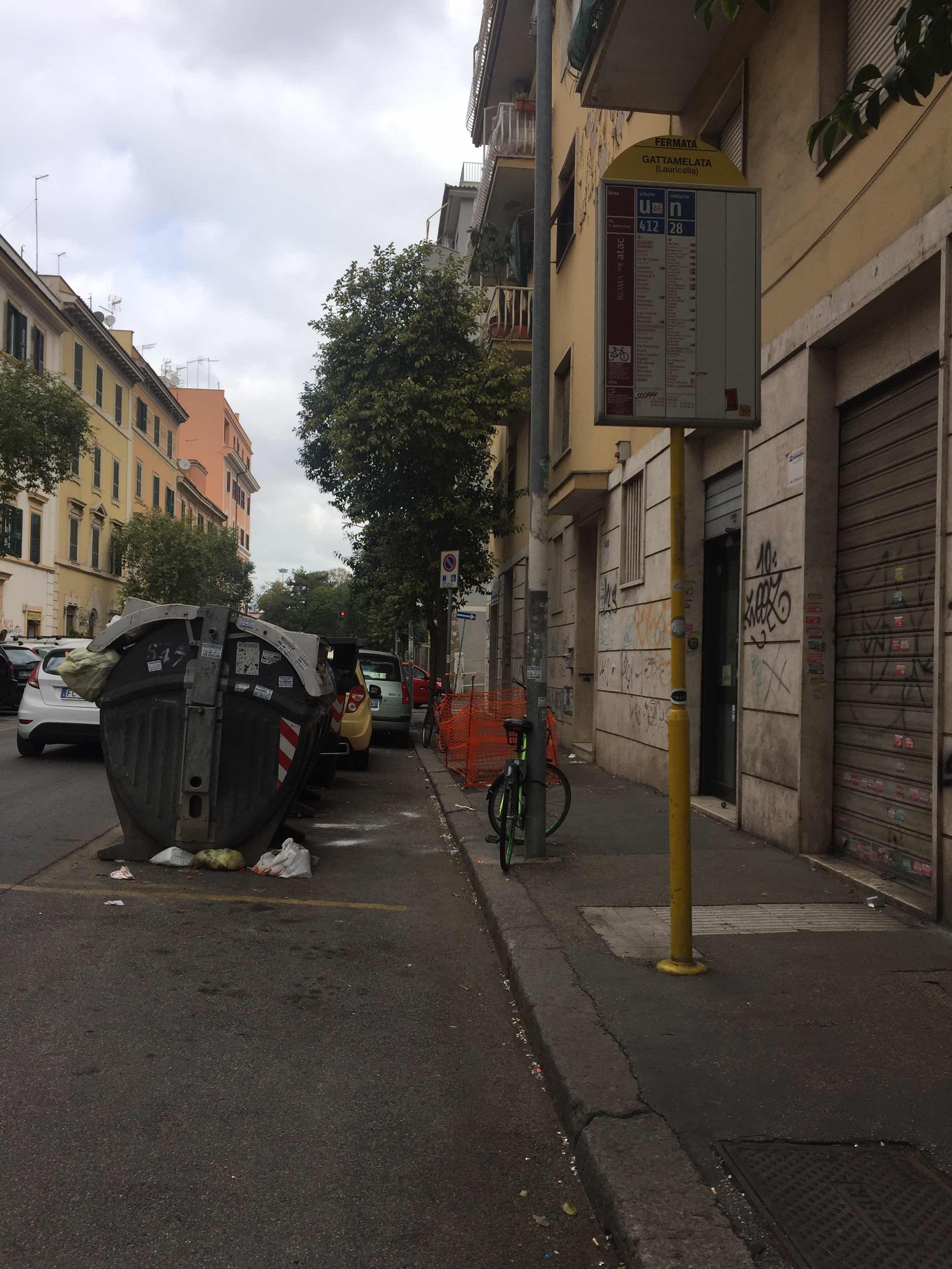 Taken by Anonymous
See Gattamelata/Lauricella stop, Roma, on the map
Public transit to Gattamelata/Lauricella stop (ID: 79358) in Roma
Looking for directions to Gattamelata/Lauricella in Roma, Italy?
Download the Moovit App to find the current schedule and step-by-step directions for Bus, Metro or Train routes that pass through Gattamelata/Lauricella.
Looking for the nearest stops closest to Gattamelata/Lauricella ? Check out this list of closest stops to your destination: Gattamelata/Di Bastelica; Prenestina/Gattamelata; San Lorenzo/Sardi Station; Gattamelata/Cane; Prenestina/Conti; Malatesta; Roma Prenestina.
Bus: 104, 150F, 412, 514, 81, NMC, N5, N543, 545, 541.Train: FL1, FL3, R, RV, FL2.Metro: C.
We make riding on public transit to Gattamelata/Lauricella easy, which is why over 1.7 billion users, including users in Roma trust Moovit as the best app for public transit.
Use the app to navigate to popular places including to the airport, hospital, stadium, grocery store, mall, coffee shop, school, college, and university.
Gattamelata/Lauricella stop’s code is 79358
The first line to this stop is NMC, at 3:21 AM, and the last line is NMC at 2:50 AM.
This stop serves ATAC’s lines
- Gattamelata/Di Bastelica,
- Prenestina/Gattamelata,
- Gattamelata/Cane,
- Prenestina/Conti
Bus stops near Gattamelata/Lauricella stop
- San Lorenzo/Sardi Station
Light Rail station near Gattamelata/Lauricella station
- Malatesta
Metro station near Gattamelata/Lauricella station
- Roma Prenestina
Train station near Gattamelata/Lauricella station
- Pontinia | Via Appia (Mesa),
- Prati Fiscali/Villa Spada,
- Forlanini (H),
- Cerveteri, Claudio Monteverdi Street 18-20,
- Borghetto | Railway Station,
- Flaminio Square,
- Merulana/Mecenate,
- Albano | Trilussa Road Appia Road,
- Viterbo | Porta Fiorentina Station,
- Latina | Galilei Siani Institute,
- Via Piave, 19,
- Alessandrino,
- Saint Peter Station Square,
- Terracina | Lido Delle Ortensie,
- Vitinia,
- Subiaco Piazza Falcone,
- Don Bosco Street,
- Viterbo,
- Civita Castellana,
- Colosseum
Popular public transit stations in Roma
Get around Roma by public transit!
Traveling around Roma has never been so easy. See step by step directions as you travel to any attraction, street or major public transit station. View bus and train schedules, arrival times, service alerts and detailed routes on a map, so you know exactly how to get to anywhere in Roma.
When traveling to any destination around Roma use Moovit's Live Directions with Get Off Notifications to know exactly where and how far to walk, how long to wait for your line, and how many stops are left. Moovit will alert you when it's time to get off — no need to constantly re-check whether yours is the next stop.
Wondering how to use public transit in Roma or how to pay for public transit in Roma? Moovit public transit app can help you navigate your way with public transit easily, and at minimum cost. It includes public transit fees, ticket prices, and costs. Looking for a map of Roma public transit lines? Moovit public transit app shows all public transit maps in Roma with all Bus, Train, Metro, Light Rail, Ferry, Funicular and Gondola routes and stops on an interactive map.
Rome and Lazio has 7 transit type(s), including: Bus, Train, Metro, Light Rail, Ferry, Funicular and Gondola, operated by several transit agencies, including ATAC, Cotral, Trenitalia, Troiani Transportation Services, BIS, ATR Mobility, Tuscia, Shuttle, Seatour, Troiani Bus Lines, CSC Mobility, Terravision, ATRAL, Tambus and Sitbus