How to get to Geiger by bus?
Click on the bus route to see step by step directions with maps, line arrival times and updated time schedules.
From Universitätsklinikum Heidelberg-Notaufnahme, Neuenheim
164 minFrom Thoraxklinik Heidelberg, Neuenheim
158 minFrom Globus Getränkemarkt, Ludwigshafen-Oggersheim
111 minFrom Globus Getränkecenter, Ludwigshafen-Oggersheim
110 minFrom Marie-Baum-Schule Heidelberg, Wieblingen
156 minFrom Hans-Warsch-Platz,Ludwigshafen Oggersheim, Ludwigshafen-Oggersheim
96 minFrom Berufsbildende Schule Technik 2, Ludwigshafen-Mundenheim
60 minFrom Möbel Höffner, Schwetzingen
72 minFrom GRN-Klinik Schwetzingen, Schwetzingen
101 min
How to get to Geiger by train?
Click on the train route to see step by step directions with maps, line arrival times and updated time schedules.
From Marie-Baum-Schule Heidelberg, Wieblingen
71 minFrom Hans-Warsch-Platz,Ludwigshafen Oggersheim, Ludwigshafen-Oggersheim
61 minFrom Krankenhaus GRN, Weinheim
79 minFrom Berufsbildende Schule Technik 2, Ludwigshafen-Mundenheim
63 minFrom Möbel Höffner, Schwetzingen
67 minFrom GRN-Klinik Schwetzingen, Schwetzingen
72 min
Bus stops near Geiger in Neckarstadt-Ost/Wohlgelegen
Light Rail stations near Geiger in Neckarstadt-Ost/Wohlgelegen
Bus lines to Geiger in Neckarstadt-Ost/Wohlgelegen
What are the closest stations to Geiger?
The closest stations to Geiger are:
- Hochuferstraße is 294 meters away, 4 min walk.
- Mannheim, Ida-Scipio-Heim is 330 meters away, 5 min walk.
- Bonifatiuskirche is 416 meters away, 6 min walk.
- Mannheim, Bonifatiuskirche is 451 meters away, 7 min walk.
- Bibienastraße is 727 meters away, 10 min walk.
Which train lines stop near Geiger?
These train lines stop near Geiger: RB35, RE60, S3, S6.
Which light rail lines stop near Geiger?
These light rail lines stop near Geiger: 4A, 5, RNV 4, RNV 4A, RNV 5, RNV 5A.
Which bus lines stop near Geiger?
These bus lines stop near Geiger: 710, 74, 76, RNV 50, RNV 61.
What’s the nearest light rail station to Geiger in Neckarstadt-Ost/Wohlgelegen?
The nearest light rail station to Geiger in Neckarstadt-Ost/Wohlgelegen is Bonifatiuskirche. It’s a 6 min walk away.
What’s the nearest bus station to Geiger in Neckarstadt-Ost/Wohlgelegen?
The nearest bus station to Geiger in Neckarstadt-Ost/Wohlgelegen is Hochuferstraße. It’s a 4 min walk away.
What time is the first light rail to Geiger in Neckarstadt-Ost/Wohlgelegen?
The RNV 4 is the first light rail that goes to Geiger in Neckarstadt-Ost/Wohlgelegen. It stops nearby at 3:32 AM.
What time is the last light rail to Geiger in Neckarstadt-Ost/Wohlgelegen?
The 4 is the last light rail that goes to Geiger in Neckarstadt-Ost/Wohlgelegen. It stops nearby at 2:05 AM.
What time is the first bus to Geiger in Neckarstadt-Ost/Wohlgelegen?
The E is the first bus that goes to Geiger in Neckarstadt-Ost/Wohlgelegen. It stops nearby at 4:30 AM.
What time is the last bus to Geiger in Neckarstadt-Ost/Wohlgelegen?
The 7 is the last bus that goes to Geiger in Neckarstadt-Ost/Wohlgelegen. It stops nearby at 1:11 AM.
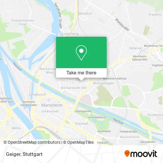
See Geiger, Neckarstadt-Ost/Wohlgelegen, on the map
Public Transit to Geiger in Neckarstadt-Ost/Wohlgelegen
Wondering how to get to Geiger in Neckarstadt-Ost/Wohlgelegen? Moovit helps you find the best way to get to Geiger with step-by-step directions from the nearest public transit station.
Moovit provides free maps and live directions to help you navigate through your city. View schedules, routes, timetables, and find out how long does it take to get to Geiger in real time.
Looking for the nearest stop or station to Geiger? Check out this list of stops closest to your destination: Hochuferstraße; Mannheim; Bonifatiuskirche; Mannheim; Bibienastraße.
Train: RB35, RE60, S3, S6.Light Rail: 4A, 5, RNV 4, RNV 4A, RNV 5, RNV 5A.Bus: 710, 74, 76, RNV 50, RNV 61, 60, 60E, 61, 5, 7, 7, E.
Want to see if there’s another route that gets you there at an earlier time? Moovit helps you find alternative routes or times. Get directions from and directions to Geiger easily from the Moovit App or Website.
We make riding to Geiger easy, which is why over 1.5 million users, including users in Neckarstadt-Ost/Wohlgelegen, trust Moovit as the best app for public transit. You don’t need to download an individual bus app or train app, Moovit is your all-in-one transit app that helps you find the best bus time or train time available.
For information on prices of bus, light rail and train, costs and ride fares to Geiger, please check the Moovit app.
Use the app to navigate to popular places including to the airport, hospital, stadium, grocery store, mall, coffee shop, school, college, and university.
Geiger Address: Moselstraße 22 68167 Mannheim street in Neckarstadt-Ost/Wohlgelegen
- Ospa Apparatebau Pauser,
- Dr. med. Elke Reichert,
- Steuer & Anwaltsbüro Angelika,
- Privatarztpraxis,
- Dr.Med. Marie-Therese Eisele,
- Neuapostolisch Moselstraße,
- Hausxpert,
- Mannheim United,
- Deutsche Bank,
- In the Green,
- Time4pc,
- Trilateral Hr Consulting Dr. Verena Mayer Coaching, Supervision,
- PC-Tuning Eser,
- Neuapostolische Kirche,
- Neuapostolische Kirche Moselstraße,
- Erich Kohl,
- Patricia Baust,
- Übersetzungsbüro Mannheim,
- Andreaheiß,
- Mannheim Mo
Places Near Geiger (Neckarstadt-Ost/Wohlgelegen)
- Mettingen Eros-Center Puff Laufhaus, Esslingen Am Neckar,
- SI-Centrum, Möhringen,
- Mercedes-Benz Museum, Bad Cannstatt,
- Mercedes-Benz Museum (Mercedes Museum Stuttgart), Bad Cannstatt,
- Schleyerhalle, Bad Cannstatt,
- Wilhelma (U-Bahn Wilhelma), Bad Cannstatt,
- Pariser Platz Stuttgart, Stuttgart-Mitte,
- Hanns-Martin-Schleyer-Halle (Stuttgart Hans-Martin-Schleyerhalle), Bad Cannstatt,
- Porsche Museum, Zuffenhausen,
- Geilhaus Haus 33a, Reutlingen-Betzingen,
- Gleis 101/102 (tief), Stuttgart-Mitte,
- Gasometer Pforzheim, Pforzheim,
- Klinikum Stuttgart - Katharinenhospital, Stuttgart-Mitte,
- Hauptbahnhof Stuttgart, Stuttgart-Mitte,
- Hanns-Martin-Schleyer-Halle, Bad Cannstatt,
- Porsche-Arena, Bad Cannstatt,
- Im Wizemann (Halle), Bad Cannstatt,
- Marmorsaal Im Weissenburgpark, Stuttgart-Süd,
- Waldfriedhof, Degerloch,
- FlixBus Haltestelle, Stuttgart
How to get to popular places in Stuttgart with public transit
Get around Neckarstadt-Ost/Wohlgelegen by public transit!
Traveling around Neckarstadt-Ost/Wohlgelegen has never been so easy. See step by step directions as you travel to any attraction, street or major public transit station. View bus and train schedules, arrival times, service alerts and detailed routes on a map, so you know exactly how to get to anywhere in Neckarstadt-Ost/Wohlgelegen.
When traveling to any destination around Neckarstadt-Ost/Wohlgelegen use Moovit's Live Directions with Get Off Notifications to know exactly where and how far to walk, how long to wait for your line, and how many stops are left. Moovit will alert you when it's time to get off — no need to constantly re-check whether yours is the next stop.
Wondering how to use public transit in Neckarstadt-Ost/Wohlgelegen or how to pay for public transit in Neckarstadt-Ost/Wohlgelegen? Moovit public transit app can help you navigate your way with public transit easily, and at minimum cost. It includes public transit fees, ticket prices, and costs. Looking for a map of Neckarstadt-Ost/Wohlgelegen public transit lines? Moovit public transit app shows all public transit maps in Neckarstadt-Ost/Wohlgelegen with all Bus, Train, Subway, Light Rail, Ferry, S-Bahn and Funicular routes and stops on an interactive map.
Stuttgart has 7 transit type(s), including: Bus, Train, Subway, Light Rail, Ferry, S-Bahn and Funicular, operated by several transit agencies, including SSB - Stadtbahn, SSB, SSB - Seilbahn / Zacke, S-Bahn Stuttgart, Rhein-Neckar-Verkehr GmbH (rnv), Karlsruher Verkehrsverbund, DB AG, DB Regiobus BW, Arverio Baden-Württemberg GmbH, DB RegioNetz Verkehrs GmbH Westfrankenbahn, DB Regio AG Baden-Württemberg, Südwestdeutsche Verkehrs-AG, DB Regio AG Mitte Region Hessen, DB and Bodensee-Oberschwaben-Bahn