Directions to General Auto & Tire (Richmond) with public transportation
The following transit lines have routes that pass near General Auto & Tire
 Bus: 14, 1.
- Train: NORTHEAST REGIONAL.
How to get to General Auto & Tire by bus?
Click on the bus route to see step by step directions with maps, line arrival times and updated time schedules.
From Lorton, VA, Fairfax County
225 minFrom Lorton, VA - Amtrak Auto Train Station (LOR), Fairfax County
230 minFrom Busch Gardens Williamsburg (Employee Parking Lot), James City County
156 minFrom Rose Gaming Resort, Prince William County
240 minFrom Potomac Mills Mall, Prince William County
215 minFrom Amazon Fulfillment Center-Ric3, Richmond
80 minFrom Woodbridge, VA, Prince William County
160 minFrom UVA Hospital Medical Center, Charlottesville
305 min
Bus stops near General Auto & Tire in Richmond
Train station near General Auto & Tire in Richmond
- Pathrichmond Main Street Amtrak Station, 56 min walk,VIEW
What are the closest stations to General Auto & Tire?
The closest stations to General Auto & Tire are:
- Brook + Lombardy is 225 yards away, 3 min walk.
- Chamberlayne + Overbrook is 312 yards away, 4 min walk.
- Pathrichmond Main Street Amtrak Station is 4729 yards away, 56 min walk.
Which bus line stops near General Auto & Tire?
14 (Hermitage/Azalea)
What’s the nearest bus station to General Auto & Tire in Richmond?
The nearest bus station to General Auto & Tire in Richmond is Brook + Lombardy. It’s a 3 min walk away.
What time is the first train to General Auto & Tire in Richmond?
The NORTHEAST REGIONAL is the first train that goes to General Auto & Tire in Richmond. It stops nearby at 5:19 AM.
What time is the last train to General Auto & Tire in Richmond?
The NORTHEAST REGIONAL is the last train that goes to General Auto & Tire in Richmond. It stops nearby at 6:52 PM.
What time is the first bus to General Auto & Tire in Richmond?
The 1 is the first bus that goes to General Auto & Tire in Richmond. It stops nearby at 4:56 AM.
What time is the last bus to General Auto & Tire in Richmond?
The 14 is the last bus that goes to General Auto & Tire in Richmond. It stops nearby at 12:23 AM.
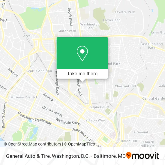
See General Auto & Tire, Richmond, on the map
Public Transit to General Auto & Tire in Richmond
Wondering how to get to General Auto & Tire in Richmond? Moovit helps you find the best way to get to General Auto & Tire with step-by-step directions from the nearest public transit station.
Moovit provides free maps and live directions to help you navigate through your city. View schedules, routes, timetables, and find out how long does it take to get to General Auto & Tire in real time.
Looking for the nearest stop or station to General Auto & Tire? Check out this list of stops closest to your destination: Brook + Lombardy; Chamberlayne + Overbrook; Pathrichmond Main Street Amtrak Station.
Bus: 14, 1.Train: NORTHEAST REGIONAL.
Want to see if there’s another route that gets you there at an earlier time? Moovit helps you find alternative routes or times. Get directions from and directions to General Auto & Tire easily from the Moovit App or Website.
We make riding to General Auto & Tire easy, which is why over 1.5 million users, including users in Richmond, trust Moovit as the best app for public transit. You don’t need to download an individual bus app or train app, Moovit is your all-in-one transit app that helps you find the best bus time or train time available.
For information on prices of bus and train, costs and ride fares to General Auto & Tire, please check the Moovit app.
Use the app to navigate to popular places including to the airport, hospital, stadium, grocery store, mall, coffee shop, school, college, and university.
General Auto & Tire Address: 2315 N Lombardy St Richmond, VA 23220 street in Richmond
- Automotive Manufacturers,
- Keith Epps Automotive,
- Nation Motors,
- Empire Automotive,
- VA Motors,
- Thirst Bistro,
- God First Christian Center,
- Union Bistro & Jazz,
- Hazel Ruth,
- Crestwood Auto Center,
- Mahogany Ladies & Gents,
- None Shall Be Lost International Ministries,
- Advanced Hair Care Clinic,
- Neighborly Resident Care,
- Crewel and Unusual,
- Glass Spot,
- S & S Caterers,
- C3 Healthcare RX VA,
- Turnkey Realty Services,
- Signarama
Places Near General Auto & Tire (Richmond)
- Rock Creek Tennis Center, Washington,
- Warner Theatre, Washington,
- M&T Bank Stadium, Baltimore,
- Amazon Hq2, Arlington County,
- PG Mall, Prince George's County,
- Sibley Memorial Hospital, Washington,
- National Museum of African American History and Culture, Washington,
- Basilica of the National Shrine, Washington,
- Marriott Marquis Washington, DC, Washington,
- National Zoo, Washington,
- Camden Yards, Baltimore,
- Capital One Arena, Washington,
- The Anthem, Washington,
- Georgetown, Washington,
- Washington DC VA Medical Center, Washington,
- National Theatre, Washington,
- Museum Of The Bible, Washington,
- Westfield Montgomery Mall, Montgomery County,
- Washington National Cathedral, Washington,
- Pennsylvania Ave NW (3rd st and pennsylvania), Washington
How to get to popular places in Washington, D.C. - Baltimore, MD with public transit
Get around Richmond by public transit!
Traveling around Richmond has never been so easy. See step by step directions as you travel to any attraction, street or major public transit station. View bus and train schedules, arrival times, service alerts and detailed routes on a map, so you know exactly how to get to anywhere in Richmond.
When traveling to any destination around Richmond use Moovit's Live Directions with Get Off Notifications to know exactly where and how far to walk, how long to wait for your line, and how many stops are left. Moovit will alert you when it's time to get off — no need to constantly re-check whether yours is the next stop.
Wondering how to use public transit in Richmond or how to pay for public transit in Richmond? Moovit public transit app can help you navigate your way with public transit easily, and at minimum cost. It includes public transit fees, ticket prices, and costs. Looking for a map of Richmond public transit lines? Moovit public transit app shows all public transit maps in Richmond with all Bus, Train, Metro, Light Rail and Ferry routes and stops on an interactive map.
Washington, D.C. - Baltimore, MD has 5 transit type(s), including: Bus, Train, Metro, Light Rail and Ferry, operated by several transit agencies, including WMATA, Montgomery County Ride On, Fairfax Connector, TheBus, PRTC, DASH - Alexandria, Arlington Transit (ART), RTA of Central Maryland, MDOT MTA, MDOT MTA Light RailLink, MDOT MTA Commuter Bus, MDOT MTA Local Bus, FXBGO!, Virginia Railway Express (VRE) and MARC