How to get to Geo Wells by bus?
Click on the bus route to see step by step directions with maps, line arrival times and updated time schedules.
From Quintino Sella Street, Florence
82 minFrom Datini Street, Florence
81 minFrom Malta Avenue, Florence
83 minFrom Aurelio Saffi Hospitality Institute, Florence
82 minFrom Elsa Morante School, Florence
90 minFrom Arrigo da Settimello Street, Florence
81 minFrom Via Aurelio Nicolodi 2, Florence
83 minFrom University of Florence, Florence
54 minFrom Aurelio Nicolodi Street, Florence
82 minFrom Orcagna Street, Florence
80 min
Bus stops near Geo Wells in Scandicci
Light Rail stations near Geo Wells in Scandicci
- De Andre, 7 min walk,VIEW
Bus lines to Geo Wells in Scandicci
What are the closest stations to Geo Wells?
The closest stations to Geo Wells are:
- Dei Ciliegi Rodari School is 449 meters away, 6 min walk.
- De Andre is 500 meters away, 7 min walk.
- Formicola Bridge is 724 meters away, 10 min walk.
- Pacchi Socet is 841 meters away, 11 min walk.
- Ponte A Vingone is 1137 meters away, 15 min walk.
- Vingone Vignono is 1150 meters away, 15 min walk.
- Constitution T1 Villa Costanza is 1653 meters away, 22 min walk.
Which bus line stops near Geo Wells?
27 (Vingone San Zanobi)
Which light rail line stops near Geo Wells?
T1 (Villa Costanza)
What’s the nearest light rail station to Geo Wells in Scandicci?
The nearest light rail station to Geo Wells in Scandicci is De Andre. It’s a 7 min walk away.
What’s the nearest bus station to Geo Wells in Scandicci?
The nearest bus station to Geo Wells in Scandicci is Dei Ciliegi Rodari School. It’s a 6 min walk away.
What time is the first light rail to Geo Wells in Scandicci?
The T2 is the first light rail that goes to Geo Wells in Scandicci. It stops nearby at 4:33 AM.
What time is the last light rail to Geo Wells in Scandicci?
The T2 is the last light rail that goes to Geo Wells in Scandicci. It stops nearby at 1:04 AM.
What time is the first bus to Geo Wells in Scandicci?
The 27 is the first bus that goes to Geo Wells in Scandicci. It stops nearby at 6:50 AM.
What time is the last bus to Geo Wells in Scandicci?
The 27 is the last bus that goes to Geo Wells in Scandicci. It stops nearby at 10:44 PM.
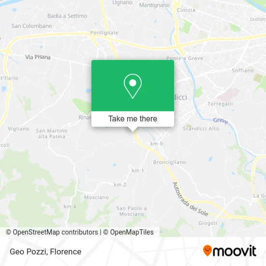
See Geo Wells, Scandicci, on the map
Public Transit to Geo Wells in Scandicci
Wondering how to get to Geo Wells in Scandicci? Moovit helps you find the best way to get to Geo Wells with step-by-step directions from the nearest public transit station.
Moovit provides free maps and live directions to help you navigate through your city. View schedules, routes, timetables, and find out how long does it take to get to Geo Wells in real time.
Looking for the nearest stop or station to Geo Wells? Check out this list of stops closest to your destination: Dei Ciliegi Rodari School; De Andre; Formicola Bridge; Pacchi Socet; Ponte A Vingone; Vingone Vignono; Constitution T1 Villa Costanza.
Bus: 27, 61, 62, 63, 371 B, 371 A, 15.Light Rail: T1.
Want to see if there’s another route that gets you there at an earlier time? Moovit helps you find alternative routes or times. Get directions from and directions to Geo Wells easily from the Moovit App or Website.
We make riding to Geo Wells easy, which is why over 1.5 million users, including users in Scandicci, trust Moovit as the best app for public transit. You don’t need to download an individual bus app or train app, Moovit is your all-in-one transit app that helps you find the best bus time or train time available.
For information on prices of bus and light rail, costs and ride fares to Geo Wells, please check the Moovit app.
Use the app to navigate to popular places including to the airport, hospital, stadium, grocery store, mall, coffee shop, school, college, and university.
Geo Wells Address: Via delle Prata, 81 50018 Scandicci street in Scandicci
- River School,
- Pietro Nenni Square,
- Artini Rag. Sauro,
- Equitalia Centro,
- Stefano Piampiano,
- Via Ponte di Formicola, 73c,
- Circular Farm Funghi Espresso,
- Cipriani Gardens by Cipriani Mauro,
- Notary Daniela Auricchio,
- Ciuffardi Schipani Boretti Cecchi,
- Triozzi Street 23,
- Pet Wellness,
- Salaorni Sergio,
- Triozzi Alley,
- Roberta Masetti,
- Arkè Scs,
- Ricci Capricci by Ciaravola Marco & C.,
- Restaurant Pizzeria Da I' Dino,
- Gabbioni Amato,
- Malanima Nadia
Places Near Geo Wells (Scandicci)
- I Gigli, Campi Bisenzio,
- Tobacco Manufacture, Florence,
- OOO, Florence,
- Nelson Mandela Forum, Florence,
- Torregalli Hospital Scandicci *, Scandicci,
- Michelangelo Square, Florence,
- Santa Maria Novella Station, Florence,
- Campi Bisenzio, Campi Bisenzio,
- Mandela Forum (Nelson Mandela Forum), Florence,
- IKEA Florence, Sesto Fiorentino,
- Santa Maria Nuova Hospital, Florence,
- Visarno Hippodrome, Florence,
- Visarno Arena, Florence,
- Cascine Park, Florence,
- Michelangelo Square, Florence,
- Asmana, Campi Bisenzio,
- Artemio Franchi Municipal Stadium, Florence,
- Field of Mars, Florence,
- Verdi Theater, Florence,
- Piero Palagi Hospital Facility-Florence, Florence
How to get to popular places in Florence with public transit
Get around Scandicci by public transit!
Traveling around Scandicci has never been so easy. See step by step directions as you travel to any attraction, street or major public transit station. View bus and train schedules, arrival times, service alerts and detailed routes on a map, so you know exactly how to get to anywhere in Scandicci.
When traveling to any destination around Scandicci use Moovit's Live Directions with Get Off Notifications to know exactly where and how far to walk, how long to wait for your line, and how many stops are left. Moovit will alert you when it's time to get off — no need to constantly re-check whether yours is the next stop.
Wondering how to use public transit in Scandicci or how to pay for public transit in Scandicci? Moovit public transit app can help you navigate your way with public transit easily, and at minimum cost. It includes public transit fees, ticket prices, and costs. Looking for a map of Scandicci public transit lines? Moovit public transit app shows all public transit maps in Scandicci with all Bus, Train, Light Rail, Ferry and Funicular routes and stops on an interactive map.
Florence has 5 transit type(s), including: Bus, Train, Light Rail, Ferry and Funicular, operated by several transit agencies, including Florence Urban - Tuscan Bus Lines, GEST, Livorno and Province - Tuscan Bus Lines, Arezzo, Florence and Provinces - Tuscan Bus Lines, Prato and Province - Tuscan Bus Lines, Lucca and Province - Tuscan Bus Lines, Massa, Carrara and Province - Tuscan Bus Lines, Pisa and Province - Tuscan Bus Lines, Grosseto, Siena and Provinces - Tuscan Bus Lines, Arezzo, Siena and Provinces - Tuscan Bus Lines, Florence and Province - Tuscan Bus Lines, Pistoia and Province - Tuscan Bus Lines, Siena and Province - Tuscan Bus Lines, Arezzo and Province - Tuscan Bus Lines and Trenitalia