How to get to Gerry's Cheapest Tree by bus?
Click on the bus route to see step by step directions with maps, line arrival times and updated time schedules.
From W.P. Wagner High School, Edmonton
97 minFrom Liberta Coffee Lab, Edmonton
75 minFrom Gateway Blvd, Edmonton
79 minFrom Corona LRT Station, Edmonton
42 minFrom 11541 Kingsway Northwest, Edmonton
53 minFrom The Westin Edmonton, Edmonton
40 minFrom W P Wagner Senior High School, Edmonton
96 minFrom Computer Trouble Shooters St Albert, St. Albert
86 minFrom Mark Messier Arena at Servus Place, St. Albert
83 min
Bus stops near Gerry's Cheapest Tree in Edmonton
Light Rail stations near Gerry's Cheapest Tree in Edmonton
- Coliseum Station, 33 min walk,VIEW
Bus lines to Gerry's Cheapest Tree in Edmonton
What are the closest stations to Gerry's Cheapest Tree?
The closest stations to Gerry's Cheapest Tree are:
- 72 Street & 132 Avenue is 330 meters away, 5 min walk.
- 66 Street & 132 Avenue is 975 meters away, 13 min walk.
- 74 Street & Delwood Road is 1024 meters away, 14 min walk.
- Coliseum Station is 2549 meters away, 33 min walk.
Which bus lines stop near Gerry's Cheapest Tree?
These bus lines stop near Gerry's Cheapest Tree: 054, 106, 114.
What’s the nearest bus station to Gerry's Cheapest Tree in Edmonton?
The nearest bus station to Gerry's Cheapest Tree in Edmonton is 72 Street & 132 Avenue. It’s a 5 min walk away.
What time is the first bus to Gerry's Cheapest Tree in Edmonton?
The 106 is the first bus that goes to Gerry's Cheapest Tree in Edmonton. It stops nearby at 6:20 AM.
What time is the last bus to Gerry's Cheapest Tree in Edmonton?
The 106 is the last bus that goes to Gerry's Cheapest Tree in Edmonton. It stops nearby at 12:23 AM.
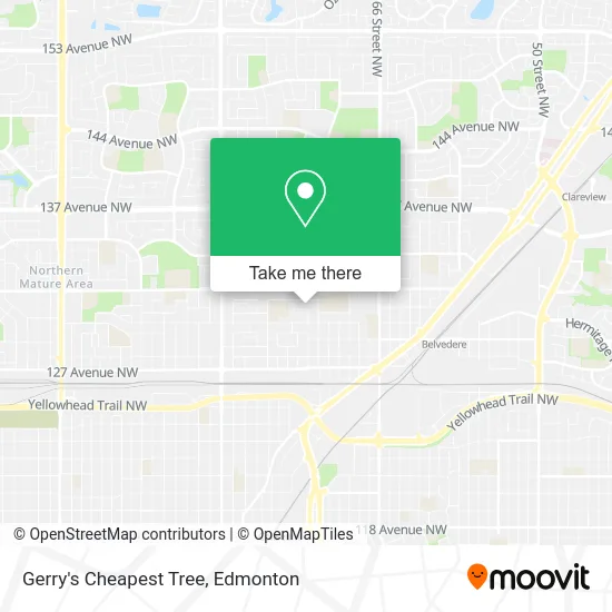
See Gerry's Cheapest Tree, Edmonton, on the map
Public Transit to Gerry's Cheapest Tree in Edmonton
Wondering how to get to Gerry's Cheapest Tree in Edmonton? Moovit helps you find the best way to get to Gerry's Cheapest Tree with step-by-step directions from the nearest public transit station.
Moovit provides free maps and live directions to help you navigate through your city. View schedules, routes, timetables, and find out how long does it take to get to Gerry's Cheapest Tree in real time.
Looking for the nearest stop or station to Gerry's Cheapest Tree? Check out this list of stops closest to your destination: 72 Street & 132 Avenue; 66 Street & 132 Avenue; 74 Street & Delwood Road; Coliseum Station.
Bus: 054, 106, 114, 626, 107, 128.
Want to see if there’s another route that gets you there at an earlier time? Moovit helps you find alternative routes or times. Get directions from and directions to Gerry's Cheapest Tree easily from the Moovit App or Website.
We make riding to Gerry's Cheapest Tree easy, which is why over 1.5 million users, including users in Edmonton, trust Moovit as the best app for public transit. You don’t need to download an individual bus app or train app, Moovit is your all-in-one transit app that helps you find the best bus time or train time available.
For information on prices of bus, costs and ride fares to Gerry's Cheapest Tree, please check the Moovit app.
Use the app to navigate to popular places including to the airport, hospital, stadium, grocery store, mall, coffee shop, school, college, and university.
Gerry's Cheapest Tree Address: 7312 130A Ave NW Edmonton, AB T5C 1Y9 street in Edmonton
- Gerry's Cheapest Tree Removal,
- Lawn and Yard Care Service,
- U-Haul,
- Amazon Locker-Shuffleboard,
- Bodyworks Massage & Specialists,
- Ali's Homes and Parks Construction,
- Pebbles Daycare Centre,
- Balwin School,
- DS Garbage Collection,
- Go2 Construction,
- Glacier Group Inc,
- Ed Prodaniuk,
- Zaks Auctions,
- Sparkle Solutions,
- Little Junipe,
- Edmonton Spanish Eben-Ezer Seventh-Day Adventist Church,
- Easy Dump,
- Edmonton Garage do,
- Edmonton's Best Plumbers,
- T.R Handyman Services
Places Near Gerry's Cheapest Tree (Edmonton)
- Edmonton VIA Rail Station, Edmonton,
- West Edmonton Mall, Edmonton,
- Grey Nuns Community Hospital, Edmonton,
- Edmonton Commonwealth Stadium, Edmonton,
- Kingsway Mall, Edmonton,
- Fort Edmonton Park, Edmonton,
- Northgate Centre, Edmonton,
- Edmonton EXPO Centre, Edmonton,
- MacEwan University, Edmonton,
- Whyte Avenue, Edmonton,
- Kaye Edmonton Clinic, Edmonton,
- Canada Place Service Canada Centre, Edmonton,
- Londonderry Mall, Edmonton,
- Borden Park, Edmonton,
- University of Alberta, Edmonton,
- Alberta Legislature Building, Edmonton,
- Edmonton Valley Zoo, Edmonton,
- Royal Alexandra Hospital, Edmonton,
- Cross Cancer Institute, Edmonton,
- Rogers Place, Edmonton
How to get to popular places in Edmonton with public transit
Get around Edmonton by public transit!
Traveling around Edmonton has never been so easy. See step by step directions as you travel to any attraction, street or major public transit station. View bus and train schedules, arrival times, service alerts and detailed routes on a map, so you know exactly how to get to anywhere in Edmonton.
When traveling to any destination around Edmonton use Moovit's Live Directions with Get Off Notifications to know exactly where and how far to walk, how long to wait for your line, and how many stops are left. Moovit will alert you when it's time to get off — no need to constantly re-check whether yours is the next stop.
Wondering how to use public transit in Edmonton or how to pay for public transit in Edmonton? Moovit public transit app can help you navigate your way with public transit easily, and at minimum cost. It includes public transit fees, ticket prices, and costs. Looking for a map of Edmonton public transit lines? Moovit public transit app shows all public transit maps in Edmonton with all Bus and Light Rail routes and stops on an interactive map.
Edmonton has 2 transit type(s), including: Bus and Light Rail, operated by several transit agencies, including ETS LRT, ETS, Strathcona County Transit, St. Albert Transit, Spruce Grove Transit, Fort Saskatchewan Transit, Beaumont Transit and Leduc Transit