Directions to GetGo (Indianapolis) with public transportation
The following transit lines have routes that pass near GetGo
 Bus: 10.
How to get to GetGo by bus?
Click on the bus route to see step by step directions with maps, line arrival times and updated time schedules.
From Dave's Mechanic Shop, Indianapolis City (Balance)
86 minFrom VA Medical Center Purple Group, Indianapolis City (Balance)
33 minFrom Wayne Township Bus Depot, Indianapolis City (Balance)
86 minFrom STARBUCKS, Indianapolis City (Balance)
72 minFrom Richard L Roudebush VA Medical Center, Indianapolis City (Balance)
30 minFrom Navy Federal Credit Union, Indianapolis City (Balance)
22 minFrom Saraga International Grocery, Indianapolis City (Balance)
52 minFrom 1152 North White River Parkway West Drive, Indianapolis
33 min
Bus stop near GetGo in Indianapolis
- Rockville Rd - 8200 W - Kroger, 2 min walk,VIEW
Bus lines to GetGo in Indianapolis
- 10, Meijer Avon,VIEW
What are the closest stations to GetGo?
The closest stations to GetGo are:
- Rockville Rd - 8200 W - Kroger is 127 yards away, 2 min walk.
Which bus line stops near GetGo?
10 (Meijer Avon)
What’s the nearest bus station to GetGo in Indianapolis?
The nearest bus station to GetGo in Indianapolis is Rockville Rd - 8200 W - Kroger. It’s a 2 min walk away.
What time is the first bus to GetGo in Indianapolis?
The 10 is the first bus that goes to GetGo in Indianapolis. It stops nearby at 6:19 AM.
What time is the last bus to GetGo in Indianapolis?
The 10 is the last bus that goes to GetGo in Indianapolis. It stops nearby at 12:22 AM.
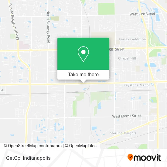
See GetGo, Indianapolis, on the map
Public Transit to GetGo in Indianapolis
Wondering how to get to GetGo in Indianapolis? Moovit helps you find the best way to get to GetGo with step-by-step directions from the nearest public transit station.
Moovit provides free maps and live directions to help you navigate through your city. View schedules, routes, timetables, and find out how long does it take to get to GetGo in real time.
Looking for the nearest stop or station to GetGo? Check out this list of stops closest to your destination: Rockville Rd - 8200 W - Kroger.
Bus: 10.
Want to see if there’s another route that gets you there at an earlier time? Moovit helps you find alternative routes or times. Get directions from and directions to GetGo easily from the Moovit App or Website.
We make riding to GetGo easy, which is why over 1.5 million users, including users in Indianapolis, trust Moovit as the best app for public transit. You don’t need to download an individual bus app or train app, Moovit is your all-in-one transit app that helps you find the best bus time or train time available.
For information on prices of bus, costs and ride fares to GetGo, please check the Moovit app.
Use the app to navigate to popular places including to the airport, hospital, stadium, grocery store, mall, coffee shop, school, college, and university.
GetGo Address: 8249 Rockville Rd Indianapolis, IN 46214 street in Indianapolis
- Indianapolis Emergency 24 7 Heating Repair,
- Geico,
- Rockville Rd / Country Club Rd,
- Chapel Hill Lions Club,
- Noteway Media,
- A and B Renovations,
- Alona Medical,
- Jason A Richey,
- G5 Management,
- Relax Spa,
- Law Office of Steven Lovern,
- Lights Alive,
- 24hr-Locksmith,
- Coinstar - Bitcoin ATM,
- Coinstar,
- German American Bank Itm,
- La Twist Hair Salon,
- Roofing Contractors,
- Biolife Plasma Services,
- Associated Bank
Places Near GetGo (Indianapolis)
- 119 W 19th St Parking, Indianapolis City (Balance),
- St. Vincent Hospital - Indianapolis, Indianapolis City (Balance),
- I U Health Methodist Hospital, Indianapolis City (Balance),
- Indiana, Indianapolis City (Balance),
- Indianapolis Airport Zone 2, Indianapolis City (Balance),
- Lucas Oil Stadium, Indianapolis City (Balance),
- Eskenazi Hospital, Indianapolis City (Balance),
- Plainfield, IN, Plainfield,
- Jersey Barn, Indianapolis City (Balance),
- Lilly Corporate Center (Eli Lilly & Co), Indianapolis City (Balance),
- I-465 / I-65 Interchange, Indianapolis City (Balance),
- THE BALT, Indianapolis City (Balance),
- Indiana Convention Center, Indianapolis City (Balance),
- Indianapolis Motor Speedway, Speedway,
- St. Vincent entrance #1, Indianapolis City (Balance),
- Castleton Square Mall, Indianapolis,
- Train Ride At Castleton Mall, Indianapolis City (Balance),
- Methodist Hospital of Indianapolis, Indianapolis City (Balance),
- Cotter's Massage Parlor With Happy Endings, Indianapolis City (Balance),
- Gainbridge Fieldhouse, Indianapolis City (Balance)
How to get to popular places in Indianapolis with public transit
Get around Indianapolis by public transit!
Traveling around Indianapolis has never been so easy. See step by step directions as you travel to any attraction, street or major public transit station. View bus and train schedules, arrival times, service alerts and detailed routes on a map, so you know exactly how to get to anywhere in Indianapolis.
When traveling to any destination around Indianapolis use Moovit's Live Directions with Get Off Notifications to know exactly where and how far to walk, how long to wait for your line, and how many stops are left. Moovit will alert you when it's time to get off — no need to constantly re-check whether yours is the next stop.
Wondering how to use public transit in Indianapolis or how to pay for public transit in Indianapolis? Moovit public transit app can help you navigate your way with public transit easily, and at minimum cost. It includes public transit fees, ticket prices, and costs. Looking for a map of Indianapolis public transit lines? Moovit public transit app shows all public transit maps in Indianapolis with all bus routes and stops on an interactive map.
Indianapolis has 1 transit type(s), including: bus, operated by several transit agencies, including IndyGo, FlixBus-us and Greyhound-us