Directions to Gisa Modas (Pinheirinho) with public transportation
The following transit lines have routes that pass near Gisa Modas
How to get to Gisa Modas by bus?
Click on the bus route to see step by step directions with maps, line arrival times and updated time schedules.
From Estação Tubo Bruno Filgueira, Bigorrilho
56 minFrom Avenida Silva Jardim, Rebouças
60 minFrom Estação Tubo Visconde de Nácar, Centro
55 minFrom Rua Francisco Nowotarski, Fazendinha
48 minFrom Campo de Santana, Campo De Santana
36 minFrom Travessa da Lapa, Centro
49 minFrom Estação Tubo Vital Brasil, Portão
53 minFrom Rua Monsenhor Célso 256-2 andar, Centro
58 minFrom Campo De Santana, Campo De Santana
56 minFrom Rua José Hauer, Boqueirão
57 min
Bus stops near Gisa Modas in Pinheirinho
Bus lines to Gisa Modas in Pinheirinho
What are the closest stations to Gisa Modas?
The closest stations to Gisa Modas are:
- Al. Nossa Senhora do Sagrado Coração, 1473 is 145 meters away, 2 min walk.
- R. Engenheiro João Bley Filho, 520 is 191 meters away, 3 min walk.
Which bus lines stop near Gisa Modas?
These bus lines stop near Gisa Modas: 631 PIRATINI / BR 476, 633 MARIA ANGÉLICA, 646 POMPÉIA / JANAÍNA, 649 PIRINEUS, F01 FAZENDA / PINHEIRINHO.
What’s the nearest bus station to Gisa Modas in Pinheirinho?
The nearest bus station to Gisa Modas in Pinheirinho is Al. Nossa Senhora do Sagrado Coração, 1473. It’s a 2 min walk away.
What time is the first bus to Gisa Modas in Pinheirinho?
The 631 PIRATINI / BR 476 is the first bus that goes to Gisa Modas in Pinheirinho. It stops nearby at 5:00 AM.
What time is the last bus to Gisa Modas in Pinheirinho?
The 631 PIRATINI / BR 476 is the last bus that goes to Gisa Modas in Pinheirinho. It stops nearby at 12:49 AM.
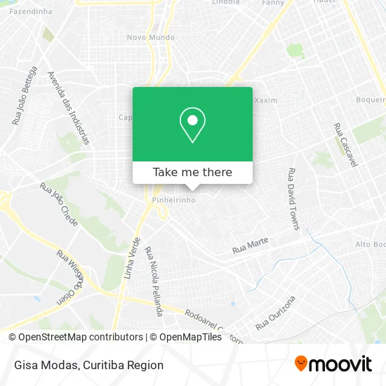
See Gisa Modas, Pinheirinho, on the map
Public Transit to Gisa Modas in Pinheirinho
Wondering how to get to Gisa Modas in Pinheirinho? Moovit helps you find the best way to get to Gisa Modas with step-by-step directions from the nearest public transit station.
Moovit provides free maps and live directions to help you navigate through your city. View schedules, routes, timetables, and find out how long does it take to get to Gisa Modas in real time.
Looking for the nearest stop or station to Gisa Modas? Check out this list of stops closest to your destination: Al. Nossa Senhora do Sagrado Coração; R. Engenheiro João Bley Filho.
Bus: 631 PIRATINI / BR 476, 633 MARIA ANGÉLICA, 646 POMPÉIA / JANAÍNA, 649 PIRINEUS, F01 FAZENDA / PINHEIRINHO.
Want to see if there’s another route that gets you there at an earlier time? Moovit helps you find alternative routes or times. Get directions from and directions to Gisa Modas easily from the Moovit App or Website.
We make riding to Gisa Modas easy, which is why over 1.5 million users, including users in Pinheirinho, trust Moovit as the best app for public transit. You don’t need to download an individual bus app or train app, Moovit is your all-in-one transit app that helps you find the best bus time or train time available.
For information on prices of bus, costs and ride fares to Gisa Modas, please check the Moovit app.
Use the app to navigate to popular places including to the airport, hospital, stadium, grocery store, mall, coffee shop, school, college, and university.
Gisa Modas Address: Rua Engenheiro João Bley Filho, 885 Pinheirinho Curitiba-PR 81870-370 street in Pinheirinho
- Tomczyk Comercio de Moveis,
- Maos de Fada Studio Nail/Hair,
- Cida Moda Intima and Cosmeticos,
- Dois Irmaos Pentecostais Producoes,
- Supermercado Jóia,
- Sonel,
- Casa de Repouso Vera Cruz,
- Oliveira Camargo Empreendimentos,
- Jvc Transportes,
- Rua Aracari, 295 - Pinheirinho,
- Cerâmica Cosmos,
- Inglat Servicos e Equipamentos de Segurança,
- Oriental Sushi e Frutos do Mar Delivery,
- Rua Adão Ordakowski 120,
- Mercado Piratini,
- Seven Padronizacoes,
- Borguesani Motos, Peças e Acessórios,
- Fernando Pinheiro Construções e Reformas,
- Rua Aracari 344,
- Vila Piratini
Places Near Gisa Modas (Pinheirinho)
- Rua General Mário Tourinho, Campina Do Siqueira,
- Hospital do Rocio, Campo,
- Rua Martim Afonso 558, Mercês,
- Hospital Nossa Senhora Das Graças, Mercês,
- Arena Da Baixada - Curitiba,
- Hhhhh, Fazendinha,
- Hospital de Clínicas (HC - UFPR), Centro,
- Shopping Estação, Rebouças,
- Campo Largo, Campo,
- Jockey Plaza Shopping Center, Tarumã,
- Pontifícia Universidade Católica do Paraná (PUCPR), Prado Velho,
- Hospital Angelina Caron, Campina Grande Do Sul,
- Jardim Botânico de Curitiba PR, Centro,
- Shopping Palladium, Portão,
- Park Shopping Barigüi, Mossunguê,
- Hospital Erasto Gaertner, Jardim Das Américas,
- Parque Barigui, Mercês,
- Hospital Madalena Sofia, Bairro Alto,
- Hospital Da Cruz Vermelha, Batel,
- Hospital Universitário Evangélico de Curitiba, Bigorrilho
How to get to popular places in Curitiba Region with public transit
Get around Pinheirinho by public transit!
Traveling around Pinheirinho has never been so easy. See step by step directions as you travel to any attraction, street or major public transit station. View bus and train schedules, arrival times, service alerts and detailed routes on a map, so you know exactly how to get to anywhere in Pinheirinho.
When traveling to any destination around Pinheirinho use Moovit's Live Directions with Get Off Notifications to know exactly where and how far to walk, how long to wait for your line, and how many stops are left. Moovit will alert you when it's time to get off — no need to constantly re-check whether yours is the next stop.
Wondering how to use public transit in Pinheirinho or how to pay for public transit in Pinheirinho? Moovit public transit app can help you navigate your way with public transit easily, and at minimum cost. It includes public transit fees, ticket prices, and costs. Looking for a map of Pinheirinho public transit lines? Moovit public transit app shows all public transit maps in Pinheirinho with all Bus and Cable Car routes and stops on an interactive map.
Curitiba Region has 2 transit type(s), including: Bus and Cable Car, operated by several transit agencies, including Sistema Integrado de Mobilidade (URBS), Sistema Integrado de Mobilidade (AMEP), URBS (Cartões bancários e Dinheiro), URBS (Cartões bancários / Cartão URBS), AMEP (Cartões bancários / Cartão MetroCard), AMEP (Cartões bancários / Cartão MetroCard / Dinheiro), Viação Colombo (Dinheiro), TRIAR (Cartão TRIAR / Dinheiro), Empresa Curitiba Cerro Azul (Dinheiro), Expresso Nossa Senhora da Penha (Dinheiro), Empresa Campo Alto Tijucas (Dinheiro), Auto Viação São José (Cartão VEM / Dinheiro), BRT S/A (Cartão VEM / Dinheiro), TransPiedade (Cartão Cidadão / Dinheiro) and Oceânica Sul (Cartão Transporte / Dinheiro)