How to get to Gleis 2 by bus?
Click on the bus route to see step by step directions with maps, line arrival times and updated time schedules.
From Robert Bosch, Reutlingen
50 minFrom Waldgasthof Weiler Hütte, Weil Im Schönbuch (Kernort)
159 minFrom Braun Möbel-Center, Jettenburg
40 minFrom Bauhaus, Reutlingen
55 minFrom Geilhaus, Reutlingen-Betzingen
51 minFrom Geilhaus Haus 33a, Reutlingen-Betzingen
51 minFrom Friedhof Römerschanze, Reutlingen
73 minFrom Cabriolo, Reutlingen-Betzingen
40 minFrom Bosch, Tor 2, Reutlingen
50 min
How to get to Gleis 2 by train?
Click on the train route to see step by step directions with maps, line arrival times and updated time schedules.
Bus stops near Gleis 2 in Tübingen
Bus lines to Gleis 2 in Tübingen
- 826A, Leinfelden Bf,VIEW
- N80, Tübingen Hauptbahnhof,VIEW
- 826, Leinfelden - Waldenbuch - Tübingen,VIEW
- 827, Häslach - Walddorf - Dettenhausen - Pfrondorf - Tübingen,VIEW
- 828, Flughafen - Echterdingen - Waldenbuch - Tübingen,VIEW
- RT828, Dettenhausen - Tübingen,VIEW
- X82, Flughafen - Echterdingen - Waldenbuch - Tübingen,VIEW
- 5, Tübingen Ulmenweg,VIEW
- N95, Tübingen Hauptbahnhof,VIEW
- 1, Tübingen Hauptbahnhof Bstg C - Tübingen Stauden,VIEW
- 10, Reutlingen Hauptbahnhof Bstg H4 - Tübingen Hauptbahnhof Bstg J,VIEW
- 13, Tübingen Aixer Straße - Tübingen Wanne Kunsthalle,VIEW
- 16, Tübingen Hauptbahnhof Bstg E - Tübingen Waldhörnlestraße,VIEW
- 21, Tübingen Hauptbahnhof Bstg D - Tübingen Egeriaplatz,VIEW
- 3, Tübingen WHO Pappelweg Bstg 2 - Tübingen Nelkenweg,VIEW
- 31, Tübingen Hauptbahnhof Bstg E - Kreßbach Schloss,VIEW
- 34, Tübingen Bergfriedhof West - Tübingen Hauptbahnhof Bstg J,VIEW
- 35, Tübingen Vor dem Großholz - Tübingen Hauptbahnhof Bstg J,VIEW
- 4, Tübingen WHO Pappelweg Bstg 2 - Tübingen Wennf. Garten,VIEW
- 7601, K'furt Südring Tal - Tübingen Hauptbahnhof Bstg A,VIEW
What are the closest stations to Gleis 2?
The closest stations to Gleis 2 are:
- Tübingen Hauptbahnhof is 41 meters away, 1 min walk.
- Tübingen Steinlach/Hbf Süd is 246 meters away, 5 min walk.
- Tübingen Poststraße is 373 meters away, 5 min walk.
- Tübingen Neckarbrücke is 434 meters away, 7 min walk.
Which train line stops near Gleis 2?
RB63 (Tübingen Hbf)
Which bus lines stop near Gleis 2?
These bus lines stop near Gleis 2: 7611, 826, 828.
What’s the nearest bus station to Gleis 2 in Tübingen?
The nearest bus station to Gleis 2 in Tübingen is Tübingen Hauptbahnhof. It’s a 1 min walk away.
What time is the first bus to Gleis 2 in Tübingen?
The N92 is the first bus that goes to Gleis 2 in Tübingen. It stops nearby at 3:14 AM.
What time is the last bus to Gleis 2 in Tübingen?
The N94 is the last bus that goes to Gleis 2 in Tübingen. It stops nearby at 2:57 AM.
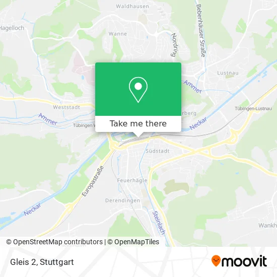
See Gleis 2, Tübingen, on the map
Public Transit to Gleis 2 in Tübingen
Wondering how to get to Gleis 2 in Tübingen? Moovit helps you find the best way to get to Gleis 2 with step-by-step directions from the nearest public transit station.
Moovit provides free maps and live directions to help you navigate through your city. View schedules, routes, timetables, and find out how long does it take to get to Gleis 2 in real time.
Looking for the nearest stop or station to Gleis 2? Check out this list of stops closest to your destination: Tübingen Hauptbahnhof; Tübingen Steinlach/Hbf Süd; Tübingen Poststraße; Tübingen Neckarbrücke.
Train: RB63.Bus: 7611, 826, 828, 826A, N80, 827, RT828, X82, 5, N95, 1, 10, 13, 16, 21, 10, 11, 12, 17, 18.
Want to see if there’s another route that gets you there at an earlier time? Moovit helps you find alternative routes or times. Get directions from and directions to Gleis 2 easily from the Moovit App or Website.
We make riding to Gleis 2 easy, which is why over 1.5 million users, including users in Tübingen, trust Moovit as the best app for public transit. You don’t need to download an individual bus app or train app, Moovit is your all-in-one transit app that helps you find the best bus time or train time available.
For information on prices of bus and train, costs and ride fares to Gleis 2, please check the Moovit app.
Use the app to navigate to popular places including to the airport, hospital, stadium, grocery store, mall, coffee shop, school, college, and university.
Location: Tübingen, Stuttgart
- Tübingen Hbf,
- Bahnhof Tübingen Hbf,
- Db Reisezentrum Tübingen,
- H.A.U.P.T. Bahnhof,
- IRE,
- Bäckerei-Konditorei Gulde,
- Minicar Tübingen,
- Unternehmensgruppe Dr.,
- Sparkasse Karlsruhe Ettlingen,
- Gaststätte Hauptbahnhof,
- Bäckerhaus Veit,
- Gustoregio,
- Austellung Tag der Seltenen Krankheit,
- Dj Jas,
- Café am See,
- ZOB Tübingen (Tübingen central train station),
- FlixBus Haltestelle,
- Kira-Maria Wintzen Heilpraktikerin,
- Kommunale Kindergaerten,
- Johanniter-Unfall-Hilfe
Places Near Gleis 2 (Tübingen)
- Mettingen Eros-Center Puff Laufhaus, Esslingen Am Neckar,
- Mercedes-Benz Museum (Mercedes Museum Stuttgart), Bad Cannstatt,
- Waldfriedhof, Degerloch,
- Geilhaus Haus 33a, Reutlingen-Betzingen,
- Porsche-Arena, Bad Cannstatt,
- Im Wizemann (Halle), Bad Cannstatt,
- SI-Centrum, Möhringen,
- Porsche Museum, Zuffenhausen,
- Pariser Platz Stuttgart, Stuttgart-Mitte,
- Wilhelma (U-Bahn Wilhelma), Bad Cannstatt,
- Schleyerhalle, Bad Cannstatt,
- Gleis 101/102 (tief), Stuttgart-Mitte,
- FlixBus Haltestelle, Stuttgart,
- Mercedes-Benz Museum, Bad Cannstatt,
- Marmorsaal Im Weissenburgpark, Stuttgart-Süd,
- Hanns-Martin-Schleyer-Halle (Stuttgart Hans-Martin-Schleyerhalle), Bad Cannstatt,
- Gasometer Pforzheim, Pforzheim,
- Hauptbahnhof Stuttgart, Stuttgart-Mitte,
- Hanns-Martin-Schleyer-Halle, Bad Cannstatt,
- Klinikum Stuttgart - Katharinenhospital, Stuttgart-Mitte
How to get to popular places in Stuttgart with public transit
Get around Tübingen by public transit!
Traveling around Tübingen has never been so easy. See step by step directions as you travel to any attraction, street or major public transit station. View bus and train schedules, arrival times, service alerts and detailed routes on a map, so you know exactly how to get to anywhere in Tübingen.
When traveling to any destination around Tübingen use Moovit's Live Directions with Get Off Notifications to know exactly where and how far to walk, how long to wait for your line, and how many stops are left. Moovit will alert you when it's time to get off — no need to constantly re-check whether yours is the next stop.
Wondering how to use public transit in Tübingen or how to pay for public transit in Tübingen? Moovit public transit app can help you navigate your way with public transit easily, and at minimum cost. It includes public transit fees, ticket prices, and costs. Looking for a map of Tübingen public transit lines? Moovit public transit app shows all public transit maps in Tübingen with all Bus, Train, Subway, Light Rail, Ferry, S-Bahn and Funicular routes and stops on an interactive map.
Stuttgart has 7 transit type(s), including: Bus, Train, Subway, Light Rail, Ferry, S-Bahn and Funicular, operated by several transit agencies, including SSB - Stadtbahn, SSB, SSB - Seilbahn / Zacke, S-Bahn Stuttgart, Rhein-Neckar-Verkehr GmbH (rnv), Karlsruher Verkehrsverbund, DB AG, DB Regiobus BW, Arverio Baden-Württemberg GmbH, DB RegioNetz Verkehrs GmbH Westfrankenbahn, DB Regio AG Baden-Württemberg, Südwestdeutsche Verkehrs-AG, DB Regio AG Mitte Region Hessen, DB and Bodensee-Oberschwaben-Bahn