How to get to Gml by bus?
Click on the bus route to see step by step directions with maps, line arrival times and updated time schedules.
From Marie-Baum-Schule Heidelberg, Wieblingen
174 minFrom Möbel Höffner, Schwetzingen
83 minFrom Friedhof Käfertal, Käfertal
82 minFrom Globus Getränkecenter, Ludwigshafen-Oggersheim
44 minFrom MVV Energie Ladestation, Käfertal
71 minFrom GRN-Klinik Schwetzingen, Schwetzingen
126 minFrom Globus Getränkemarkt, Ludwigshafen-Oggersheim
45 minFrom FH 1863, Neckarstadt-Ost/Wohlgelegen
60 min
How to get to Gml by train?
Click on the train route to see step by step directions with maps, line arrival times and updated time schedules.
From Marie-Baum-Schule Heidelberg, Wieblingen
61 minFrom Möbel Höffner, Schwetzingen
60 minFrom Krankenhaus GRN, Weinheim
84 minFrom MVV Energie Ladestation, Käfertal
73 minFrom GRN-Klinik Schwetzingen, Schwetzingen
65 minFrom Bad Dürkheim Reha, Bad Dürkheim
88 minFrom FH 1863, Neckarstadt-Ost/Wohlgelegen
60 min
Light Rail stations near Gml in Ludwigshafen-Nördliche Innenstadt
Bus stops near Gml in Ludwigshafen-Nördliche Innenstadt
Bus lines to Gml in Ludwigshafen-Nördliche Innenstadt
- 4, Frankenthal am Römig,VIEW
- 4, Bad Dürkheim,VIEW
- 71, Notwende,VIEW
- 4, Lu Hauptbahnhof,VIEW
- 4, Berliner Platz,VIEW
- 70, Lu Hauptbahnhof,VIEW
- 78, Basf Süd,VIEW
- 78E, Basf Süd,VIEW
- 80, Mundenheim Bahnhof,VIEW
- E, Schulbus,VIEW
- 74, Berliner Platz,VIEW
- 74E, Leininger Straße,VIEW
- 75, Rheingönheim,VIEW
- 75E, Bbs Franz-Zang-Str,VIEW
- 90, Berliner Platz,VIEW
- 90E, Berliner Platz,VIEW
- 80E, BASF Süd (Tor 1+7) – BASF (Tor 1+2) – Goerdelerplatz – Marienkirche – Rohrlachstraße – Valentin-Bauer-Siedlung – LU Hochschule – Mundenheim Bf,VIEW
- E, Oppau, Fritz-Haber-Straße BASF Tor 12+13 - Valentin-Bauer-Siedlung,VIEW
- E, Hans-Warsch-Platz - Valentin-Bauer-Siedlung,VIEW
What are the closest stations to Gml?
The closest stations to Gml are:
- Marienkirche is 281 meters away, 4 min walk.
- Ludwigshafen, Marienkirche is 298 meters away, 5 min walk.
- Pettenkoferstraße is 337 meters away, 5 min walk.
- Apostelkirche is 618 meters away, 8 min walk.
- Rohrlachstraße is 620 meters away, 8 min walk.
- Heinrich-Ries-Halle is 625 meters away, 9 min walk.
- Goerdelerplatz is 633 meters away, 9 min walk.
Which train lines stop near Gml?
These train lines stop near Gml: S3, S6.
Which light rail lines stop near Gml?
These light rail lines stop near Gml: 10, 4A, 7, RNV 4, RNV 4A.
Which bus lines stop near Gml?
These bus lines stop near Gml: 60, 62, 71, 710, RNV 60, RNV 65.
What’s the nearest light rail station to Gml in Ludwigshafen-Nördliche Innenstadt?
The nearest light rail station to Gml in Ludwigshafen-Nördliche Innenstadt is Marienkirche. It’s a 4 min walk away.
What’s the nearest bus station to Gml in Ludwigshafen-Nördliche Innenstadt?
The nearest bus station to Gml in Ludwigshafen-Nördliche Innenstadt is Pettenkoferstraße. It’s a 5 min walk away.
What time is the first light rail to Gml in Ludwigshafen-Nördliche Innenstadt?
The E is the first light rail that goes to Gml in Ludwigshafen-Nördliche Innenstadt. It stops nearby at 4:25 AM.
What time is the last light rail to Gml in Ludwigshafen-Nördliche Innenstadt?
The E is the last light rail that goes to Gml in Ludwigshafen-Nördliche Innenstadt. It stops nearby at 9:05 PM.
What time is the first bus to Gml in Ludwigshafen-Nördliche Innenstadt?
The 90E is the first bus that goes to Gml in Ludwigshafen-Nördliche Innenstadt. It stops nearby at 4:17 AM.
What time is the last bus to Gml in Ludwigshafen-Nördliche Innenstadt?
The 90 is the last bus that goes to Gml in Ludwigshafen-Nördliche Innenstadt. It stops nearby at 12:40 AM.
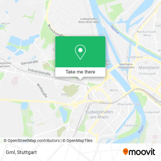
See Gml, Ludwigshafen-Nördliche Innenstadt, on the map
Public Transit to Gml in Ludwigshafen-Nördliche Innenstadt
Wondering how to get to Gml in Ludwigshafen-Nördliche Innenstadt? Moovit helps you find the best way to get to Gml with step-by-step directions from the nearest public transit station.
Moovit provides free maps and live directions to help you navigate through your city. View schedules, routes, timetables, and find out how long does it take to get to Gml in real time.
Looking for the nearest stop or station to Gml? Check out this list of stops closest to your destination: Marienkirche; Ludwigshafen; Pettenkoferstraße; Apostelkirche; Rohrlachstraße; Heinrich-Ries-Halle; Goerdelerplatz.
Train: S3, S6.Light Rail: 10, 4A, 7, RNV 4, RNV 4A.Bus: 60, 62, 71, 710, RNV 60, RNV 65, 4, 4, 4, 4, 74, 74E, 75, 75E, E, 70, 78, 78E, 80, E, 90, 90E, 80E, E, E.
Want to see if there’s another route that gets you there at an earlier time? Moovit helps you find alternative routes or times. Get directions from and directions to Gml easily from the Moovit App or Website.
We make riding to Gml easy, which is why over 1.5 million users, including users in Ludwigshafen-Nördliche Innenstadt, trust Moovit as the best app for public transit. You don’t need to download an individual bus app or train app, Moovit is your all-in-one transit app that helps you find the best bus time or train time available.
For information on prices of light rail, bus and train, costs and ride fares to Gml, please check the Moovit app.
Use the app to navigate to popular places including to the airport, hospital, stadium, grocery store, mall, coffee shop, school, college, and university.
Gml Address: Bürgermeister-Grünzweig-Straße 87 Hemshof, 67059 Ludwigshafen am Rhein street in Ludwigshafen-Nördliche Innenstadt
- Zentrale Abfallwirtschaft Kaiserslautern,
- Ladestation für Elektrofahrzeuge,
- Barzan Celik,
- Autovermietung Car4rent,
- Mhkw,
- Gemeinschafts-Müllheizkraftwerk Ludwigshafen (Gml),
- Uhde Datentechnik,
- Siegels Bestattungs,
- Marienpark,
- Esw Energiehaus Stadtwerke,
- Technische Werke Ludwigshafen am Rhein,
- Rhein-Neckar,
- Tankhof Hauck,
- Mz Limousinenservice Ludwigshafen,
- Blumenhaus Jean Kullmann,
- As Immobilien Rhein Neckar,
- Naturfreunde Rlp e.V. und Naturfreunde Jugend Vereinsmanagement,
- AD-Cm, Inhaber Clifford Mordi,
- Dachdeckerei Sovulj M.,
- Dr. med. Rainer Kullik
Places Near Gml (Ludwigshafen-Nördliche Innenstadt)
- Schleyerhalle, Bad Cannstatt,
- Mercedes-Benz Museum (Mercedes Museum Stuttgart), Bad Cannstatt,
- Waldfriedhof, Degerloch,
- Geilhaus Haus 33a, Reutlingen-Betzingen,
- Porsche Museum, Zuffenhausen,
- SI-Centrum, Möhringen,
- Pariser Platz Stuttgart, Stuttgart-Mitte,
- Im Wizemann (Halle), Bad Cannstatt,
- Gasometer Pforzheim, Pforzheim,
- Wilhelma (U-Bahn Wilhelma), Bad Cannstatt,
- Hauptbahnhof Stuttgart, Stuttgart-Mitte,
- Porsche-Arena, Bad Cannstatt,
- Klinikum Stuttgart - Katharinenhospital, Stuttgart-Mitte,
- Mettingen Eros-Center Puff Laufhaus, Esslingen Am Neckar,
- Mercedes-Benz Museum, Bad Cannstatt,
- Hanns-Martin-Schleyer-Halle, Bad Cannstatt,
- Gleis 101/102 (tief), Stuttgart-Mitte,
- Hanns-Martin-Schleyer-Halle (Stuttgart Hans-Martin-Schleyerhalle), Bad Cannstatt,
- Marmorsaal Im Weissenburgpark, Stuttgart-Süd,
- FlixBus Haltestelle, Stuttgart
How to get to popular places in Stuttgart with public transit
Get around Ludwigshafen-Nördliche Innenstadt by public transit!
Traveling around Ludwigshafen-Nördliche Innenstadt has never been so easy. See step by step directions as you travel to any attraction, street or major public transit station. View bus and train schedules, arrival times, service alerts and detailed routes on a map, so you know exactly how to get to anywhere in Ludwigshafen-Nördliche Innenstadt.
When traveling to any destination around Ludwigshafen-Nördliche Innenstadt use Moovit's Live Directions with Get Off Notifications to know exactly where and how far to walk, how long to wait for your line, and how many stops are left. Moovit will alert you when it's time to get off — no need to constantly re-check whether yours is the next stop.
Wondering how to use public transit in Ludwigshafen-Nördliche Innenstadt or how to pay for public transit in Ludwigshafen-Nördliche Innenstadt? Moovit public transit app can help you navigate your way with public transit easily, and at minimum cost. It includes public transit fees, ticket prices, and costs. Looking for a map of Ludwigshafen-Nördliche Innenstadt public transit lines? Moovit public transit app shows all public transit maps in Ludwigshafen-Nördliche Innenstadt with all Bus, Train, Subway, Light Rail, Ferry, S-Bahn and Funicular routes and stops on an interactive map.
Stuttgart has 7 transit type(s), including: Bus, Train, Subway, Light Rail, Ferry, S-Bahn and Funicular, operated by several transit agencies, including SSB - Stadtbahn, SSB, SSB - Seilbahn / Zacke, S-Bahn Stuttgart, Rhein-Neckar-Verkehr GmbH (rnv), Karlsruher Verkehrsverbund, DB AG, DB Regiobus BW, Arverio Baden-Württemberg GmbH, DB RegioNetz Verkehrs GmbH Westfrankenbahn, DB Regio AG Baden-Württemberg, Südwestdeutsche Verkehrs-AG, DB Regio AG Mitte Region Hessen, DB and Bodensee-Oberschwaben-Bahn
Public transit lines with stations closest to Gml in Ludwigshafen-Nördliche Innenstadt
Bus lines with stations closest to Gml in Ludwigshafen-Nördliche Innenstadt
Rohrlachstraße
 74Berliner Platz Bf LU Mitte – Am Schwanen – Marienkrankenhaus – Niederfeld – Valentin-Bauer-Siedlung – LU Hauptbahnhof – LU Rathaus
- 74EBerliner Platz Bf LU Mitte – Am Schwanen – Marienkrankenhaus – Niederfeld – Valentin-Bauer-Siedlung – LU Hauptbahnhof – LU Rathaus
- 75Berliner Platz Bf LU Mitte – LU Hauptbahnhof – LU Hochschule – Marienkrankenhaus – Rheingönheim Bf – Rheingönheim Neubruch
- 75EBerliner Platz Bf LU Mitte – LU Hauptbahnhof – LU Hochschule – Marienkrankenhaus – Rheingönheim Bf – Rheingönheim Neubruch
- EValentin-Bauer-Siedlung - Ostringplatz
Apostelkirche
- 70LU Hauptbahnhof - LU Rathaus - Marienkirche - BASF (Tor 1+2) - Friesenheim Mitte - Sternstraße - Hans-Warsch-Platz - Adolf-Kolping-Straße
- 78BASF Süd (Tor 1+7) – LU Hauptbahnhof – LU Hochschule – Kallstadter Str. – Maudach Kleestraße
- 78EBASF Süd (Tor 1+7) – LU Hauptbahnhof – LU Hochschule – Kallstadter Str. – Maudach Kleestraße
- 80BASF Süd (Tor 1+7) – BASF (Tor 1+2) – Goerdelerplatz – Marienkirche – Rohrlachstraße – Valentin-Bauer-Siedlung – LU Hochschule – Mundenheim Bf
- EAbteistraße - Goerdelerplatz