How to get to Gnc by bus?
Click on the bus route to see step by step directions with maps, line arrival times and updated time schedules.
From 16900 NW 12th Ave, Miami Gardens
85 minFrom Happy Endings Massage Parlor, North Westside
77 minFrom Northside Station, Miami
32 minFrom Sawgrass Mall, Miami
80 minFrom NW 23rd St / NW 21st Ave, Miami
74 minFrom NW 27th Ave / NW 79th St, Miami
42 minFrom Sheraton Miami Airport Hotel and Executive Meeting Center, Miami
43 minFrom Holiday Inn Express Hotel & Suites-Miami Airport East, Miami
56 minFrom DoubleTree by Hilton Hotel Miami Airport & Convention Center, North Westside
71 minFrom Ebay Store, Miami
117 min
How to get to Gnc by train?
Click on the train route to see step by step directions with maps, line arrival times and updated time schedules.
Bus stops near Gnc in Hialeah
Train station near Gnc in Hialeah
- Okeechobee, 44 min walk,VIEW
Bus lines to Gnc in Hialeah
What are the closest stations to Gnc?
The closest stations to Gnc are:
- W 8 Av & W 44 Pl is 510 yards away, 7 min walk.
- W 49 St & 8 Av Hialeah is 641 yards away, 8 min walk.
- Okeechobee is 3774 yards away, 44 min walk.
Which bus lines stop near Gnc?
These bus lines stop near Gnc: 103, HIAMAR.
Which train line stops near Gnc?
GREEN (Dadeland South Stat.rail Northbound→Palmetto Station Rail Northbound)
What’s the nearest bus station to Gnc in Hialeah?
The nearest bus station to Gnc in Hialeah is W 8 Av & W 44 Pl. It’s a 7 min walk away.
What time is the first train to Gnc in Hialeah?
The GREEN is the first train that goes to Gnc in Hialeah. It stops nearby at 5:03 AM.
What time is the last train to Gnc in Hialeah?
The GREEN is the last train that goes to Gnc in Hialeah. It stops nearby at 12:56 AM.
What time is the first bus to Gnc in Hialeah?
The 103 is the first bus that goes to Gnc in Hialeah. It stops nearby at 5:03 AM.
What time is the last bus to Gnc in Hialeah?
The 54 is the last bus that goes to Gnc in Hialeah. It stops nearby at 12:01 AM.
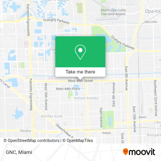
See Gnc, Hialeah, on the map
Public Transit to Gnc in Hialeah
Wondering how to get to Gnc in Hialeah? Moovit helps you find the best way to get to Gnc with step-by-step directions from the nearest public transit station.
Moovit provides free maps and live directions to help you navigate through your city. View schedules, routes, timetables, and find out how long does it take to get to Gnc in real time.
Looking for the nearest stop or station to Gnc? Check out this list of stops closest to your destination: W 8 Av & W 44 Pl; W 49 St & 8 Av Hialeah; Okeechobee.
Bus: 103, HIAMAR, 54.Train: GREEN.
Want to see if there’s another route that gets you there at an earlier time? Moovit helps you find alternative routes or times. Get directions from and directions to Gnc easily from the Moovit App or Website.
We make riding to Gnc easy, which is why over 1.7 million users, including users in Hialeah, trust Moovit as the best app for public transit. You don’t need to download an individual bus app or train app, Moovit is your all-in-one transit app that helps you find the best bus time or train time available.
For information on prices of bus and train, costs and ride fares to Gnc, please check the Moovit app.
Use the app to navigate to popular places including to the airport, hospital, stadium, grocery store, mall, coffee shop, school, college, and university.
Gnc Address: 587 W 49th St street in Hialeah
- Burlington Coat Factory,
- Burlington,
- Rainbow,
- Las Madrinas Medical Center Powered by Centrum Health,
- Conviva Senior Primary Care,
- Julio Lopez-Andujar, Md,
- Conviva Westland,
- Luis A Cuza, Aprn,
- Centerwell Retail Pharmacy,
- Conviva Care Center,
- Monastery of the Most Holy Trinity (Discalced Carmelite Nuns),
- Nana's Child Care Learning Center, Inc.,
- Law Offices Of Alex Hanna, Pa,
- The Burger Den,
- The Meltdown,
- Florida Blue Center - Hialeah,
- Top Spin Tennis Academy,
- Palm Springs Medical Building Of Hialeah,
- Hero Hype Comic Con,
- Vitamin Shoppe
Places Near Gnc (Hialeah)
- Keiser University Flagship Campus, West Palm Beach,
- Miami VA Hospital, Miami,
- Brickell City Centre, Miami,
- Zoo Miami, Miami,
- Sawgrass Mall, Miami,
- Bayside Marketplace, Miami,
- Miami Freedom Park, Miami,
- Aventura Mall, Miami Beach,
- Hard Rock Stadium, Miami Gardens,
- Marlins Park, Miami,
- Richard E. Gerstein Justice Building, Miami,
- Little Havana, Miami,
- Port of Miami Cruise Terminal, Miami,
- Dolphin Mall, Miami,
- Wynwood, Miami,
- Aventura Mall, Miami,
- Dolphin Mall Bus, Miami,
- Sawgrass mall ( FL ), Miami Beach,
- Miami Design District, Miami,
- Miami-Dade County Courthouse, Miami
How to get to popular places in Miami with public transit
Get around Hialeah by public transit!
Traveling around Hialeah has never been so easy. See step by step directions as you travel to any attraction, street or major public transit station. View bus and train schedules, arrival times, service alerts and detailed routes on a map, so you know exactly how to get to anywhere in Hialeah.
When traveling to any destination around Hialeah use Moovit's Live Directions with Get Off Notifications to know exactly where and how far to walk, how long to wait for your line, and how many stops are left. Moovit will alert you when it's time to get off — no need to constantly re-check whether yours is the next stop.
Wondering how to use public transit in Hialeah or how to pay for public transit in Hialeah? Moovit public transit app can help you navigate your way with public transit easily, and at minimum cost. It includes public transit fees, ticket prices, and costs. Looking for a map of Hialeah public transit lines? Moovit public transit app shows all public transit maps in Hialeah with all Bus, Train, Light Rail and Ferry routes and stops on an interactive map.
Miami has 4 transit type(s), including: Bus, Train, Light Rail and Ferry, operated by several transit agencies, including Broward County Transit, Miami-Dade Transit, Metrorail, Palm Tran, Tri-Rail, Brightline, MARTY, City of Homestead Trolley, Key West Transit, Treasure Coast Connector, GoLine IRT, Amtrak, Greyhound-us, FlixBus-us and Aventura Express Shuttle Bus