How to get to Go Charity by bus?
Click on the bus route to see step by step directions with maps, line arrival times and updated time schedules.
From E 34th St, Manhattan
82 minFrom 10th Avenue, Manhattan
83 minFrom Pier 35, Manhattan
120 minFrom MTA Bus - M1/M2/M3 (Madison Ave & E 30th St), Manhattan
69 minFrom 195 E Broadway (Broadway), Manhattan
111 minFrom Chelsea Piers, Manhattan
85 minFrom Pier 40 - Hudson River Park, Manhattan
80 minFrom 145 E 32nd St, Manhattan
75 min
How to get to Go Charity by subway?
Click on the subway route to see step by step directions with maps, line arrival times and updated time schedules.
From E 34th St, Manhattan
48 minFrom 10th Avenue, Manhattan
44 minFrom Pier 35, Manhattan
47 minFrom MTA Bus - M1/M2/M3 (Madison Ave & E 30th St), Manhattan
41 minFrom 195 E Broadway (Broadway), Manhattan
32 minFrom Chelsea Piers, Manhattan
50 minFrom Pier 40 - Hudson River Park, Manhattan
46 minFrom 145 E 32nd St, Manhattan
39 min
Bus stops near Go Charity in New York - New Jersey
Subway station near Go Charity in New York - New Jersey
- 36 St, 5 min walk,VIEW
Bus lines to Go Charity in New York - New Jersey
What are the closest stations to Go Charity?
The closest stations to Go Charity are:
- 3 Av/33 St is 174 yards away, 3 min walk.
- 36 St/3 Av is 317 yards away, 4 min walk.
- 36 St is 396 yards away, 5 min walk.
- 2 Av/37 St is 430 yards away, 6 min walk.
- Brooklyn (3 Av/38th St) is 439 yards away, 6 min walk.
Which bus lines stop near Go Charity?
These bus lines stop near Go Charity: B35, B37, B70.
Which subway lines stop near Go Charity?
These subway lines stop near Go Charity: D, N, R.
What’s the nearest subway station to Go Charity in New York - New Jersey?
The nearest subway station to Go Charity in New York - New Jersey is 36 St. It’s a 5 min walk away.
What’s the nearest bus station to Go Charity in New York - New Jersey?
The nearest bus station to Go Charity in New York - New Jersey is 3 Av/33 St. It’s a 3 min walk away.
What time is the first subway to Go Charity in New York - New Jersey?
The R is the first subway that goes to Go Charity in New York - New Jersey. It stops nearby at 3:00 AM.
What time is the last subway to Go Charity in New York - New Jersey?
The D is the last subway that goes to Go Charity in New York - New Jersey. It stops nearby at 3:50 AM.
What time is the first bus to Go Charity in New York - New Jersey?
The B35 is the first bus that goes to Go Charity in New York - New Jersey. It stops nearby at 3:00 AM.
What time is the last bus to Go Charity in New York - New Jersey?
The B35 is the last bus that goes to Go Charity in New York - New Jersey. It stops nearby at 2:50 AM.
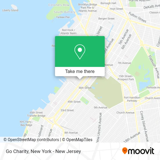
See Go Charity, New York - New Jersey, on the map
Public Transit to Go Charity in New York - New Jersey
Wondering how to get to Go Charity in New York - New Jersey? Moovit helps you find the best way to get to Go Charity with step-by-step directions from the nearest public transit station.
Moovit provides free maps and live directions to help you navigate through your city. View schedules, routes, timetables, and find out how long does it take to get to Go Charity in real time.
Looking for the nearest stop or station to Go Charity? Check out this list of stops closest to your destination: 3 Av/33 St; 36 St/3 Av; 36 St; 2 Av/37 St; Brooklyn (3 Av/38th St).
Bus: B35, B37, B70, FLIXBUS 2609.Subway: D, N, R, W.
Want to see if there’s another route that gets you there at an earlier time? Moovit helps you find alternative routes or times. Get directions from and directions to Go Charity easily from the Moovit App or Website.
We make riding to Go Charity easy, which is why over 1.5 million users, including users in New York - New Jersey, trust Moovit as the best app for public transit. You don’t need to download an individual bus app or train app, Moovit is your all-in-one transit app that helps you find the best bus time or train time available.
For information on prices of subway and bus, costs and ride fares to Go Charity, please check the Moovit app.
Use the app to navigate to popular places including to the airport, hospital, stadium, grocery store, mall, coffee shop, school, college, and university.
Go Charity Address: 68 34th St street in New York - New Jersey
- Future Assurance,
- Cowbird Creative,
- B3d Labs,
- Bahamas Pergola,
- Ted and Chelsea,
- James Carney,
- Brooklyn Escape Room,
- Nazz Forge,
- Gun Hill Publick House,
- Trimech,
- Kaizenkan Aikido Dojo,
- Mr. Boddington's Studio,
- Sophisticated Stature,
- Arcade,
- Nanucella,
- Especially Puglia,
- Eq Architecture Pllc,
- Theo Rock Nazz Llc,
- Jetson Bike,
- Guggenheim Museum Solomon R
Places Near Go Charity (New York - New Jersey)
- Wall Street, Manhattan,
- 911 Memorial, Manhattan,
- qqqq, Manhattan,
- 376 Hudson Street, Manhattan,
- 3 Stone St, Manhattan,
- Hudson Yards, Manhattan,
- 26 Federal Plaza, Manhattan,
- Katz's Deli, Manhattan,
- San Gennaro Feast, Manhattan,
- 1 Police Plaza, Manhattan,
- Queens Center Mall, Queens,
- Times Square, Manhattan,
- Pier 83, Manhattan,
- Rockefeller Center, Manhattan,
- 111 Centre New York City Supreme Court, Manhattan,
- Bellevue Hospital, Manhattan,
- Chinatown, Manhattan,
- Mountainside Hospital, Glen Ridge,
- 66 John Street, Manhattan,
- SoHo, Manhattan
How to get to popular places in New York - New Jersey with public transit
Get around New York - New Jersey by public transit!
Traveling around New York - New Jersey has never been so easy. See step by step directions as you travel to any attraction, street or major public transit station. View bus and train schedules, arrival times, service alerts and detailed routes on a map, so you know exactly how to get to anywhere in New York - New Jersey.
When traveling to any destination around New York - New Jersey use Moovit's Live Directions with Get Off Notifications to know exactly where and how far to walk, how long to wait for your line, and how many stops are left. Moovit will alert you when it's time to get off — no need to constantly re-check whether yours is the next stop.
Wondering how to use public transit in New York - New Jersey or how to pay for public transit in New York - New Jersey? Moovit public transit app can help you navigate your way with public transit easily, and at minimum cost. It includes public transit fees, ticket prices, and costs. Looking for a map of New York - New Jersey public transit lines? Moovit public transit app shows all public transit maps in New York - New Jersey with all Bus, Train, Subway, Light Rail, Ferry and Cable Car routes and stops on an interactive map.
New York - New Jersey has 6 transit type(s), including: Bus, Train, Subway, Light Rail, Ferry and Cable Car, operated by several transit agencies, including MTA Subway, Metro-North Railroad, LIRR, PATH, MTA New York City Transit - Express routes, MTA Bus, NJ Transit, NYC Ferry, NICE bus, Bee-Line Bus, NJ Transit Rail, Norwalk Transit District, Hartford Line, River Valley Transit and HART