How to get to Go-Plast by bus?
Click on the bus route to see step by step directions with maps, line arrival times and updated time schedules.
From Fraccionamiento México, Aguascalientes
31 minFrom Fraccionamiento El Mezquital, Aguascalientes
46 minFrom Hospital Psiquiatrico de Aguascalientes, Aguascalientes
53 minFrom Fracc. Periodistas, Aguascalientes
46 minFrom American Standard, Aguascalientes
64 minFrom Cortijo San Marcos, Aguascalientes
64 minFrom Fracc. San Sebastián, Aguascalientes
46 minFrom Fracc. Lomas de Vista Bella, Aguascalientes
55 min
Bus stops near Go-Plast in Aguascalientes
Bus lines to Go-Plast in Aguascalientes
What are the closest stations to Go-Plast?
The closest stations to Go-Plast are:
- No Name is 194 meters away, 3 min walk.
- Agropecuario is 231 meters away, 4 min walk.
- Héroe De Nacozari Norte, 3005 is 388 meters away, 6 min walk.
- Avenida Independencia, 1506(Lb) is 524 meters away, 7 min walk.
- Avenida Aguascalientes Norte, 612 is 536 meters away, 8 min walk.
Which bus lines stop near Go-Plast?
These bus lines stop near Go-Plast: RUTA 06, RUTA 10, RUTA 34.
What’s the nearest bus station to Go-Plast in Aguascalientes?
The nearest bus station to Go-Plast in Aguascalientes is No Name. It’s a 3 min walk away.
What time is the first bus to Go-Plast in Aguascalientes?
The RUTA 10 is the first bus that goes to Go-Plast in Aguascalientes. It stops nearby at 6:15 AM.
What time is the last bus to Go-Plast in Aguascalientes?
The RUTA 03 is the last bus that goes to Go-Plast in Aguascalientes. It stops nearby at 10:11 PM.
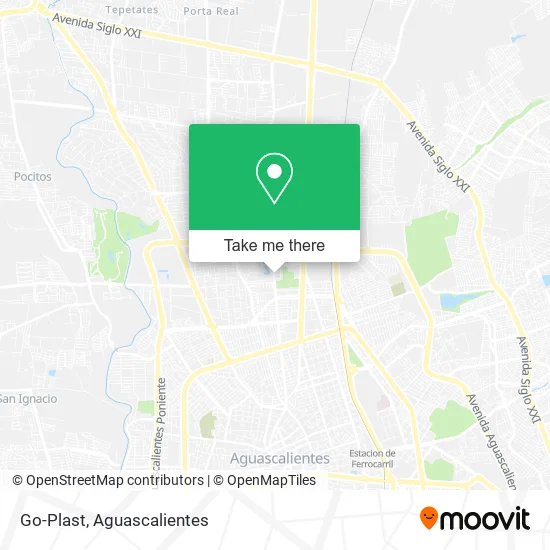
See Go-Plast, Aguascalientes, on the map
Public Transit to Go-Plast in Aguascalientes
Wondering how to get to Go-Plast in Aguascalientes? Moovit helps you find the best way to get to Go-Plast with step-by-step directions from the nearest public transit station.
Moovit provides free maps and live directions to help you navigate through your city. View schedules, routes, timetables, and find out how long does it take to get to Go-Plast in real time.
Looking for the nearest stop or station to Go-Plast? Check out this list of stops closest to your destination: No Name; Agropecuario; Héroe De Nacozari Norte; Avenida Independencia; Avenida Aguascalientes Norte.
Bus: RUTA 06, RUTA 10, RUTA 34, RUTA 05, RUTA 18, RUTA 35, RUTA 45, RUTA 03, RUTA 30, RUTA 40.
Want to see if there’s another route that gets you there at an earlier time? Moovit helps you find alternative routes or times. Get directions from and directions to Go-Plast easily from the Moovit App or Website.
We make riding to Go-Plast easy, which is why over 1.5 million users, including users in Aguascalientes, trust Moovit as the best app for public transit. You don’t need to download an individual bus app or train app, Moovit is your all-in-one transit app that helps you find the best bus time or train time available.
For information on prices of bus, costs and ride fares to Go-Plast, please check the Moovit app.
Use the app to navigate to popular places including to the airport, hospital, stadium, grocery store, mall, coffee shop, school, college, and university.
Go-Plast Address: Calle Uva, Fracc Centro Comercial Agropecuario, 20135 Aguascalientes, Aguascalientes street in Aguascalientes
- Lonas y Malla Sombras,
- Mi Alimento,
- Bodega de Sandias,
- Verduras El Ojitos,
- Loncheria Beto,
- Papas Gaytan,
- Fratel Abarrotera,
- Dulces y Chocolates del Bajio,
- Tacos Los Toños,
- Modelorama Agropecuario,
- Jugos,
- Menudos Licha,
- Loncheria S,
- Cocina Economica El Michoacano,
- Nopaleria,
- Venta de Semillas,
- Lonceria,
- Venta de Tomates,
- Verdurleria,
- Loncheria Abba Banquetes
Places Near Go-Plast (Aguascalientes)
- Jesús María, Aguascalientes,
- Hospital Imss No. 3, Aguascalientes,
- La Isla San Marcos, Aguascalientes,
- Imss Clinica 1, Aguascalientes,
- ESPACIOS, Aguascalientes,
- Blvd. Luis Donaldo Colosio, Aguascalientes,
- Nuevo Hospital Hidalgo, Aguascalientes,
- Isla San Marcos, Aguascalientes,
- Terminal De Combis, Aguascalientes,
- clinica 3 uaa, Aguascalientes,
- Aeropuerto de Aguascalientes S.A. de C.V., Aguascalientes,
- Parque Las Tres Centurias, Aguascalientes,
- Universidad Autónoma de Aguascalientes, Aguascalientes,
- Agropecuario, Aguascalientes,
- Villas de Nuestra Señora de la Asunción, Aguascalientes,
- Centro Comercial Altaria, Aguascalientes,
- Villasuncion, Aguascalientes,
- Central De Autobuses, Aguascalientes,
- Ciudad industrial, Aguascalientes,
- Centro, Aguascalientes
How to get to popular places in Aguascalientes with public transit
Get around Aguascalientes by public transit!
Traveling around Aguascalientes has never been so easy. See step by step directions as you travel to any attraction, street or major public transit station. View bus and train schedules, arrival times, service alerts and detailed routes on a map, so you know exactly how to get to anywhere in Aguascalientes.
When traveling to any destination around Aguascalientes use Moovit's Live Directions with Get Off Notifications to know exactly where and how far to walk, how long to wait for your line, and how many stops are left. Moovit will alert you when it's time to get off — no need to constantly re-check whether yours is the next stop.
Wondering how to use public transit in Aguascalientes or how to pay for public transit in Aguascalientes? Moovit public transit app can help you navigate your way with public transit easily, and at minimum cost. It includes public transit fees, ticket prices, and costs. Looking for a map of Aguascalientes public transit lines? Moovit public transit app shows all public transit maps in Aguascalientes with all bus routes and stops on an interactive map.
Aguascalientes has 1 transit type(s), including: bus, operated by several transit agencies, including Coordinación General de Movilidad