How to get to Go Project by bus?
Click on the bus route to see step by step directions with maps, line arrival times and updated time schedules.
From The Lucerne Hotel, Manhattan
66 minFrom Asian TS Massage, Manhattan
35 minFrom East 93rd Street, Manhattan
73 minFrom 32-20 northern blvd, Queens
61 minFrom New York Hilton Midtown, Manhattan
37 minFrom Maspeth, Queens
59 minFrom East 90th Street Ferry Terminal, Manhattan
62 minFrom 92nd Street Y, Manhattan
74 minFrom The Jewish Museum, Manhattan
58 minFrom Gerald Schoenfeld Theatre, Manhattan
50 min
How to get to Go Project by train?
Click on the train route to see step by step directions with maps, line arrival times and updated time schedules.
How to get to Go Project by subway?
Click on the subway route to see step by step directions with maps, line arrival times and updated time schedules.
From The Lucerne Hotel, Manhattan
33 minFrom Asian TS Massage, Manhattan
26 minFrom East 93rd Street, Manhattan
40 minFrom 32-20 northern blvd, Queens
40 minFrom New York Hilton Midtown, Manhattan
31 minFrom East 90th Street Ferry Terminal, Manhattan
51 minFrom 92nd Street Y, Manhattan
36 minFrom The Jewish Museum, Manhattan
43 minFrom Gerald Schoenfeld Theatre, Manhattan
29 min
Bus stops near Go Project in Manhattan
- Broadway/Morris St, 1 min walk,VIEW
- Battery Pl/Greenwich St, 1 min walk,VIEW
- The Battery, 1 min walk,VIEW
- Battery Pl / Washington St, 1 min walk,VIEW
- Battery Pl/Washington St, 1 min walk,VIEW
- Greenwich St/Battery Pl, 1 min walk,VIEW
- Hugh Carey Tunnel-Non-Public, 1 min walk,VIEW
- New York - Greenwich St @ Morris St, 2 min walk,VIEW
- State St/Battery Pl, 2 min walk,VIEW
Subway stations near Go Project in Manhattan
Bus lines to Go Project in Manhattan
- SIM3C, Midtown Via Church St Via 6 Av,VIEW
- SIM33C, Midtown Via Church Via Madison Av,VIEW
- M55, South Ferry,VIEW
- SIM35, Downtown Frankfort St Via Water St,VIEW
- SIM1, Soho Houston St Via Church St,VIEW
- SIM1C, Midtown Via Church St Via 6 Av,VIEW
- SIM4, Downtown Worth St Via Church St,VIEW
- SIM4C, Huguenot Via Richmond Av Via Arthur Kill,VIEW
- 120, New York Lower Manhattan,VIEW
- DOWNTOWN CONNECTION, Chambers Street,VIEW
- SIM2, Tottenville - Lower Manhattan Express,VIEW
- SIM15, Eltingville - Lower Manhattan Express,VIEW
- SIM32, Travis - Lower Manhattan Express,VIEW
- SIM34, Mariners Harbor - Lower Manhattan Express,VIEW
- BXM18, Riverdale 263 St Via Madison Av Via H. Hudson Pky,VIEW
- X27, Bay Ridge Shore Rd Via Broadway,VIEW
- X28, Coney Island Sea Gate Via Broadway,VIEW
- X37, Bay Ridge Shore Rd Via 23 St Via Fdr Dr,VIEW
- 314, Wall Street to Parkway Express - Ends Monmouth,VIEW
- 404, Wall Street to Route 9 (Pine Street),VIEW
What are the closest stations to Go Project?
The closest stations to Go Project are:
- Broadway/Morris St is 11 yards away, 1 min walk.
- Battery Pl/Greenwich St is 11 yards away, 1 min walk.
- The Battery is 25 yards away, 1 min walk.
- Battery Pl / Washington St is 32 yards away, 1 min walk.
- Bowling Green is 46 yards away, 1 min walk.
- Battery Pl/Washington St is 47 yards away, 1 min walk.
- Greenwich St/Battery Pl is 51 yards away, 1 min walk.
- Hugh Carey Tunnel-Non-Public is 66 yards away, 1 min walk.
- New York - Greenwich St @ Morris St is 82 yards away, 2 min walk.
- State St/Battery Pl is 105 yards away, 2 min walk.
- Whitehall St-South Ferry is 232 yards away, 3 min walk.
- Broad St is 487 yards away, 6 min walk.
Which bus lines stop near Go Project?
These bus lines stop near Go Project: BXM18, M15-SBS, M20, M55, QM11.
Which train line stops near Go Project?
GRE (Hoboken - World Trade Center)
Which subway lines stop near Go Project?
These subway lines stop near Go Project: 1, 4, 5.
What’s the nearest subway station to Go Project in Manhattan?
The nearest subway station to Go Project in Manhattan is Bowling Green. It’s a 1 min walk away.
What’s the nearest bus station to Go Project in Manhattan?
The nearest bus stations to Go Project in Manhattan are Broadway/Morris St, Battery Pl/Greenwich St, The Battery, Battery Pl / Washington St, Battery Pl/Washington St, Greenwich St/Battery Pl and Hugh Carey Tunnel-Non-Public. The closest one is a 1 min walk away.
What time is the first subway to Go Project in Manhattan?
The 4 is the first subway that goes to Go Project in Manhattan. It stops nearby at 3:00 AM.
What time is the last subway to Go Project in Manhattan?
The 4 is the last subway that goes to Go Project in Manhattan. It stops nearby at 3:57 AM.
What time is the first bus to Go Project in Manhattan?
The SIM1C is the first bus that goes to Go Project in Manhattan. It stops nearby at 3:46 AM.
What time is the last bus to Go Project in Manhattan?
The SIM1C is the last bus that goes to Go Project in Manhattan. It stops nearby at 2:57 AM.
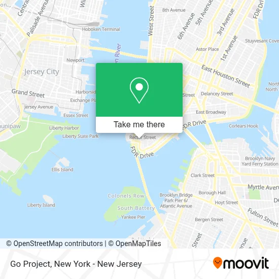
See Go Project, Manhattan, on the map
Public Transit to Go Project in Manhattan
Wondering how to get to Go Project in Manhattan? Moovit helps you find the best way to get to Go Project with step-by-step directions from the nearest public transit station.
Moovit provides free maps and live directions to help you navigate through your city. View schedules, routes, timetables, and find out how long does it take to get to Go Project in real time.
Looking for the nearest stop or station to Go Project? Check out this list of stops closest to your destination: Broadway/Morris St; Battery Pl/Greenwich St; The Battery; Battery Pl / Washington St; Bowling Green; Battery Pl/Washington St; Greenwich St/Battery Pl; Hugh Carey Tunnel-Non-Public; New York - Greenwich St @ Morris St; State St/Battery Pl; Whitehall St-South Ferry; Broad St.
Bus: BXM18, M15-SBS, M20, M55, QM11, SIM35, DOWNTOWN CONNECTION, SIM3C, SIM33C.Train: GRE.Subway: 1, 4, 5, N, R, W, J, M, Z.
Want to see if there’s another route that gets you there at an earlier time? Moovit helps you find alternative routes or times. Get directions from and directions to Go Project easily from the Moovit App or Website.
We make riding to Go Project easy, which is why over 1.5 million users, including users in Manhattan, trust Moovit as the best app for public transit. You don’t need to download an individual bus app or train app, Moovit is your all-in-one transit app that helps you find the best bus time or train time available.
For information on prices of subway, bus and train, costs and ride fares to Go Project, please check the Moovit app.
Use the app to navigate to popular places including to the airport, hospital, stadium, grocery store, mall, coffee shop, school, college, and university.
Go Project Address: 11 Broadway street in Manhattan
- Aspire Tech Security Awareness Training,
- The Klein Law Group, Pc,
- Mcomber Mcomber & Luber, P.C.,
- Rebel Road Studios,
- Highline Studios,
- Support For Sage 50,
- Mars Nails,
- Peng Fang Law Office,
- Nyc Top View,
- Παιδικός Βρεφικός Σταθμός Ο Τιραμολα,
- The Law Office Of Charles Kee,
- In Nyc It,
- Jewish Union Foundation,
- City Dental Group Nyc,
- Mason Law, Pllc,
- Ski Engineering Systems,
- The Law Office Of Steven Alizio,
- Nyc Dmv,
- Ismilekids Pediatric Dentistry - Dr. Jacqueline Dikansky,
- Custom Closet Nyc
Places Near Go Project (Manhattan)
- Hudson Yards, Manhattan,
- Katz's Deli, Manhattan,
- SoHo, Manhattan,
- 376 Hudson Street, Manhattan,
- Times Square, Manhattan,
- Pier 83, Manhattan,
- Wall Street, Manhattan,
- 911 Memorial, Manhattan,
- Chinatown, Manhattan,
- 1 Police Plaza, Manhattan,
- 3 Stone St, Manhattan,
- Bellevue Hospital, Manhattan,
- Queens Center Mall, Queens,
- 111 Centre New York City Supreme Court, Manhattan,
- 66 John Street, Manhattan,
- San Gennaro Feast, Manhattan,
- qqqq, Manhattan,
- Mountainside Hospital, Glen Ridge,
- Rockefeller Center, Manhattan,
- 26 Federal Plaza, Manhattan
How to get to popular places in New York - New Jersey with public transit
Get around Manhattan by public transit!
Traveling around Manhattan has never been so easy. See step by step directions as you travel to any attraction, street or major public transit station. View bus and train schedules, arrival times, service alerts and detailed routes on a map, so you know exactly how to get to anywhere in Manhattan.
When traveling to any destination around Manhattan use Moovit's Live Directions with Get Off Notifications to know exactly where and how far to walk, how long to wait for your line, and how many stops are left. Moovit will alert you when it's time to get off — no need to constantly re-check whether yours is the next stop.
Wondering how to use public transit in Manhattan or how to pay for public transit in Manhattan? Moovit public transit app can help you navigate your way with public transit easily, and at minimum cost. It includes public transit fees, ticket prices, and costs. Looking for a map of Manhattan public transit lines? Moovit public transit app shows all public transit maps in Manhattan with all Bus, Train, Subway, Light Rail, Ferry and Cable Car routes and stops on an interactive map.
New York - New Jersey has 6 transit type(s), including: Bus, Train, Subway, Light Rail, Ferry and Cable Car, operated by several transit agencies, including MTA Subway, Metro-North Railroad, LIRR, PATH, MTA New York City Transit - Express routes, MTA Bus, NJ Transit, NYC Ferry, NICE bus, Bee-Line Bus, NJ Transit Rail, Norwalk Transit District, Hartford Line, River Valley Transit and HART