How to get to Goalco Proyectos by bus?
Click on the bus route to see step by step directions with maps, line arrival times and updated time schedules.
From Parque Andrés Avelino Cáceres, San Isidro, San Isidro
30 minFrom Larcomar, Miraflores
42 minFrom UTEC, Barranco
47 minFrom Hospital Dos de Mayo, Lima
45 minFrom av carlos izaguirre, Los Olivos
55 minFrom Av Argentina Las Malvinas, Lima
32 minFrom San Miguel, Surquillo
37 minFrom Centro De Convenciones De Lima, San Borja
38 minFrom MZ O LT COOPERATIVA VIRGEN DE FATIMA SMP, San Martin
49 minFrom Ministerio de Educación, San Borja
37 min
Bus stops near Goalco Proyectos in San Miguel
Bus lines to Goalco Proyectos in San Miguel
- 1275, Upc (Santiago De Surco) - Oquendo (San Martín De Porres),VIEW
- 1304, Pachacamac - Callao,VIEW
- IM18, Upc (Santiago De Surco) - Chuquitanta (San Martín De Porres),VIEW
- 1315, Jose Galvez (Pachacamac) - Óvalo Centenario (Callao),VIEW
- IO40, Los Olivos - San Miguel,VIEW
- 201, Ovalo La Perla (Callao) - Ceres (Ate),VIEW
- 204, Manchay (Pachacamac) - Faucett (San Miguel),VIEW
- OM19, Chepen (Villa El Salvador),VIEW
- 1163, Santa Margarita (Ventanilla) - Jockey Plaza (Surco),VIEW
- IM47, Km. 22 - Faucett - La Marina - Brasil - Caquetá - Km. 22,VIEW
What are the closest stations to Goalco Proyectos?
The closest stations to Goalco Proyectos are:
- Hiraoka is 67 meters away, 2 min walk.
- Escardó is 69 meters away, 2 min walk.
- Rafael Escardo is 84 meters away, 2 min walk.
- Padre Urraca is 211 meters away, 3 min walk.
Which bus lines stop near Goalco Proyectos?
These bus lines stop near Goalco Proyectos: 1275, 1304, 1315, 201, IO40.
What’s the nearest bus station to Goalco Proyectos in San Miguel?
The nearest bus stations to Goalco Proyectos in San Miguel are Hiraoka, Escardó and Rafael Escardo. The closest one is a 2 min walk away.
What time is the first bus to Goalco Proyectos in San Miguel?
The 1315 is the first bus that goes to Goalco Proyectos in San Miguel. It stops nearby at 4:15 AM.
What time is the last bus to Goalco Proyectos in San Miguel?
The 1315 is the last bus that goes to Goalco Proyectos in San Miguel. It stops nearby at 1:09 AM.
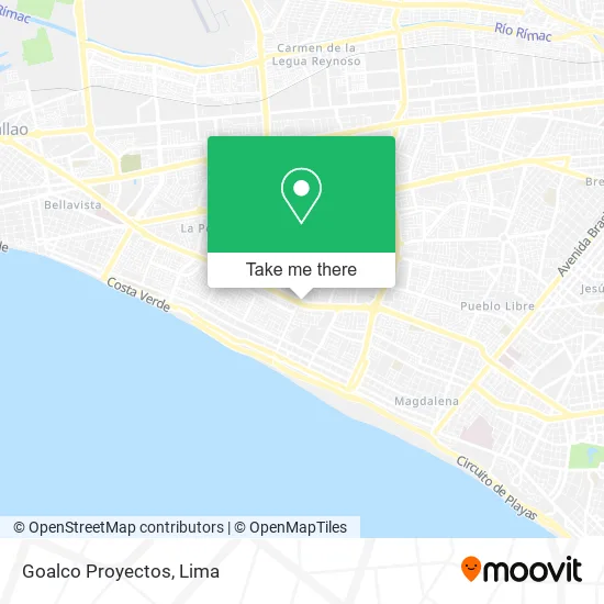
See Goalco Proyectos, San Miguel, on the map
Public Transit to Goalco Proyectos in San Miguel
Wondering how to get to Goalco Proyectos in San Miguel? Moovit helps you find the best way to get to Goalco Proyectos with step-by-step directions from the nearest public transit station.
Moovit provides free maps and live directions to help you navigate through your city. View schedules, routes, timetables, and find out how long does it take to get to Goalco Proyectos in real time.
Looking for the nearest stop or station to Goalco Proyectos? Check out this list of stops closest to your destination: Hiraoka; Escardó; Rafael Escardo; Padre Urraca.
Bus: 1275, 1304, 1315, 201, IO40, IM18, 204, OM19, 1163, IM47.
Want to see if there’s another route that gets you there at an earlier time? Moovit helps you find alternative routes or times. Get directions from and directions to Goalco Proyectos easily from the Moovit App or Website.
We make riding to Goalco Proyectos easy, which is why over 1.5 million users, including users in San Miguel, trust Moovit as the best app for public transit. You don’t need to download an individual bus app or train app, Moovit is your all-in-one transit app that helps you find the best bus time or train time available.
For information on prices of bus, costs and ride fares to Goalco Proyectos, please check the Moovit app.
Use the app to navigate to popular places including to the airport, hospital, stadium, grocery store, mall, coffee shop, school, college, and university.
Goalco Proyectos Address: Avenida de la Marina Maranga 7ma Etapa, 15088 San Miguel street in San Miguel
- Traviekids,
- Scaletti Farina María Emilia,
- Instituto de Religiosas de San José de G,
- D'Lia,
- Indiana Expedition E.I.R.L,
- Sastrería John,
- Lubricantes Especiales Omega,
- Abastecimiento Indust. Quipu,
- Mueblería Pando,
- Av Venezuela 5187 dpto 302 torre Begonias Condominio Altos de San Miguel,
- Calle Cesar Lopez Rojas 173 San Miguel,
- Altura de Hiraoka de la Av La Marina,
- Urb Pando 3 calle santa paula 556 San Miguel Alt cdra 15 Av Universitaria,
- Alt cdra 9 de Av Brasil JESúS MARíA,
- La perla alta callao calle los vinzes s n Urb Bata Rimac limite con Distrito de San Miguel,
- Calle Quiquijana 253 3er Piso cruce Av Precursores con Av Faucett,
- Calle Manuela Marticorena 193 Pando 5ta etapa ( Colegio Juan 23 y Colegio Juan 23) Alt de la cdra 1,
- Av Insurgentes ° 330 Dpto 302,
- JUAN PARRA DEL RIEGO 180 SAN MIGUEL MARANGA,
- Calle chacabuco 180 dpto 303 urb maranga san miguel Residencial Libertad
Places Near Goalco Proyectos (San Miguel)
- Aeropuerto Internacional Jorge Chávez, Ventanilla,
- Circuito Mágico Del Agua, Lima,
- Pontificia Universidad Católica del Perú - PUCP, San Miguel,
- av arequipa, Lima,
- Plaza San Miguel, San Miguel,
- Hospital Edgardo Rebagliati Martins, Jesus Mari,
- Paradero Av.Brasil,
- Gamarra,
- Parque Kennedy, Miraflores,
- Jockey Plaza, Santiago D,
- Real Plaza Puruchuco, Ate,
- Av. Salaverry, Jesus Mari,
- Larcomar, Miraflores,
- Centro Comercial Plaza Norte, Independen,
- Miraflores, Miraflores,
- Barranco, Barranco,
- Mall Del Sur,
- Parque de las Leyendas, San Miguel,
- Av. Abancay, Lima,
- Av. La Marina, San Miguel
How to get to popular places in Lima with public transit
Get around San Miguel by public transit!
Traveling around San Miguel has never been so easy. See step by step directions as you travel to any attraction, street or major public transit station. View bus and train schedules, arrival times, service alerts and detailed routes on a map, so you know exactly how to get to anywhere in San Miguel.
When traveling to any destination around San Miguel use Moovit's Live Directions with Get Off Notifications to know exactly where and how far to walk, how long to wait for your line, and how many stops are left. Moovit will alert you when it's time to get off — no need to constantly re-check whether yours is the next stop.
Wondering how to use public transit in San Miguel or how to pay for public transit in San Miguel? Moovit public transit app can help you navigate your way with public transit easily, and at minimum cost. It includes public transit fees, ticket prices, and costs. Looking for a map of San Miguel public transit lines? Moovit public transit app shows all public transit maps in San Miguel with all Bus, Metro and Ferry routes and stops on an interactive map.
Lima has 3 transit type(s), including: Bus, Metro and Ferry, operated by several transit agencies, including Metro de Lima Línea 2 , Metro de Lima, Corredor Rojo, Metropolitano, Metropolitano - Alimentadores, Corredor Morado, Corredor Azul, Rutas Tradicionales, Transportes y Servicios La Esperanza S.A., Las Flores S.A., Virgen de la Asunción S.A., Consorcio HAM, Transportes y Service Canadá S.A., ETUL4SA and ETUCHISA