How to get to Good Feet Store by bus?
Click on the bus route to see step by step directions with maps, line arrival times and updated time schedules.
From Rose Gaming Resort, Prince William County
40 minFrom Lorton, VA - Amtrak Auto Train Station (LOR), Fairfax County
91 minFrom Franconia-Springfield Metro Station, Fairfax County
49 minFrom Burke, VA, Fairfax County
166 minFrom National Geospatial-Intelligence Agency (NGA), Fairfax County
94 minFrom Transportation Security Administration - TSA Headquarters, Fairfax County
57 minFrom U.S. Department of State SA-28, Fairfax County
66 minFrom Department of State SA 34, Fairfax County
128 minFrom Lorton, VA, Fairfax County
92 min
Bus stops near Good Feet Store in Prince William County
Train station near Good Feet Store in Prince William County
- Rippon Station, 64 min walk,VIEW
Bus lines to Good Feet Store in Prince William County
- 52, Woodbridge Vre Station Departures,VIEW
- 91, 91 - Hub - Galveston Court,VIEW
- 94, 94 - Lake Ridge,VIEW
- 53, 53 - Stonebridge Garage,VIEW
- 95, Franconia-Springfield Metro,VIEW
- 95-SS, Prince William Metro Express,VIEW
- 96, 96 - Hub - Pwc Courthouse,VIEW
- 563, Woodbridge - Neabsco Garage,VIEW
- 972-M, Eastern Lot Connector,VIEW
What are the closest stations to Good Feet Store?
The closest stations to Good Feet Store are:
- Potomac Center Blvd @ Potomac Town Ctr is 496 yards away, 7 min walk.
- Opitz Blvd @ Sentara Medical Center is 979 yards away, 12 min walk.
- Stonebridge Garage - Northside is 984 yards away, 12 min walk.
- Stonebridge Garage - Southside is 1003 yards away, 13 min walk.
- Rippon Station is 5417 yards away, 64 min walk.
Which bus lines stop near Good Feet Store?
These bus lines stop near Good Feet Store: 52, 95.
What’s the nearest bus station to Good Feet Store in Prince William County?
The nearest bus station to Good Feet Store in Prince William County is Potomac Center Blvd @ Potomac Town Ctr. It’s a 7 min walk away.
What time is the first train to Good Feet Store in Prince William County?
The FREDERICKSBURG LINE is the first train that goes to Good Feet Store in Prince William County. It stops nearby at 5:51 AM.
What time is the last train to Good Feet Store in Prince William County?
The FREDERICKSBURG LINE is the last train that goes to Good Feet Store in Prince William County. It stops nearby at 7:45 PM.
What time is the first bus to Good Feet Store in Prince William County?
The 563 is the first bus that goes to Good Feet Store in Prince William County. It stops nearby at 4:22 AM.
What time is the last bus to Good Feet Store in Prince William County?
The 95 is the last bus that goes to Good Feet Store in Prince William County. It stops nearby at 11:14 PM.
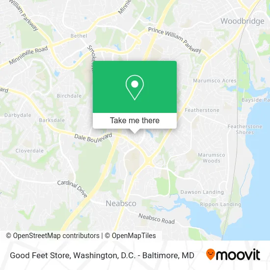
See Good Feet Store, Prince William County, on the map
Public Transit to Good Feet Store in Prince William County
Wondering how to get to Good Feet Store in Prince William County? Moovit helps you find the best way to get to Good Feet Store with step-by-step directions from the nearest public transit station.
Moovit provides free maps and live directions to help you navigate through your city. View schedules, routes, timetables, and find out how long does it take to get to Good Feet Store in real time.
Looking for the nearest stop or station to Good Feet Store? Check out this list of stops closest to your destination: Potomac Center Blvd @ Potomac Town Ctr; Opitz Blvd @ Sentara Medical Center; Stonebridge Garage - Northside; Stonebridge Garage - Southside; Rippon Station.
Bus: 52, 95, 91, 94, 53, 95-SS, 96, 563, 972-M.Train: FREDERICKSBURG LINE.
Want to see if there’s another route that gets you there at an earlier time? Moovit helps you find alternative routes or times. Get directions from and directions to Good Feet Store easily from the Moovit App or Website.
We make riding to Good Feet Store easy, which is why over 1.5 million users, including users in Prince William County, trust Moovit as the best app for public transit. You don’t need to download an individual bus app or train app, Moovit is your all-in-one transit app that helps you find the best bus time or train time available.
For information on prices of bus, costs and ride fares to Good Feet Store, please check the Moovit app.
Use the app to navigate to popular places including to the airport, hospital, stadium, grocery store, mall, coffee shop, school, college, and university.
Good Feet Store Address: 15101 Potomac Town Pl Woodbridge, VA 22191 street in Prince William County
- The Sleep Number Store by Select Comfort,
- STARBUCKS,
- Firepan Korean BBQ,
- Woodbridge Rotary Club,
- Woodbridge Beerfest,
- La-Z-Boy Home Furnishings & Décor,
- Way City Church,
- Bni Woodbridge Business Exchange,
- Ultimate Fantasy Cars LLC,
- Kojam Productions, Inc.,
- Rollin Gears Roadside,
- Avision Worldwide,
- Charlotte Tilbury,
- Pack & Ship Guarantee,
- Jacobs-Abbey Global Institute for Leadership Studies,
- Galarza,
- Lunchbox on Wheels,
- Shred Nations,
- Stonebridge at Potomac Town Center,
- Alamo Drafthouse Cinema Woodbridge
Places Near Good Feet Store (Prince William County)
- The Anthem, Washington,
- Rock Creek Tennis Center, Washington,
- Warner Theatre, Washington,
- Camden Yards, Baltimore,
- M&T Bank Stadium, Baltimore,
- Pennsylvania Ave NW (3rd st and pennsylvania), Washington,
- Amazon Hq2, Arlington County,
- Museum Of The Bible, Washington,
- Westfield Montgomery Mall, Montgomery County,
- National Zoo, Washington,
- Basilica of the National Shrine, Washington,
- National Museum of African American History and Culture, Washington,
- Sibley Memorial Hospital, Washington,
- Georgetown, Washington,
- Capital One Arena, Washington,
- Washington DC VA Medical Center, Washington,
- PG Mall, Prince George's County,
- National Mall, Washington,
- Washington National Cathedral, Washington,
- Marriott Marquis Washington, DC, Washington
How to get to popular places in Washington, D.C. - Baltimore, MD with public transit
Get around Prince William County by public transit!
Traveling around Prince William County has never been so easy. See step by step directions as you travel to any attraction, street or major public transit station. View bus and train schedules, arrival times, service alerts and detailed routes on a map, so you know exactly how to get to anywhere in Prince William County.
When traveling to any destination around Prince William County use Moovit's Live Directions with Get Off Notifications to know exactly where and how far to walk, how long to wait for your line, and how many stops are left. Moovit will alert you when it's time to get off — no need to constantly re-check whether yours is the next stop.
Wondering how to use public transit in Prince William County or how to pay for public transit in Prince William County? Moovit public transit app can help you navigate your way with public transit easily, and at minimum cost. It includes public transit fees, ticket prices, and costs. Looking for a map of Prince William County public transit lines? Moovit public transit app shows all public transit maps in Prince William County with all Bus, Train, Metro, Light Rail and Ferry routes and stops on an interactive map.
Washington, D.C. - Baltimore, MD has 5 transit type(s), including: Bus, Train, Metro, Light Rail and Ferry, operated by several transit agencies, including WMATA, Montgomery County Ride On, Fairfax Connector, TheBus, PRTC, DASH - Alexandria, Arlington Transit (ART), RTA of Central Maryland, MDOT MTA, MDOT MTA Light RailLink, MDOT MTA Commuter Bus, MDOT MTA Local Bus, FXBGO!, Virginia Railway Express (VRE) and MARC