How to get to Good Life by bus?
Click on the bus route to see step by step directions with maps, line arrival times and updated time schedules.
From Ollie's Bargain Outlet, Boynton Beach-Delray Beach
59 minFrom Brazzers, Boca Raton
48 minFrom Sample Rd, Deerfield Beach
97 minFrom Tri-Rail-Pompano Beach Station, Pompano Beach
92 minFrom Intersection : N Andrews Ave & Sample Rd., Pompano Beach
93 minFrom Pretty in Palm Beach, Boynton Beach-Delray Beach
86 minFrom Tri-Rail-Deerfield Beach Station, Deerfield Beach
82 minFrom Amazon Fulfillment Center-DMF3, Pompano Beach
101 min
How to get to Good Life by train?
Click on the train route to see step by step directions with maps, line arrival times and updated time schedules.
Bus stops near Good Life in Boca Raton
Train stations near Good Life in Boca Raton
Bus lines to Good Life in Boca Raton
What are the closest stations to Good Life?
The closest stations to Good Life are:
- NW 20TH ST at NW BOCA RATON BLVD is 188 yards away, 3 min walk.
- FL ATL BLVD at UNV VLG APT is 1132 yards away, 14 min walk.
- FEDERAL HWY at NE 14TH ST is 1670 yards away, 20 min walk.
- Boca Raton is 2846 yards away, 34 min walk.
- Boca Raton Station is 4444 yards away, 52 min walk.
Which bus lines stop near Good Life?
These bus lines stop near Good Life: 1, 91, 94.
Which train line stops near Good Life?
TRIRAIL (Northbound To Mangonia Park)
What’s the nearest bus station to Good Life in Boca Raton?
The nearest bus station to Good Life in Boca Raton is NW 20TH ST at NW BOCA RATON BLVD. It’s a 3 min walk away.
What time is the first train to Good Life in Boca Raton?
The TRIRAIL is the first train that goes to Good Life in Boca Raton. It stops nearby at 4:28 AM.
What time is the last train to Good Life in Boca Raton?
The BLFM is the last train that goes to Good Life in Boca Raton. It stops nearby at 11:53 PM.
What time is the first bus to Good Life in Boca Raton?
The 94 is the first bus that goes to Good Life in Boca Raton. It stops nearby at 6:16 AM.
What time is the last bus to Good Life in Boca Raton?
The 1 is the last bus that goes to Good Life in Boca Raton. It stops nearby at 9:24 PM.
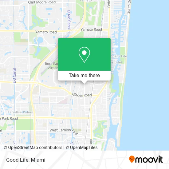
See Good Life, Boca Raton, on the map
Public Transit to Good Life in Boca Raton
Wondering how to get to Good Life in Boca Raton? Moovit helps you find the best way to get to Good Life with step-by-step directions from the nearest public transit station.
Moovit provides free maps and live directions to help you navigate through your city. View schedules, routes, timetables, and find out how long does it take to get to Good Life in real time.
Looking for the nearest stop or station to Good Life? Check out this list of stops closest to your destination: NW 20TH ST at NW BOCA RATON BLVD; FL ATL BLVD at UNV VLG APT; FEDERAL HWY at NE 14TH ST; Boca Raton; Boca Raton Station.
Bus: 1, 91, 94.Train: TRIRAIL, BLFM.
Want to see if there’s another route that gets you there at an earlier time? Moovit helps you find alternative routes or times. Get directions from and directions to Good Life easily from the Moovit App or Website.
We make riding to Good Life easy, which is why over 1.5 million users, including users in Boca Raton, trust Moovit as the best app for public transit. You don’t need to download an individual bus app or train app, Moovit is your all-in-one transit app that helps you find the best bus time or train time available.
For information on prices of bus and train, costs and ride fares to Good Life, please check the Moovit app.
Use the app to navigate to popular places including to the airport, hospital, stadium, grocery store, mall, coffee shop, school, college, and university.
Good Life Address: 1920 NW 2nd Ave Boca Raton, FL 33432 street in Boca Raton
- A1a Limo,
- Zen Den Yoga School,
- Mylan Nail Studios,
- Mike Jurus Photography,
- Tuff Truck Parts,
- K-Apartments,
- Myo-Functional Therapy,
- Ascension Wellness,
- Boca Colonics,
- Juan Carlos Cherkezian,
- Ross Realty,
- World Class Languages,
- Capstone Engineering Services,
- Fae Consulting,
- Panther Precious Metal,
- Body Glow Studio,
- Integrative Healing Holistic Psychotherapy,
- Prime Motors Leasing,
- Glamourous Nailz,
- Gorgeous Skin & Lashes Spa
Places Near Good Life (Boca Raton)
- Bayside Marketplace, Miami,
- Richard E. Gerstein Justice Building, Miami,
- Dolphin Mall, Miami,
- Zoo Miami, Miami,
- Brickell City Centre, Miami,
- Aventura Mall, Miami,
- Miami Freedom Park, Miami,
- Sawgrass mall ( FL ), Miami Beach,
- Marlins Park, Miami,
- Sawgrass Mall, Miami,
- Miami Design District, Miami,
- Miami-Dade County Courthouse, Miami,
- Hard Rock Stadium, Miami Gardens,
- Wynwood, Miami,
- Port of Miami Cruise Terminal, Miami,
- Keiser University Flagship Campus, West Palm Beach,
- Aventura Mall, Miami Beach,
- Dolphin Mall Bus, Miami,
- Little Havana, Miami,
- Miami VA Hospital, Miami
How to get to popular places in Miami with public transit
Get around Boca Raton by public transit!
Traveling around Boca Raton has never been so easy. See step by step directions as you travel to any attraction, street or major public transit station. View bus and train schedules, arrival times, service alerts and detailed routes on a map, so you know exactly how to get to anywhere in Boca Raton.
When traveling to any destination around Boca Raton use Moovit's Live Directions with Get Off Notifications to know exactly where and how far to walk, how long to wait for your line, and how many stops are left. Moovit will alert you when it's time to get off — no need to constantly re-check whether yours is the next stop.
Wondering how to use public transit in Boca Raton or how to pay for public transit in Boca Raton? Moovit public transit app can help you navigate your way with public transit easily, and at minimum cost. It includes public transit fees, ticket prices, and costs. Looking for a map of Boca Raton public transit lines? Moovit public transit app shows all public transit maps in Boca Raton with all Bus, Train, Light Rail and Ferry routes and stops on an interactive map.
Miami has 4 transit type(s), including: Bus, Train, Light Rail and Ferry, operated by several transit agencies, including Broward County Transit, Miami-Dade Transit, Metrorail, Palm Tran, Tri-Rail, Brightline, MARTY, City of Homestead Trolley, Key West Transit, Treasure Coast Connector, GoLine IRT, Amtrak, Greyhound-us, FlixBus-us and Aventura Express Shuttle Bus