How to get to Goodwill by bus?
Click on the bus route to see step by step directions with maps, line arrival times and updated time schedules.
From 16900 NW 12th Ave, Miami Gardens
48 minFrom Omega Maintenance Services, Miramar-Pembroke Pines
79 minFrom Us07, Miami Beach
53 minFrom A To Z Marble Restoration, Hollywood
79 minFrom Miami Shores, Miami
55 minFrom Yellow Green Farmers Market, Hollywood
80 minFrom Aventura Mall, Miami Beach
59 minFrom Fire Cutz Lounge, Miami
57 minFrom Sheridan Technical Center, Hollywood
82 minFrom Satan's Church Of The Believer, Miami Beach
62 min
How to get to Goodwill by train?
Click on the train route to see step by step directions with maps, line arrival times and updated time schedules.
Bus stops near Goodwill in Miami
Train station near Goodwill in Miami
- Aventura, 59 min walk,VIEW
Bus lines to Goodwill in Miami
What are the closest stations to Goodwill?
The closest stations to Goodwill are:
- Ne 18 Av & Ne 186 St is 93 yards away, 2 min walk.
- Ne 185 St & Ne 18 Av is 106 yards away, 2 min walk.
- Aventura is 4995 yards away, 59 min walk.
Which bus lines stop near Goodwill?
These bus lines stop near Goodwill: 183, 510.
Which train line stops near Goodwill?
BLFM (Mco)
What’s the nearest bus station to Goodwill in Miami?
The nearest bus stations to Goodwill in Miami are Ne 18 Av & Ne 186 St and Ne 185 St & Ne 18 Av. The closest one is a 2 min walk away.
What time is the first train to Goodwill in Miami?
The BLFM is the first train that goes to Goodwill in Miami. It stops nearby at 6:04 AM.
What time is the last train to Goodwill in Miami?
The BLFM is the last train that goes to Goodwill in Miami. It stops nearby at 12:07 AM.
What time is the first bus to Goodwill in Miami?
The 9 is the first bus that goes to Goodwill in Miami. It stops nearby at 4:15 AM.
What time is the last bus to Goodwill in Miami?
The 9 is the last bus that goes to Goodwill in Miami. It stops nearby at 12:43 AM.
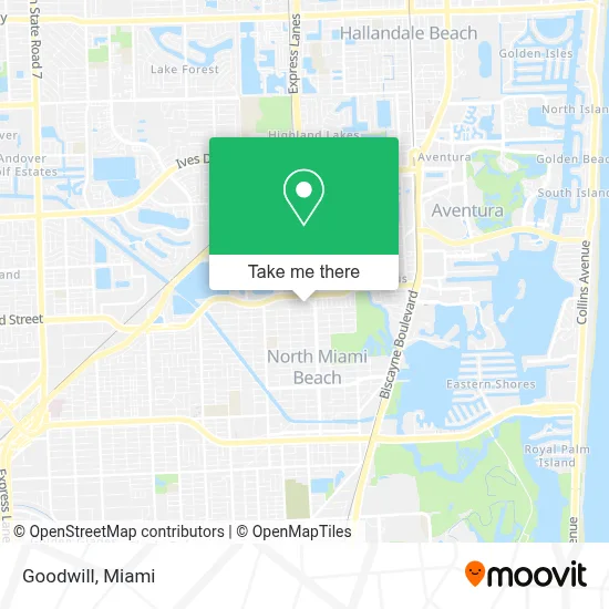
See Goodwill, Miami, on the map
Public Transit to Goodwill in Miami
Wondering how to get to Goodwill in Miami? Moovit helps you find the best way to get to Goodwill with step-by-step directions from the nearest public transit station.
Moovit provides free maps and live directions to help you navigate through your city. View schedules, routes, timetables, and find out how long does it take to get to Goodwill in real time.
Looking for the nearest stop or station to Goodwill? Check out this list of stops closest to your destination: Ne 18 Av & Ne 186 St; Ne 185 St & Ne 18 Av; Aventura.
Bus: 183, 510, 9, 95, NMBEACB.Train: BLFM.
Want to see if there’s another route that gets you there at an earlier time? Moovit helps you find alternative routes or times. Get directions from and directions to Goodwill easily from the Moovit App or Website.
We make riding to Goodwill easy, which is why over 1.5 million users, including users in Miami, trust Moovit as the best app for public transit. You don’t need to download an individual bus app or train app, Moovit is your all-in-one transit app that helps you find the best bus time or train time available.
For information on prices of bus and train, costs and ride fares to Goodwill, please check the Moovit app.
Use the app to navigate to popular places including to the airport, hospital, stadium, grocery store, mall, coffee shop, school, college, and university.
Goodwill Address: Northeast 183rd Street street in Miami
- Synovus Bank,
- T-Mobile,
- NE 19th Ave / NE 185th St,
- Fast Time Share Exit,
- Skylake Mall,
- T.J. Maxx,
- NE 18 Av,
- Sunray West,
- Greynolds Park,
- Miami Gardens Dr & NE 14th Ave,
- Greynolds Park,
- Skylake, FL,
- Star Design,
- Tracht Gut,
- Michael-Ann Russell JCC,
- NE 19th Ave / NE 171st St,
- Northeast 171st Street & Northeast 19th Avenue,
- Chick-fil-A,
- Forest Direct,
- Ojus Elementary School
Places Near Goodwill (Miami)
- Miami-Dade County Courthouse, Miami,
- Miami VA Hospital, Miami,
- Hard Rock Stadium, Miami Gardens,
- Marlins Park, Miami,
- Bayside Marketplace, Miami,
- Port of Miami Cruise Terminal, Miami,
- Aventura Mall, Miami,
- Miami Design District, Miami,
- Dolphin Mall, Miami,
- Little Havana, Miami,
- Brickell City Centre, Miami,
- Richard E. Gerstein Justice Building, Miami,
- Wynwood, Miami,
- Aventura Mall, Miami Beach,
- Sawgrass mall ( FL ), Miami Beach,
- Dolphin Mall Bus, Miami,
- Sawgrass Mall, Miami,
- Miami Freedom Park, Miami,
- Keiser University Flagship Campus, West Palm Beach,
- Zoo Miami, Miami
How to get to popular places in Miami with public transit
Get around Miami by public transit!
Traveling around Miami has never been so easy. See step by step directions as you travel to any attraction, street or major public transit station. View bus and train schedules, arrival times, service alerts and detailed routes on a map, so you know exactly how to get to anywhere in Miami.
When traveling to any destination around Miami use Moovit's Live Directions with Get Off Notifications to know exactly where and how far to walk, how long to wait for your line, and how many stops are left. Moovit will alert you when it's time to get off — no need to constantly re-check whether yours is the next stop.
Wondering how to use public transit in Miami or how to pay for public transit in Miami? Moovit public transit app can help you navigate your way with public transit easily, and at minimum cost. It includes public transit fees, ticket prices, and costs. Looking for a map of Miami public transit lines? Moovit public transit app shows all public transit maps in Miami with all Bus, Train, Light Rail and Ferry routes and stops on an interactive map.
Miami has 4 transit type(s), including: Bus, Train, Light Rail and Ferry, operated by several transit agencies, including Broward County Transit, Miami-Dade Transit, Metrorail, Palm Tran, Tri-Rail, Brightline, MARTY, City of Homestead Trolley, Key West Transit, Treasure Coast Connector, GoLine IRT, Amtrak, Greyhound-us, FlixBus-us and Aventura Express Shuttle Bus