Directions to Goodwill (Roanoke) with public transportation
The following transit lines have routes that pass near Goodwill
 Bus: GREYHOUND US0600, 72, 41, 55, 61.
- Train: NORTHEAST REGIONAL.
How to get to Goodwill by bus?
Click on the bus route to see step by step directions with maps, line arrival times and updated time schedules.
How to get to Goodwill by train?
Click on the train route to see step by step directions with maps, line arrival times and updated time schedules.
Bus stops near Goodwill in Roanoke
- Campbell Eb at 5th, 4 min walk,VIEW
- 3rd St at Church Ave, 4 min walk,VIEW
- Campbell Wb at 5th, 5 min walk,VIEW
- Salem Eb at 4th, 5 min walk,VIEW
- 3rd St Station Slip D, 7 min walk,VIEW
- 3rd St Station Slip A, 7 min walk,VIEW
- 3rd St Station Slip L, 7 min walk,VIEW
- 3rd St Station Slip B, 7 min walk,VIEW
- 3rd St Station Slip J, 7 min walk,VIEW
- 3rd St Station Slip C, 7 min walk,VIEW
- 3rd St Station Slip H, 8 min walk,VIEW
- 3rd St Station Slip I, 8 min walk,VIEW
Train station near Goodwill in Roanoke
- Roanoke, 16 min walk,VIEW
Bus lines to Goodwill in Roanoke
- 72, 72 - Lewis Gale Hospital To Third Street Station,VIEW
- 41, 11th Sb at Jamison,VIEW
- 55, Tanglewood Mall (Barnes And Noble),VIEW
- 61, Red Rock Nb at Brambleton (Shell Station),VIEW
- 42, 3rd St Station Slip K,VIEW
- 56, 3rd St Station Slip P,VIEW
- 62, 3rd St Station Slip O,VIEW
- 71, Lewis Gale Medical Center,VIEW
- 12, 12 - Valley View Mall To Third Street Station,VIEW
- 66, 66 - Carlton & Grandin To Third Street Station,VIEW
- 76, 76 - Veterans Hospital To Third Street Station,VIEW
- SWB, 3rd St Station Slip D,VIEW
- 26, 3rd St Station Slip A,VIEW
- 65, 65 - Third Street Station To Carlton & Grandin,VIEW
- 35, 35 - Third Street Station To Vinton,VIEW
- 36, 3rd St Station Slip L,VIEW
- 75, 75 - Third Street Station To Veterans Hospital,VIEW
- 51, Tanglewood Mall (Barnes And Noble),VIEW
- 91, Apperson Eb at Riverview,VIEW
- 92, 3rd St Station Slip C,VIEW
What are the closest stations to Goodwill?
The closest stations to Goodwill are:
- Campbell Eb at 5th is 278 yards away, 4 min walk.
- 3rd St at Church Ave is 282 yards away, 4 min walk.
- Campbell Wb at 5th is 370 yards away, 5 min walk.
- Salem Eb at 4th is 379 yards away, 5 min walk.
- 3rd St Station Slip D is 510 yards away, 7 min walk.
- 3rd St Station Slip A is 538 yards away, 7 min walk.
- 3rd St Station Slip L is 538 yards away, 7 min walk.
- 3rd St Station Slip B is 540 yards away, 7 min walk.
- 3rd St Station Slip J is 548 yards away, 7 min walk.
- 3rd St Station Slip C is 565 yards away, 7 min walk.
- 3rd St Station Slip H is 615 yards away, 8 min walk.
- 3rd St Station Slip I is 617 yards away, 8 min walk.
- Roanoke is 1289 yards away, 16 min walk.
Which bus line stops near Goodwill?
GREYHOUND US0600 (Nashville Bus Station)
Which train line stops near Goodwill?
NORTHEAST REGIONAL (Roanoke)
What’s the nearest train station to Goodwill in Roanoke?
The nearest train station to Goodwill in Roanoke is Roanoke. It’s a 16 min walk away.
What’s the nearest bus station to Goodwill in Roanoke?
The nearest bus stations to Goodwill in Roanoke are Campbell Eb at 5th and 3rd St at Church Ave. The closest one is a 4 min walk away.
What time is the first train to Goodwill in Roanoke?
The NORTHEAST REGIONAL is the first train that goes to Goodwill in Roanoke. It stops nearby at 9:35 AM.
What time is the last train to Goodwill in Roanoke?
The NORTHEAST REGIONAL is the last train that goes to Goodwill in Roanoke. It stops nearby at 10:13 PM.
What time is the first bus to Goodwill in Roanoke?
The SWB is the first bus that goes to Goodwill in Roanoke. It stops nearby at 5:15 AM.
What time is the last bus to Goodwill in Roanoke?
The SWB is the last bus that goes to Goodwill in Roanoke. It stops nearby at 10:21 PM.
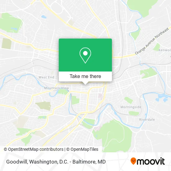
See Goodwill, Roanoke, on the map
Public Transit to Goodwill in Roanoke
Wondering how to get to Goodwill in Roanoke? Moovit helps you find the best way to get to Goodwill with step-by-step directions from the nearest public transit station.
Moovit provides free maps and live directions to help you navigate through your city. View schedules, routes, timetables, and find out how long does it take to get to Goodwill in real time.
Looking for the nearest stop or station to Goodwill? Check out this list of stops closest to your destination: Campbell Eb at 5th; 3rd St at Church Ave; Campbell Wb at 5th; Salem Eb at 4th; 3rd St Station Slip D; 3rd St Station Slip A; 3rd St Station Slip L; 3rd St Station Slip B; 3rd St Station Slip J; 3rd St Station Slip C; 3rd St Station Slip H; 3rd St Station Slip I; Roanoke.
Bus: GREYHOUND US0600, 72, 41, 55, 61, 42, 56, 62, 71, 12, 66, 76.Train: NORTHEAST REGIONAL.
Want to see if there’s another route that gets you there at an earlier time? Moovit helps you find alternative routes or times. Get directions from and directions to Goodwill easily from the Moovit App or Website.
We make riding to Goodwill easy, which is why over 1.5 million users, including users in Roanoke, trust Moovit as the best app for public transit. You don’t need to download an individual bus app or train app, Moovit is your all-in-one transit app that helps you find the best bus time or train time available.
For information on prices of bus and train, costs and ride fares to Goodwill, please check the Moovit app.
Use the app to navigate to popular places including to the airport, hospital, stadium, grocery store, mall, coffee shop, school, college, and university.
Goodwill Address: 352 Church Ave SW Roanoke, VA 24016 street in Roanoke
- American Red Cross,
- American Biosystems Inc,
- Bang Studios,
- Straight Street,
- Kirk Family Ymca,
- Roanoke City Police,
- Oakey's Roanoke Chapel,
- Roanoke City Sheriff,
- Highland Park Barber Shop,
- Oakey's Garage,
- Roanoke City Jail Administration Office,
- Final Track Studios,
- Roanoke City Jail Annex,
- Roanoke City Juvenile And Domestic Relations District Court,
- James G. Mullet, MD,
- Virgina Career Works,
- Oliver W Hill Justice Center,
- The Roanoke General District Court,
- Goerge's Affair With Flowers,
- SP+ Parking
Places Near Goodwill (Roanoke)
- Warner Theatre, Washington,
- Basilica of the National Shrine, Washington,
- Marriott Marquis Washington, DC, Washington,
- National Theatre, Washington,
- Westfield Montgomery Mall, Montgomery County,
- Amazon Hq2, Arlington County,
- Capital One Arena, Washington,
- Georgetown, Washington,
- Washington DC VA Medical Center, Washington,
- Rock Creek Tennis Center, Washington,
- National Museum of African American History and Culture, Washington,
- Camden Yards, Baltimore,
- Museum Of The Bible, Washington,
- Pennsylvania Ave NW (3rd st and pennsylvania), Washington,
- The Anthem, Washington,
- Sibley Memorial Hospital, Washington,
- M&T Bank Stadium, Baltimore,
- National Zoo, Washington,
- PG Mall, Prince George's County,
- Washington National Cathedral, Washington
How to get to popular places in Washington, D.C. - Baltimore, MD with public transit
Get around Roanoke by public transit!
Traveling around Roanoke has never been so easy. See step by step directions as you travel to any attraction, street or major public transit station. View bus and train schedules, arrival times, service alerts and detailed routes on a map, so you know exactly how to get to anywhere in Roanoke.
When traveling to any destination around Roanoke use Moovit's Live Directions with Get Off Notifications to know exactly where and how far to walk, how long to wait for your line, and how many stops are left. Moovit will alert you when it's time to get off — no need to constantly re-check whether yours is the next stop.
Wondering how to use public transit in Roanoke or how to pay for public transit in Roanoke? Moovit public transit app can help you navigate your way with public transit easily, and at minimum cost. It includes public transit fees, ticket prices, and costs. Looking for a map of Roanoke public transit lines? Moovit public transit app shows all public transit maps in Roanoke with all Bus, Train, Metro, Light Rail and Ferry routes and stops on an interactive map.
Washington, D.C. - Baltimore, MD has 5 transit type(s), including: Bus, Train, Metro, Light Rail and Ferry, operated by several transit agencies, including WMATA, Montgomery County Ride On, Fairfax Connector, TheBus, PRTC, DASH - Alexandria, Arlington Transit (ART), RTA of Central Maryland, MDOT MTA, MDOT MTA Light RailLink, MDOT MTA Commuter Bus, MDOT MTA Local Bus, FXBGO!, Virginia Railway Express (VRE) and MARC