Directions to Goozzy (Newton) with public transportation
The following transit lines have routes that pass near Goozzy
 Bus: 52, 60, 59, GREEN LINE D SHUTTLE, GREEN LINE D SHUTTLE.
- Train: FRAMINGHAM/WORCESTER.
- Subway: GREEN LINE D.
How to get to Goozzy by bus?
Click on the bus route to see step by step directions with maps, line arrival times and updated time schedules.
From Embassy Suites by Hilton Boston Waltham, Waltham
97 minFrom The Cheesecake Factory, Boston
44 minFrom Prudential Center South Garden, Boston
40 minFrom Hyatt Regency Cambridge - Overlooking Boston, Cambridge
55 minFrom Boston Scientific Shuttle: Prudential Center Stop, Boston
40 minFrom Earls Kitchen + Bar, Boston
41 minFrom Academy Of the Pacific Rim Charter Public School, Boston
107 minFrom HJB, Boston
43 minFrom Boston Temple, Boston
55 minFrom Jamaica Plain, Boston
67 min
How to get to Goozzy by train?
Click on the train route to see step by step directions with maps, line arrival times and updated time schedules.
From The Cheesecake Factory, Boston
80 minFrom Prudential Center South Garden, Boston
78 minFrom Boston Scientific Shuttle: Prudential Center Stop, Boston
79 minFrom Earls Kitchen + Bar, Boston
80 minFrom Academy Of the Pacific Rim Charter Public School, Boston
206 minFrom HJB, Boston
84 minFrom Boston Temple, Boston
72 min
How to get to Goozzy by subway?
Click on the subway route to see step by step directions with maps, line arrival times and updated time schedules.
From The Cheesecake Factory, Boston
49 minFrom Prudential Center South Garden, Boston
51 minFrom Hyatt Regency Cambridge - Overlooking Boston, Cambridge
57 minFrom Boston Scientific Shuttle: Prudential Center Stop, Boston
49 minFrom Earls Kitchen + Bar, Boston
51 minFrom HJB, Boston
45 minFrom Boston Temple, Boston
44 minFrom Jamaica Plain, Boston
75 min
Bus stops near Goozzy in Newton
Subway station near Goozzy in Newton
- Eliot, 15 min walk,VIEW
Bus lines to Goozzy in Newton
- 52, Dedham Mall,VIEW
- 59, Watertown Square via Needham St - Needham Junction via Needham St,VIEW
- GREEN LINE D SHUTTLE, Newton Highlands - Brookline Hills,VIEW
- GREEN LINE D SHUTTLE, Newton Highlands - Kenmore,VIEW
- GREEN LINE D SHUTTLE, Riverside - Brookline Hills,VIEW
- GREEN LINE D SHUTTLE, Newton Highlands - Fenway,VIEW
- GREEN LINE D SHUTTLE, Newton Highlands - Kenmore via Saint Mary's Street,VIEW
- NEEDHAM LINE SHUTTLE, Newton Highlands - Forest Hills,VIEW
- GREEN LINE D SHUTTLE, Riverside - Newton Highlands,VIEW
- GREEN LINE D SHUTTLE, Riverside - Kenmore via Saint Mary's Street,VIEW
- GREEN LINE D SHUTTLE, Riverside - Fenway,VIEW
- GREEN LINE D SHUTTLE, Riverside - Kenmore (Shuttle),VIEW
- GREEN LINE D SHUTTLE, Riverside - Brookline Village,VIEW
- GREEN LINE D SHUTTLE, Riverside - Copley (Shuttle),VIEW
- GREEN LINE D SHUTTLE, Riverside - Reservoir,VIEW
- GREEN LINE D SHUTTLE, Newton Highlands - Reservoir,VIEW
- GREEN LINE D SHUTTLE, Riverside - Kenmore,VIEW
What are the closest stations to Goozzy?
The closest stations to Goozzy are:
- Parker St @ Stearns St is 447 yards away, 6 min walk.
- Newton Highlands is 699 yards away, 9 min walk.
- Newton Highlands - Walnut St @ Floral St is 878 yards away, 11 min walk.
- Eliot is 1228 yards away, 15 min walk.
Which bus lines stop near Goozzy?
These bus lines stop near Goozzy: 52, 60.
Which train line stops near Goozzy?
FRAMINGHAM/WORCESTER (#521 | Worcester)
Which subway line stops near Goozzy?
GREEN LINE D (Government Center)
What’s the nearest subway station to Goozzy in Newton?
The nearest subway station to Goozzy in Newton is Eliot. It’s a 15 min walk away.
What’s the nearest bus station to Goozzy in Newton?
The nearest bus station to Goozzy in Newton is Parker St @ Stearns St. It’s a 6 min walk away.
What time is the first subway to Goozzy in Newton?
The GREEN LINE D is the first subway that goes to Goozzy in Newton. It stops nearby at 4:48 AM.
What time is the last subway to Goozzy in Newton?
The GREEN LINE D is the last subway that goes to Goozzy in Newton. It stops nearby at 2:44 AM.
What time is the first bus to Goozzy in Newton?
The 59 is the first bus that goes to Goozzy in Newton. It stops nearby at 6:18 AM.
What time is the last bus to Goozzy in Newton?
The 59 is the last bus that goes to Goozzy in Newton. It stops nearby at 8:07 PM.
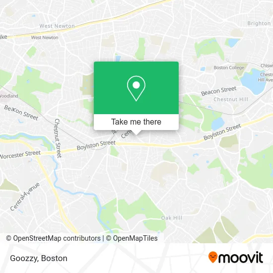
See Goozzy, Newton, on the map
Public Transit to Goozzy in Newton
Wondering how to get to Goozzy in Newton? Moovit helps you find the best way to get to Goozzy with step-by-step directions from the nearest public transit station.
Moovit provides free maps and live directions to help you navigate through your city. View schedules, routes, timetables, and find out how long does it take to get to Goozzy in real time.
Looking for the nearest stop or station to Goozzy? Check out this list of stops closest to your destination: Parker St @ Stearns St; Newton Highlands; Newton Highlands - Walnut St @ Floral St; Eliot.
Bus: 52, 60, 59, GREEN LINE D SHUTTLE, GREEN LINE D SHUTTLE, GREEN LINE D SHUTTLE, GREEN LINE D SHUTTLE, GREEN LINE D SHUTTLE, GREEN LINE D SHUTTLE, GREEN LINE D SHUTTLE, GREEN LINE D SHUTTLE, GREEN LINE D SHUTTLE.Train: FRAMINGHAM/WORCESTER.Subway: GREEN LINE D.
Want to see if there’s another route that gets you there at an earlier time? Moovit helps you find alternative routes or times. Get directions from and directions to Goozzy easily from the Moovit App or Website.
We make riding to Goozzy easy, which is why over 1.7 million users, including users in Newton, trust Moovit as the best app for public transit. You don’t need to download an individual bus app or train app, Moovit is your all-in-one transit app that helps you find the best bus time or train time available.
For information on prices of subway, bus and train, costs and ride fares to Goozzy, please check the Moovit app.
Use the app to navigate to popular places including to the airport, hospital, stadium, grocery store, mall, coffee shop, school, college, and university.
Location: Newton, Boston
- Charles River Instructional Systems,
- Certapro Painters of Newton,
- USPS Collection Box - Blue Box,
- Oak-Wood Park,
- Weeks Park,
- Newtown MA,
- BMB Music Productions,
- Mass Vein Care,
- David August MD,
- Chase,
- AA Global Printing,
- Sheila Nicholas, le Lt,
- Auto Repair Shop,
- Nahabedian,
- Goldstein and Herndon,
- George P Kozak MD,
- Women's Health Services,
- Senior Soure,
- Youko Yeracaris Dr,
- Mister Clean Up Service
Places Near Goozzy (Newton)
- Wilbur Theatre, Boston,
- Cheers, Boston,
- Isabella Stewart Gardner Museum, Boston,
- Seaport District, Boston,
- Mgm Music Hall, Boston,
- Quincy Market, Boston,
- Wang Theater, Boston,
- Leader Bank Pavilion (Leader Bank Pavillion), Boston,
- Td Garden, Boston,
- Boston Medical Center, Boston,
- House Of Blues, Boston,
- Boston Children's Hospital, Boston,
- Faneuil Hall, Boston,
- Museum Of Science, Boston,
- Boston Common, Boston,
- Boston Convention & Exhibition Center, Boston,
- Castle Island, Boston,
- North End, Boston,
- Prudential Center, Boston,
- Massachusetts General Hospital, Boston
How to get to popular places in Boston with public transit
Get around Newton by public transit!
Traveling around Newton has never been so easy. See step by step directions as you travel to any attraction, street or major public transit station. View bus and train schedules, arrival times, service alerts and detailed routes on a map, so you know exactly how to get to anywhere in Newton.
When traveling to any destination around Newton use Moovit's Live Directions with Get Off Notifications to know exactly where and how far to walk, how long to wait for your line, and how many stops are left. Moovit will alert you when it's time to get off — no need to constantly re-check whether yours is the next stop.
Wondering how to use public transit in Newton or how to pay for public transit in Newton? Moovit public transit app can help you navigate your way with public transit easily, and at minimum cost. It includes public transit fees, ticket prices, and costs. Looking for a map of Newton public transit lines? Moovit public transit app shows all public transit maps in Newton with all Bus, Train, Subway and Ferry routes and stops on an interactive map.
Boston has 4 transit type(s), including: Bus, Train, Subway and Ferry, operated by several transit agencies, including MBTA, Southeastern Regional Transit Authority, MetroWest Regional Transit Authority, Rhode Island Public Transit Authority, WRTA, Lowell Regional Transit Authority, Merrimack Valley Transit, Montachusett Regional Transit Authority, Cape Cod Regional Transit Authority, Brockton Area Transit Authority, Martha's Vineyard Transit Authority, the WAVE - Nantucket Regional Transit Authority, GATRA, Cape Ann Transportation Authority and Massport