Directions to Gopher Hole (Baltimore County) with public transportation
The following transit lines have routes that pass near Gopher Hole
 Bus: 51, CITYLINK GREEN, CITYLINK RED, 52, TOWSON PURPLE.
How to get to Gopher Hole by bus?
Click on the bus route to see step by step directions with maps, line arrival times and updated time schedules.
From The Maryland Zoo In Baltimore, Baltimore
67 minFrom Baltimore Museum Of Art, Baltimore
48 minFrom Reisterstown Road Plaza, Baltimore
74 minFrom Mva, Baltimore
52 minFrom Druid Hill Park, Baltimore
73 minFrom Johns Hopkins University, Baltimore
49 minFrom Mondawmin Mall, Baltimore
63 minFrom Good Samaritan Hospital, Baltimore
32 minFrom Pimlico Race Course, Baltimore
59 minFrom Medstar Union Memorial Hospital, Baltimore
41 min
Bus stops near Gopher Hole in Baltimore County
Light Rail stations near Gopher Hole in Baltimore County
- Lutherville, 52 min walk,VIEW
Bus lines to Gopher Hole in Baltimore County
What are the closest stations to Gopher Hole?
The closest stations to Gopher Hole are:
- Dulaney Valley Rd & Southerly Rd is 366 yards away, 5 min walk.
- Dulaney Valley Rd @ Southerly Rd Nb 0001 (North) is 441 yards away, 6 min walk.
- Fairmount Ave & Dulaney Valley Rd FS Wb is 609 yards away, 8 min walk.
- Fairmount Avenue at Bosley Avenue Wb 0038 (West) is 748 yards away, 9 min walk.
- Fairmount Ave & Towsongate Dr FS Eb is 920 yards away, 11 min walk.
- Lutherville is 4382 yards away, 52 min walk.
Which bus lines stop near Gopher Hole?
These bus lines stop near Gopher Hole: 51, CITYLINK GREEN, CITYLINK RED.
What’s the nearest bus station to Gopher Hole in Baltimore County?
The nearest bus station to Gopher Hole in Baltimore County is Dulaney Valley Rd & Southerly Rd. It’s a 5 min walk away.
What time is the first light rail to Gopher Hole in Baltimore County?
The LIGHT RAILLINK is the first light rail that goes to Gopher Hole in Baltimore County. It stops nearby at 4:40 AM.
What time is the last light rail to Gopher Hole in Baltimore County?
The LIGHT RAILLINK is the last light rail that goes to Gopher Hole in Baltimore County. It stops nearby at 1:02 AM.
What time is the first bus to Gopher Hole in Baltimore County?
The CITYLINK GREEN is the first bus that goes to Gopher Hole in Baltimore County. It stops nearby at 4:01 AM.
What time is the last bus to Gopher Hole in Baltimore County?
The CITYLINK GREEN is the last bus that goes to Gopher Hole in Baltimore County. It stops nearby at 3:18 AM.
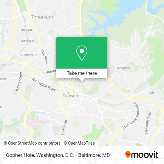
See Gopher Hole, Baltimore County, on the map
Public Transit to Gopher Hole in Baltimore County
Wondering how to get to Gopher Hole in Baltimore County? Moovit helps you find the best way to get to Gopher Hole with step-by-step directions from the nearest public transit station.
Moovit provides free maps and live directions to help you navigate through your city. View schedules, routes, timetables, and find out how long does it take to get to Gopher Hole in real time.
Looking for the nearest stop or station to Gopher Hole? Check out this list of stops closest to your destination: Dulaney Valley Rd & Southerly Rd; Dulaney Valley Rd @ Southerly Rd Nb 0001 (North); Fairmount Ave & Dulaney Valley Rd FS Wb; Fairmount Avenue at Bosley Avenue Wb 0038 (West); Fairmount Ave & Towsongate Dr FS Eb; Lutherville.
Bus: 51, CITYLINK GREEN, CITYLINK RED, 52, TOWSON PURPLE, 93, TOWSON ORANGE, 36.
Want to see if there’s another route that gets you there at an earlier time? Moovit helps you find alternative routes or times. Get directions from and directions to Gopher Hole easily from the Moovit App or Website.
We make riding to Gopher Hole easy, which is why over 1.5 million users, including users in Baltimore County, trust Moovit as the best app for public transit. You don’t need to download an individual bus app or train app, Moovit is your all-in-one transit app that helps you find the best bus time or train time available.
For information on prices of bus, costs and ride fares to Gopher Hole, please check the Moovit app.
Use the app to navigate to popular places including to the airport, hospital, stadium, grocery store, mall, coffee shop, school, college, and university.
Gopher Hole Address: 1021 Dulaney Valley Rd Towson, MD 21286 street in Baltimore County
- Pilates Center at Goucher College,
- Alice's Restaurant,
- Heubeck Hall,
- Dorsey College Center,
- Goucher College,
- USPS Collection Box - Blue Box,
- Goucher College Campus Loop,
- Pearlstone Student Center,
- Edenwald Retirement Community,
- Wolfe Dr,
- Mission and Values,
- General German Aged Peoples Home,
- Candid Auto Repair,
- Goucher College,
- Sheraton-Baltimore North Hotel Parking,
- Towson Garage Door,
- E&E Performance Contracting,
- Dr Anisa Mirza,
- Al Samm - Wesbanco Mortgage Lending Officer,
- WesBanco
Places Near Gopher Hole (Baltimore County)
- Sibley Memorial Hospital, Washington,
- Warner Theatre, Washington,
- PG Mall, Prince George's County,
- Pennsylvania Ave NW (3rd st and pennsylvania), Washington,
- National Zoo, Washington,
- Basilica of the National Shrine, Washington,
- The Anthem, Washington,
- Georgetown, Washington,
- Amazon Hq2, Arlington County,
- Washington National Cathedral, Washington,
- Rock Creek Tennis Center, Washington,
- Marriott Marquis Washington, DC, Washington,
- Washington DC VA Medical Center, Washington,
- National Theatre, Washington,
- Westfield Montgomery Mall, Montgomery County,
- Camden Yards, Baltimore,
- Capital One Arena, Washington,
- M&T Bank Stadium, Baltimore,
- Museum Of The Bible, Washington,
- National Museum of African American History and Culture, Washington
How to get to popular places in Washington, D.C. - Baltimore, MD with public transit
Get around Baltimore County by public transit!
Traveling around Baltimore County has never been so easy. See step by step directions as you travel to any attraction, street or major public transit station. View bus and train schedules, arrival times, service alerts and detailed routes on a map, so you know exactly how to get to anywhere in Baltimore County.
When traveling to any destination around Baltimore County use Moovit's Live Directions with Get Off Notifications to know exactly where and how far to walk, how long to wait for your line, and how many stops are left. Moovit will alert you when it's time to get off — no need to constantly re-check whether yours is the next stop.
Wondering how to use public transit in Baltimore County or how to pay for public transit in Baltimore County? Moovit public transit app can help you navigate your way with public transit easily, and at minimum cost. It includes public transit fees, ticket prices, and costs. Looking for a map of Baltimore County public transit lines? Moovit public transit app shows all public transit maps in Baltimore County with all Bus, Train, Metro, Light Rail and Ferry routes and stops on an interactive map.
Washington, D.C. - Baltimore, MD has 5 transit type(s), including: Bus, Train, Metro, Light Rail and Ferry, operated by several transit agencies, including WMATA, Montgomery County Ride On, Fairfax Connector, TheBus, PRTC, DASH - Alexandria, Arlington Transit (ART), RTA of Central Maryland, MDOT MTA, MDOT MTA Light RailLink, MDOT MTA Commuter Bus, MDOT MTA Local Bus, FXBGO!, Virginia Railway Express (VRE) and MARC