How to get to Gordon Food Service Distribution by bus?
Click on the bus route to see step by step directions with maps, line arrival times and updated time schedules.
From Publix (Publix Super Markets), Miami
69 minFrom Alamo Rent A Car, Miami
65 minFrom 3801 NW 21 St, Miami
62 minFrom Greyhound Bus Station, Miami, FL, Miami
62 minFrom Cape Coral Insure, Hialeah
97 minFrom Holiday Inn Express Hotel & Suites-Miami Airport East, Miami
59 minFrom Walmart Supercenter, Hialeah
58 minFrom HIALEAH FLAMINGO NORTH ROUTE, North Westside
100 minFrom Miami Airport Metrorail Central Station, Miami
60 minFrom Tuuci, Hialeah
52 min
How to get to Gordon Food Service Distribution by train?
Click on the train route to see step by step directions with maps, line arrival times and updated time schedules.
From Alamo Rent A Car, Miami
50 minFrom 3801 NW 21 St, Miami
46 minFrom Greyhound Bus Station, Miami, FL, Miami
47 minFrom Holiday Inn Express Hotel & Suites-Miami Airport East, Miami
55 minFrom HIALEAH FLAMINGO NORTH ROUTE, North Westside
80 minFrom Miami Airport Metrorail Central Station, Miami
47 minFrom Tuuci, Hialeah
50 min
Bus stops near Gordon Food Service Distribution in Miami
Train stations near Gordon Food Service Distribution in Miami
Bus lines to Gordon Food Service Distribution in Miami
What are the closest stations to Gordon Food Service Distribution?
The closest stations to Gordon Food Service Distribution are:
- Nw 32 Av & Nw 125 St is 265 yards away, 4 min walk.
- Nw 119 St@nw 32 Av is 985 yards away, 13 min walk.
- Northside is 3898 yards away, 46 min walk.
- Opa-Locka Station is 4407 yards away, 52 min walk.
Which bus line stops near Gordon Food Service Distribution?
32 (32 - Omni Terminal)
Which train line stops near Gordon Food Service Distribution?
TRIRAIL (Northbound To Mangonia Park)
What’s the nearest bus station to Gordon Food Service Distribution in Miami?
The nearest bus station to Gordon Food Service Distribution in Miami is Nw 32 Av & Nw 125 St. It’s a 4 min walk away.
What time is the first train to Gordon Food Service Distribution in Miami?
The TRIRAIL is the first train that goes to Gordon Food Service Distribution in Miami. It stops nearby at 4:02 AM.
What time is the last train to Gordon Food Service Distribution in Miami?
The GREEN is the last train that goes to Gordon Food Service Distribution in Miami. It stops nearby at 12:49 AM.
What time is the first bus to Gordon Food Service Distribution in Miami?
The 32 is the first bus that goes to Gordon Food Service Distribution in Miami. It stops nearby at 5:33 AM.
What time is the last bus to Gordon Food Service Distribution in Miami?
The 32 is the last bus that goes to Gordon Food Service Distribution in Miami. It stops nearby at 11:50 PM.
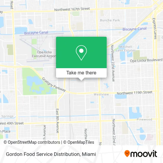
See Gordon Food Service Distribution, Miami, on the map
Public Transit to Gordon Food Service Distribution in Miami
Wondering how to get to Gordon Food Service Distribution in Miami? Moovit helps you find the best way to get to Gordon Food Service Distribution with step-by-step directions from the nearest public transit station.
Moovit provides free maps and live directions to help you navigate through your city. View schedules, routes, timetables, and find out how long does it take to get to Gordon Food Service Distribution in real time.
Looking for the nearest stop or station to Gordon Food Service Distribution? Check out this list of stops closest to your destination: Nw 32 Av & Nw 125 St; Nw 119 St@nw 32 Av; Northside; Opa-Locka Station.
Bus: 32, OPALKAN.Train: TRIRAIL, GREEN.
Want to see if there’s another route that gets you there at an earlier time? Moovit helps you find alternative routes or times. Get directions from and directions to Gordon Food Service Distribution easily from the Moovit App or Website.
We make riding to Gordon Food Service Distribution easy, which is why over 1.5 million users, including users in Miami, trust Moovit as the best app for public transit. You don’t need to download an individual bus app or train app, Moovit is your all-in-one transit app that helps you find the best bus time or train time available.
For information on prices of bus and train, costs and ride fares to Gordon Food Service Distribution, please check the Moovit app.
Use the app to navigate to popular places including to the airport, hospital, stadium, grocery store, mall, coffee shop, school, college, and university.
Gordon Food Service Distribution Address: 3301 NW 125th St Miami, FL 33167 street in Miami
- Marotta Tank,
- A Action Used Auto Parts,
- Lock Towns Ind LVG Apts.,
- Getrems,
- Hamersmith, Inc.,
- Motorcycle Training Institute Inc. (Mtii.Com),
- 12300 NW 32nd Ave,
- Iberia Foods,
- Junkyard Miami - Buys Junk Cars,
- Junk Yard Miami,
- Mich Auto Sales,
- Easy Drive Auto Sales,
- Assetco Freight,
- Crusher Recycling,
- Locksmith 24 Hours of Miami Dade Co,
- Autos by Mja,
- Business,
- Chicos Used Parts,
- Joel Auto Parts,
- Winn-dixie Distribution Center
Places Near Gordon Food Service Distribution (Miami)
- Sawgrass mall ( FL ), Miami Beach,
- Little Havana, Miami,
- Sawgrass Mall, Miami,
- Zoo Miami, Miami,
- Wynwood, Miami,
- Miami Freedom Park, Miami,
- Hard Rock Stadium, Miami Gardens,
- Miami Design District, Miami,
- Port of Miami Cruise Terminal, Miami,
- Keiser University Flagship Campus, West Palm Beach,
- Bayside Marketplace, Miami,
- Dolphin Mall, Miami,
- Richard E. Gerstein Justice Building, Miami,
- Miami VA Hospital, Miami,
- Dolphin Mall Bus, Miami,
- Marlins Park, Miami,
- Brickell City Centre, Miami,
- Miami-Dade County Courthouse, Miami,
- Aventura Mall, Miami Beach,
- Aventura Mall, Miami
How to get to popular places in Miami with public transit
Get around Miami by public transit!
Traveling around Miami has never been so easy. See step by step directions as you travel to any attraction, street or major public transit station. View bus and train schedules, arrival times, service alerts and detailed routes on a map, so you know exactly how to get to anywhere in Miami.
When traveling to any destination around Miami use Moovit's Live Directions with Get Off Notifications to know exactly where and how far to walk, how long to wait for your line, and how many stops are left. Moovit will alert you when it's time to get off — no need to constantly re-check whether yours is the next stop.
Wondering how to use public transit in Miami or how to pay for public transit in Miami? Moovit public transit app can help you navigate your way with public transit easily, and at minimum cost. It includes public transit fees, ticket prices, and costs. Looking for a map of Miami public transit lines? Moovit public transit app shows all public transit maps in Miami with all Bus, Train, Light Rail and Ferry routes and stops on an interactive map.
Miami has 4 transit type(s), including: Bus, Train, Light Rail and Ferry, operated by several transit agencies, including Broward County Transit, Miami-Dade Transit, Metrorail, Palm Tran, Tri-Rail, Brightline, MARTY, City of Homestead Trolley, Key West Transit, Treasure Coast Connector, GoLine IRT, Amtrak, Greyhound-us, FlixBus-us and Aventura Express Shuttle Bus