How to get to Govcloudlogic by bus?
Click on the bus route to see step by step directions with maps, line arrival times and updated time schedules.
From The Westin Arlington Gateway, Arlington County
40 minFrom Seven Corners Center (Seven Corners Shopping Center Falls Church VA), Fairfax County
31 minFrom Hilton McLean Tysons Corner, Fairfax County
40 minFrom Hilton Alexandria Mark Center, Alexandria
69 minFrom Nova- Alexandria Campus, Alexandria
59 minFrom Walmart, Arlington County
42 minFrom The Ritz-Carlton, Tysons Corner, Fairfax County
37 minFrom Kaiser Permanente Tysons Corner Medical Center, Fairfax County
52 minFrom [I-495] Exit 54 - Braddock Road, Fairfax County
70 min
How to get to Govcloudlogic by metro?
Click on the metro route to see step by step directions with maps, line arrival times and updated time schedules.
From The Westin Arlington Gateway, Arlington County
47 minFrom Seven Corners Center (Seven Corners Shopping Center Falls Church VA), Fairfax County
60 minFrom Hilton McLean Tysons Corner, Fairfax County
68 minFrom Walmart, Arlington County
47 minFrom The Ritz-Carlton, Tysons Corner, Fairfax County
58 minFrom Kaiser Permanente Tysons Corner Medical Center, Fairfax County
69 min
Bus stops near Govcloudlogic in Fairfax County
Metro station near Govcloudlogic in Fairfax County
- Dunn Loring Merrifield Metro Station, 56 min walk,VIEW
Bus lines to Govcloudlogic in Fairfax County
What are the closest stations to Govcloudlogic?
The closest stations to Govcloudlogic are:
- Gallows Rd+Arlington Bl is 195 yards away, 3 min walk.
- Gallows Rd @ Arlington Blvd is 199 yards away, 3 min walk.
- Gallows @ Willow Oaks Corporate Dr is 494 yards away, 7 min walk.
- Wilow Oaks Corporate Dr & Williams Dr is 580 yards away, 8 min walk.
- Williams Dr+Arlington Bl is 809 yards away, 10 min walk.
- Dunn Loring Merrifield Metro Station is 4710 yards away, 56 min walk.
Which bus lines stop near Govcloudlogic?
These bus lines stop near Govcloudlogic: 401, 402, F60, F61.
Which metro line stops near Govcloudlogic?
ORANGE (Vienna)
What’s the nearest bus station to Govcloudlogic in Fairfax County?
The nearest bus stations to Govcloudlogic in Fairfax County are Gallows Rd+Arlington Bl and Gallows Rd @ Arlington Blvd. The closest one is a 3 min walk away.
What time is the first metro to Govcloudlogic in Fairfax County?
The ORANGE is the first metro that goes to Govcloudlogic in Fairfax County. It stops nearby at 5:00 AM.
What time is the last metro to Govcloudlogic in Fairfax County?
The ORANGE is the last metro that goes to Govcloudlogic in Fairfax County. It stops nearby at 12:32 AM.
What time is the first bus to Govcloudlogic in Fairfax County?
The 401 is the first bus that goes to Govcloudlogic in Fairfax County. It stops nearby at 4:09 AM.
What time is the last bus to Govcloudlogic in Fairfax County?
The F61 is the last bus that goes to Govcloudlogic in Fairfax County. It stops nearby at 2:34 AM.
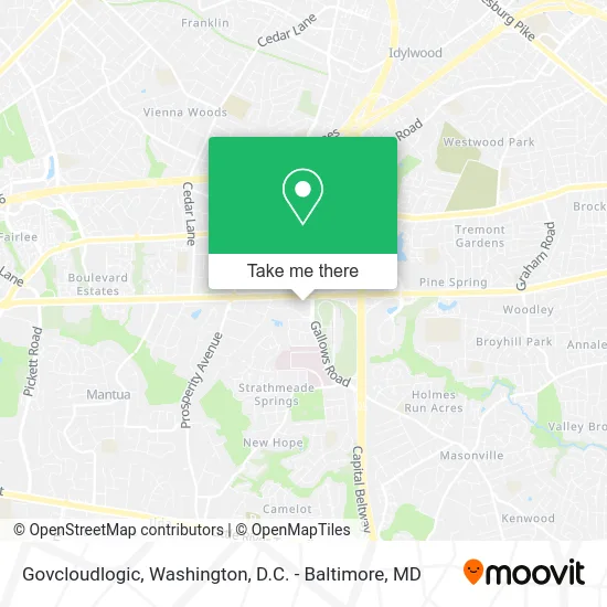
See Govcloudlogic, Fairfax County, on the map
Public Transit to Govcloudlogic in Fairfax County
Wondering how to get to Govcloudlogic in Fairfax County? Moovit helps you find the best way to get to Govcloudlogic with step-by-step directions from the nearest public transit station.
Moovit provides free maps and live directions to help you navigate through your city. View schedules, routes, timetables, and find out how long does it take to get to Govcloudlogic in real time.
Looking for the nearest stop or station to Govcloudlogic? Check out this list of stops closest to your destination: Gallows Rd+Arlington Bl; Gallows Rd @ Arlington Blvd; Gallows @ Willow Oaks Corporate Dr; Wilow Oaks Corporate Dr & Williams Dr; Williams Dr+Arlington Bl; Dunn Loring Merrifield Metro Station.
Bus: 401, 402, F60, F61, 671, F62.Metro: ORANGE.
Want to see if there’s another route that gets you there at an earlier time? Moovit helps you find alternative routes or times. Get directions from and directions to Govcloudlogic easily from the Moovit App or Website.
We make riding to Govcloudlogic easy, which is why over 1.5 million users, including users in Fairfax County, trust Moovit as the best app for public transit. You don’t need to download an individual bus app or train app, Moovit is your all-in-one transit app that helps you find the best bus time or train time available.
For information on prices of bus and metro, costs and ride fares to Govcloudlogic, please check the Moovit app.
Use the app to navigate to popular places including to the airport, hospital, stadium, grocery store, mall, coffee shop, school, college, and university.
Govcloudlogic Address: 8270 Willow Oaks Corporate Dr Fairfax, VA 22031 street in Fairfax County
- Lipp-Farr,
- Arthritis and Rheumatism Associates PC - Fairfax,
- D. Andrew Parker, M.D.,
- Doctor - K,
- Michael S. Antonis, D.O., RDMS, Caq-SM,
- Digital Smile Design Clinic,
- Dell,
- Ricoh Business Solutions,
- 8260 Willow Oaks Corporate Center,
- Willow Oaks Corporate Center Metro Shuttle,
- StarVista Entertainment Time Life,
- Other Procedures,
- Fairfax Radiology Breast Center of Fairfax,
- Sunny & Fine's Breakfast Burritos,
- In My Office,
- SRA International,
- Dzyne Technologies,
- Awesome Financial Center,
- Swift & Gentle Moving + Storage,
- Law Office of Afsana Chowdhury
Places Near Govcloudlogic (Fairfax County)
- Washington National Cathedral, Washington,
- The Anthem, Washington,
- Marriott Marquis Washington, DC, Washington,
- Amazon Hq2, Arlington County,
- Warner Theatre, Washington,
- National Zoo, Washington,
- Capital One Arena, Washington,
- Sibley Memorial Hospital, Washington,
- Museum Of The Bible, Washington,
- National Mall, Washington,
- Basilica of the National Shrine, Washington,
- Westfield Montgomery Mall, Montgomery County,
- Pennsylvania Ave NW (3rd st and pennsylvania), Washington,
- Rock Creek Tennis Center, Washington,
- Camden Yards, Baltimore,
- Georgetown, Washington,
- National Museum of African American History and Culture, Washington,
- Washington DC VA Medical Center, Washington,
- PG Mall, Prince George's County,
- M&T Bank Stadium, Baltimore
How to get to popular places in Washington, D.C. - Baltimore, MD with public transit
Get around Fairfax County by public transit!
Traveling around Fairfax County has never been so easy. See step by step directions as you travel to any attraction, street or major public transit station. View bus and train schedules, arrival times, service alerts and detailed routes on a map, so you know exactly how to get to anywhere in Fairfax County.
When traveling to any destination around Fairfax County use Moovit's Live Directions with Get Off Notifications to know exactly where and how far to walk, how long to wait for your line, and how many stops are left. Moovit will alert you when it's time to get off — no need to constantly re-check whether yours is the next stop.
Wondering how to use public transit in Fairfax County or how to pay for public transit in Fairfax County? Moovit public transit app can help you navigate your way with public transit easily, and at minimum cost. It includes public transit fees, ticket prices, and costs. Looking for a map of Fairfax County public transit lines? Moovit public transit app shows all public transit maps in Fairfax County with all Bus, Train, Metro, Light Rail and Ferry routes and stops on an interactive map.
Washington, D.C. - Baltimore, MD has 5 transit type(s), including: Bus, Train, Metro, Light Rail and Ferry, operated by several transit agencies, including WMATA, Montgomery County Ride On, Fairfax Connector, TheBus, PRTC, DASH - Alexandria, Arlington Transit (ART), RTA of Central Maryland, MDOT MTA, MDOT MTA Light RailLink, MDOT MTA Commuter Bus, MDOT MTA Local Bus, FXBGO!, Virginia Railway Express (VRE) and MARC