How to get to Gps Display by bus?
Click on the bus route to see step by step directions with maps, line arrival times and updated time schedules.
From Praça Wilson Sales (Praça Nova Suíça), U.T.P. Jardim Atlantico
44 minFrom Salão do Reino das Testemunhas de Jeová, Goiania
101 minFrom Setor Morada do Sol, Goiania
79 minFrom Clinica Medical Center Setor Marista, U.T.P. Marista
44 minFrom Avenida T-15, 7371, U.T.P. Bueno
45 minFrom Residencial Recreio Panorama, Goiania
80 minFrom Vila pedroso, U.T.P. Vila Pedroso
55 minFrom Jardim da Luz, U.T.P. Parque Das Laranjeiras E Jardim Da Luz
65 minFrom Conjunto Guadalajara, U.T.P. Cidade Jardim
58 minFrom Cais Campinas, U.T.P. Campinas
38 min
Bus stops near Gps Display in U.T.P. Santa Genoveva
Bus lines to Gps Display in U.T.P. Santa Genoveva
- 262, Vale Dos Sonhos ⇆ Centro - Via St. Jaó,VIEW
- 225, Vale dos Sonhos ⇆ Centro - Via T. Paulo Garcia,VIEW
- 280, Vale Dos Sonhos ⇆ Centro - Via Guanabara III,VIEW
- 302, Campus II UFG ⇆ Marista,VIEW
- 931, Vale dos Sonhos,VIEW
- 264, Pça. da Bíblia → St. Jaó → Sta. Genoveva,VIEW
- 263, Campus II UFG / Pça. da Bíblia,VIEW
- 581, T. Nerópolis / St. Sul / Pça. da Bíblia,VIEW
What are the closest stations to Gps Display?
The closest stations to Gps Display are:
- Avenida Sucuri, 1993 is 166 meters away, 3 min walk.
- Avenida São Francisco, 1158 is 565 meters away, 8 min walk.
- Praça Capitão Frazão, 913 is 664 meters away, 9 min walk.
- Rua Gaipá is 728 meters away, 10 min walk.
Which bus lines stop near Gps Display?
These bus lines stop near Gps Display: 225, 262, 264, 280, 302.
What’s the nearest bus station to Gps Display in U.T.P. Santa Genoveva?
The nearest bus station to Gps Display in U.T.P. Santa Genoveva is Avenida Sucuri, 1993. It’s a 3 min walk away.
What time is the first bus to Gps Display in U.T.P. Santa Genoveva?
The 263 is the first bus that goes to Gps Display in U.T.P. Santa Genoveva. It stops nearby at 4:53 AM.
What time is the last bus to Gps Display in U.T.P. Santa Genoveva?
The 581 is the last bus that goes to Gps Display in U.T.P. Santa Genoveva. It stops nearby at 12:14 AM.
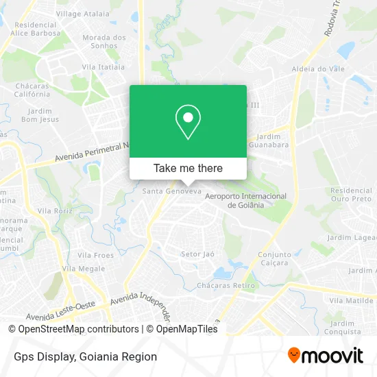
See Gps Display, U.T.P. Santa Genoveva, on the map
Public Transit to Gps Display in U.T.P. Santa Genoveva
Wondering how to get to Gps Display in U.T.P. Santa Genoveva? Moovit helps you find the best way to get to Gps Display with step-by-step directions from the nearest public transit station.
Moovit provides free maps and live directions to help you navigate through your city. View schedules, routes, timetables, and find out how long does it take to get to Gps Display in real time.
Looking for the nearest stop or station to Gps Display? Check out this list of stops closest to your destination: Avenida Sucuri; Avenida São Francisco; Praça Capitão Frazão; Rua Gaipá.
Bus: 225, 262, 264, 280, 302, 931, 263, 581.
Want to see if there’s another route that gets you there at an earlier time? Moovit helps you find alternative routes or times. Get directions from and directions to Gps Display easily from the Moovit App or Website.
We make riding to Gps Display easy, which is why over 1.5 million users, including users in U.T.P. Santa Genoveva, trust Moovit as the best app for public transit. You don’t need to download an individual bus app or train app, Moovit is your all-in-one transit app that helps you find the best bus time or train time available.
For information on prices of bus, costs and ride fares to Gps Display, please check the Moovit app.
Use the app to navigate to popular places including to the airport, hospital, stadium, grocery store, mall, coffee shop, school, college, and university.
Gps Display Address: Avenida Serra Dourada, Santa Genoveva Goiânia-GO 74730-530 street in U.T.P. Santa Genoveva
- Alto Motivo Cadeiras de Rodas e Adaptação Veicular,
- Edem Agrominerais,
- SP Engenharia,
- Bradel Goias Distribuicao,
- Century on Line,
- Dialogus Escola de Idiomas,
- Gou Clinicas de Odontologia Aparecida de Goiânia,
- Minha Cidade Legal,
- Rua Itacorá Quadra 96,
- Plasticom Plásticos Indústria e Comércio,
- Rua Serra Dourada 1528,
- Avenida Interlândia Quadra 87,
- Campestre Agrotecnologia Indústria e Comércio,
- Uni Rapido Transportes de Cargas,
- Assconsol Goias,
- Via Energy,
- Plastform Embalagens,
- Dcco Rental,
- Azul Cargo,
- Avenida Santos Dumont 1115
Places Near Gps Display (U.T.P. Santa Genoveva)
- Rodeio Show de Aparecida, Aparecida De Goiânia,
- Hospital das Clínicas (HC), U.T.P. Leste Universitario,
- HUGOL - Hospital De Urgências Governador Octávio Lage, U.T.P. V. Regina/Pq. Ind. Paulista/Santos Dumont,
- Avenida Rio Verde, Aparecida De Goiânia,
- Senador Canedo, Senador Canedo,
- Hospital Santa Casa de Misericórdia de Goiânia, U.T.P. Bueno,
- Avenida 44, Goiania,
- Aeroporto de Goiânia / Santa Genoveva (GYN), U.T.P. Aeroporto Internacional,
- Avenida T-2, U.T.P. Bueno,
- Rodovia BR - 153, Aparecida De Goiânia,
- Terminal Rodoviário De Goiânia, U.T.P. Central,
- Buriti Shopping, Aparecida De Goiânia,
- Terminal Recanto do Bosque, Goiania,
- Terminal Araguaia, Aparecida De Goiânia,
- Terminal Praça A, U.T.P. Campinas,
- ICF Instituto de Ciências Farmacêuticas Unidade Clinica, U.T.P. Novo Horizonte/Faicalville,
- Jardim América Goiânia - GO, U.T.P. Jardim America,
- Hospital de Urgências de Goiânia (HUGO), U.T.P. Pedro Ludovico/Bela Vista/Jardim Das Esmeraldas,
- Setor Expansul, Aparecida De Goiânia,
- Hospital e Maternidade São Judas Tadeu, U.T.P. Jardim Europa
How to get to popular places in Goiania Region with public transit
Get around U.T.P. Santa Genoveva by public transit!
Traveling around U.T.P. Santa Genoveva has never been so easy. See step by step directions as you travel to any attraction, street or major public transit station. View bus and train schedules, arrival times, service alerts and detailed routes on a map, so you know exactly how to get to anywhere in U.T.P. Santa Genoveva.
When traveling to any destination around U.T.P. Santa Genoveva use Moovit's Live Directions with Get Off Notifications to know exactly where and how far to walk, how long to wait for your line, and how many stops are left. Moovit will alert you when it's time to get off — no need to constantly re-check whether yours is the next stop.
Wondering how to use public transit in U.T.P. Santa Genoveva or how to pay for public transit in U.T.P. Santa Genoveva? Moovit public transit app can help you navigate your way with public transit easily, and at minimum cost. It includes public transit fees, ticket prices, and costs. Looking for a map of U.T.P. Santa Genoveva public transit lines? Moovit public transit app shows all public transit maps in U.T.P. Santa Genoveva with all bus routes and stops on an interactive map.
Goiania Region has 1 transit type(s), including: bus, operated by several transit agencies, including Redemob Consórcio - CMTC