How to get to Graf by bus?
Click on the bus route to see step by step directions with maps, line arrival times and updated time schedules.
From Audi Forum Neckarsulm, Verwaltungsgemeinschaft Neckarsulm
109 minFrom Klinikum am Gesundbrunnen, Heilbronn
118 minFrom Christiane-Herzog-Schule, Böckingen
136 minFrom Slk-Kliniken Heilbronn P1, Heilbronn
117 minFrom Thermen & Badewelt Sinsheim, Sinsheim
44 minFrom Audi AG Neckarsulm A21, Verwaltungsgemeinschaft Neckarsulm
125 minFrom Antalya Pizza & Kebaphaus, Verwaltungsgemeinschaft Eppingen
65 minFrom Kaufland, Mosbach
108 minFrom Luson Hair, Verwaltungsgemeinschaft Bad Friedrichshall
141 minFrom Vulpiusklinik, Bad Rappenau
133 min
How to get to Graf by train?
Click on the train route to see step by step directions with maps, line arrival times and updated time schedules.
From Audi Forum Neckarsulm, Verwaltungsgemeinschaft Neckarsulm
73 minFrom Christiane-Herzog-Schule, Böckingen
114 minFrom Thermen & Badewelt Sinsheim, Sinsheim
66 minFrom Audi AG Neckarsulm A21, Verwaltungsgemeinschaft Neckarsulm
82 minFrom Antalya Pizza & Kebaphaus, Verwaltungsgemeinschaft Eppingen
122 minFrom Kaufland, Mosbach
124 minFrom Luson Hair, Verwaltungsgemeinschaft Bad Friedrichshall
72 minFrom Vulpiusklinik, Bad Rappenau
57 min
Bus stops near Graf in Ehrstädt
Light Rail stations near Graf in Ehrstädt
- Grombach Gleis 1, 34 min walk,VIEW
Bus lines to Graf in Ehrstädt
What are the closest stations to Graf?
The closest stations to Graf are:
- Ehrstädt, Rathaus is 274 meters away, 4 min walk.
- Ehrstädt, Weedplatz is 369 meters away, 5 min walk.
- Grombach Gleis 1 is 2655 meters away, 34 min walk.
- Grombach Gleis 2 is 2655 meters away, 34 min walk.
- Grombach is 2655 meters away, 34 min walk.
Which train line stops near Graf?
S42 (Sinsheim (Elsenz) Hbf)
Which light rail line stops near Graf?
S42 (Sinsheim, Hauptbahnhof)
Which bus lines stop near Graf?
These bus lines stop near Graf: 682, 686, 765.
What’s the nearest bus station to Graf in Ehrstädt?
The nearest bus station to Graf in Ehrstädt is Ehrstädt, Rathaus. It’s a 4 min walk away.
What time is the first light rail to Graf in Ehrstädt?
The S42 is the first light rail that goes to Graf in Ehrstädt. It stops nearby at 4:50 AM.
What time is the last light rail to Graf in Ehrstädt?
The S42 is the last light rail that goes to Graf in Ehrstädt. It stops nearby at 12:38 AM.
What time is the first train to Graf in Ehrstädt?
The S42 is the first train that goes to Graf in Ehrstädt. It stops nearby at 4:50 AM.
What time is the last train to Graf in Ehrstädt?
The S42 is the last train that goes to Graf in Ehrstädt. It stops nearby at 12:38 AM.
What time is the first bus to Graf in Ehrstädt?
The 7956 is the first bus that goes to Graf in Ehrstädt. It stops nearby at 4:11 AM.
What time is the last bus to Graf in Ehrstädt?
The 7956 is the last bus that goes to Graf in Ehrstädt. It stops nearby at 1:55 AM.
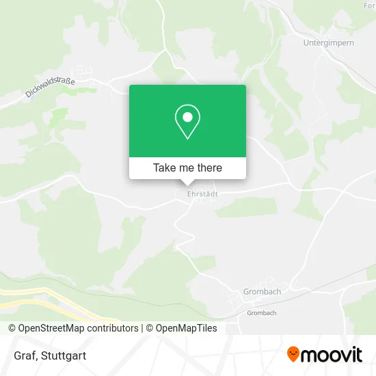
See Graf, Ehrstädt, on the map
Public Transit to Graf in Ehrstädt
Wondering how to get to Graf in Ehrstädt? Moovit helps you find the best way to get to Graf with step-by-step directions from the nearest public transit station.
Moovit provides free maps and live directions to help you navigate through your city. View schedules, routes, timetables, and find out how long does it take to get to Graf in real time.
Looking for the nearest stop or station to Graf? Check out this list of stops closest to your destination: Ehrstädt, Rathaus; Ehrstädt, Weedplatz; Grombach Gleis 1; Grombach Gleis 2; Grombach.
Train: S42, RE 5, RE 10B, RE7, S7, RE10B.Light Rail: S42.Bus: 682, 686, 765, 7956, 797, 797.
Want to see if there’s another route that gets you there at an earlier time? Moovit helps you find alternative routes or times. Get directions from and directions to Graf easily from the Moovit App or Website.
We make riding to Graf easy, which is why over 1.5 million users, including users in Ehrstädt, trust Moovit as the best app for public transit. You don’t need to download an individual bus app or train app, Moovit is your all-in-one transit app that helps you find the best bus time or train time available.
For information on prices of bus, train and light rail, costs and ride fares to Graf, please check the Moovit app.
Use the app to navigate to popular places including to the airport, hospital, stadium, grocery store, mall, coffee shop, school, college, and university.
Graf Address: Hinterdorfstraße 26 Ehrstädt, 74889 Sinsheim street in Ehrstädt
- Nadines Entwicklungsraum,
- Graf Werkzeugbau,
- Evelyn Krenz Siebdruckerei,
- SV Ehrstädt 1946 e.V. Sportverein,
- Eisautomat Ehrstädt,
- Friedhof Ehrstädt,
- Seewiesenhalle,
- Evangelische Kirche Ehrstädt,
- Sonne,
- Gasthaus Sonne,
- Kalahari Multimediale Dienstleistungen GmbH I.L.,
- VB Kraichgau eG Zweigstelle Ehrstädt,
- Rathaus,
- Rößle,
- Kraichgau Antik,
- Gasthaus Zum Rössle,
- Altes Schulhaus,
- Pizza-Service Pronto Chef,
- Rathaus Ehrstädt,
- Oliver Benz Elektrotechnik
Places Near Graf (Ehrstädt)
- Waldfriedhof, Degerloch,
- Im Wizemann (Halle), Bad Cannstatt,
- FlixBus Haltestelle, Stuttgart,
- Schleyerhalle, Bad Cannstatt,
- Gasometer Pforzheim, Pforzheim,
- Geilhaus Haus 33a, Reutlingen-Betzingen,
- Hanns-Martin-Schleyer-Halle (Stuttgart Hans-Martin-Schleyerhalle), Bad Cannstatt,
- Wilhelma (U-Bahn Wilhelma), Bad Cannstatt,
- Gleis 101/102 (tief), Stuttgart-Mitte,
- Mercedes-Benz Museum (Mercedes Museum Stuttgart), Bad Cannstatt,
- Porsche-Arena, Bad Cannstatt,
- Porsche Museum, Zuffenhausen,
- Hauptbahnhof Stuttgart, Stuttgart-Mitte,
- Klinikum Stuttgart - Katharinenhospital, Stuttgart-Mitte,
- Marmorsaal Im Weissenburgpark, Stuttgart-Süd,
- SI-Centrum, Möhringen,
- Pariser Platz Stuttgart, Stuttgart-Mitte,
- Hanns-Martin-Schleyer-Halle, Bad Cannstatt,
- Mercedes-Benz Museum, Bad Cannstatt,
- Mettingen Eros-Center Puff Laufhaus, Esslingen Am Neckar
How to get to popular places in Stuttgart with public transit
Get around Ehrstädt by public transit!
Traveling around Ehrstädt has never been so easy. See step by step directions as you travel to any attraction, street or major public transit station. View bus and train schedules, arrival times, service alerts and detailed routes on a map, so you know exactly how to get to anywhere in Ehrstädt.
When traveling to any destination around Ehrstädt use Moovit's Live Directions with Get Off Notifications to know exactly where and how far to walk, how long to wait for your line, and how many stops are left. Moovit will alert you when it's time to get off — no need to constantly re-check whether yours is the next stop.
Wondering how to use public transit in Ehrstädt or how to pay for public transit in Ehrstädt? Moovit public transit app can help you navigate your way with public transit easily, and at minimum cost. It includes public transit fees, ticket prices, and costs. Looking for a map of Ehrstädt public transit lines? Moovit public transit app shows all public transit maps in Ehrstädt with all Bus, Train, Subway, Light Rail, Ferry, S-Bahn and Funicular routes and stops on an interactive map.
Stuttgart has 7 transit type(s), including: Bus, Train, Subway, Light Rail, Ferry, S-Bahn and Funicular, operated by several transit agencies, including SSB - Stadtbahn, SSB, SSB - Seilbahn / Zacke, S-Bahn Stuttgart, Rhein-Neckar-Verkehr GmbH (rnv), Karlsruher Verkehrsverbund, DB AG, DB Regiobus BW, Arverio Baden-Württemberg GmbH, DB RegioNetz Verkehrs GmbH Westfrankenbahn, DB Regio AG Baden-Württemberg, Südwestdeutsche Verkehrs-AG, DB Regio AG Mitte Region Hessen, DB and Bodensee-Oberschwaben-Bahn