Directions to Grainger (Richmond) with public transportation
The following transit lines have routes that pass near Grainger
 Bus: 3A, 3B, 5, FLIXBUS N2601, 3C.
- Train: NORTHEAST REGIONAL.
How to get to Grainger by bus?
Click on the bus route to see step by step directions with maps, line arrival times and updated time schedules.
From Rose Gaming Resort, Prince William County
248 minFrom Lorton, VA - Amtrak Auto Train Station (LOR), Fairfax County
238 minFrom Busch Gardens Williamsburg (Employee Parking Lot), James City County
122 minFrom Hampton University, Hampton
274 minFrom Lorton, VA, Fairfax County
233 minFrom Potomac Mills Mall, Prince William County
223 minFrom Woodbridge, VA, Prince William County
172 minFrom UVA Hospital Medical Center, Charlottesville
312 minFrom Amazon Fulfillment Center-Ric3, Richmond
69 min
Bus stops near Grainger in Richmond
Train station near Grainger in Richmond
- Pathrichmond Main Street Amtrak Station, 21 min walk,VIEW
Bus lines to Grainger in Richmond
What are the closest stations to Grainger?
The closest stations to Grainger are:
- 4th + Magnolia is 767 yards away, 10 min walk.
- Richmond North (Mcdonalds Mechanicsville Tpk) is 852 yards away, 11 min walk.
- Whitcomb + Deforest is 1624 yards away, 20 min walk.
- Pathrichmond Main Street Amtrak Station is 1760 yards away, 21 min walk.
Which bus lines stop near Grainger?
These bus lines stop near Grainger: 3A, 3B, 5, FLIXBUS N2601.
What’s the nearest train station to Grainger in Richmond?
The nearest train station to Grainger in Richmond is Pathrichmond Main Street Amtrak Station. It’s a 21 min walk away.
What’s the nearest bus station to Grainger in Richmond?
The nearest bus station to Grainger in Richmond is 4th + Magnolia. It’s a 10 min walk away.
What time is the first train to Grainger in Richmond?
The NORTHEAST REGIONAL is the first train that goes to Grainger in Richmond. It stops nearby at 5:19 AM.
What time is the last train to Grainger in Richmond?
The NORTHEAST REGIONAL is the last train that goes to Grainger in Richmond. It stops nearby at 6:52 PM.
What time is the first bus to Grainger in Richmond?
The 3A is the first bus that goes to Grainger in Richmond. It stops nearby at 5:07 AM.
What time is the last bus to Grainger in Richmond?
The 3C is the last bus that goes to Grainger in Richmond. It stops nearby at 1:26 AM.
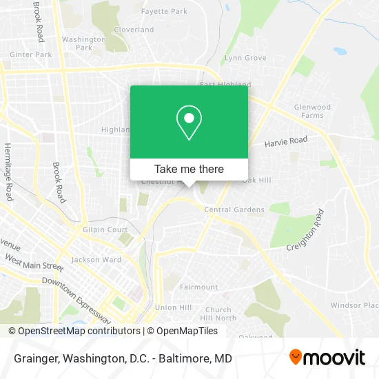
See Grainger, Richmond, on the map
Public Transit to Grainger in Richmond
Wondering how to get to Grainger in Richmond? Moovit helps you find the best way to get to Grainger with step-by-step directions from the nearest public transit station.
Moovit provides free maps and live directions to help you navigate through your city. View schedules, routes, timetables, and find out how long does it take to get to Grainger in real time.
Looking for the nearest stop or station to Grainger? Check out this list of stops closest to your destination: 4th + Magnolia; Richmond North (Mcdonalds Mechanicsville Tpk); Whitcomb + Deforest; Pathrichmond Main Street Amtrak Station.
Bus: 3A, 3B, 5, FLIXBUS N2601, 3C, FLIXBUS 2605.Train: NORTHEAST REGIONAL.
Want to see if there’s another route that gets you there at an earlier time? Moovit helps you find alternative routes or times. Get directions from and directions to Grainger easily from the Moovit App or Website.
We make riding to Grainger easy, which is why over 1.5 million users, including users in Richmond, trust Moovit as the best app for public transit. You don’t need to download an individual bus app or train app, Moovit is your all-in-one transit app that helps you find the best bus time or train time available.
For information on prices of bus and train, costs and ride fares to Grainger, please check the Moovit app.
Use the app to navigate to popular places including to the airport, hospital, stadium, grocery store, mall, coffee shop, school, college, and university.
Grainger Address: 2424 Magnolia Ct Richmond, VA 23223 street in Richmond
- Tom's Meat & Produce,
- Gizmoagency-Digital Marketing Agency,
- L&W Supply,
- Building Specialties,
- Sydnor Hydro,
- Power Installations,
- Hertless,
- TH Logistics,
- Northside Electric,
- Techdesign Corporation,
- Party Perfect,
- Strickland Machine Company,
- International Roofing,
- City Electric Supply Richmond East,
- Woodland Cemetery,
- My Guys Moving & Storage,
- Two Guys and A Truck,
- Advanced Tower Integration Services,
- Guaranteed Supply,
- Exit 192/Mechanicsville/E
Places Near Grainger (Richmond)
- National Museum of African American History and Culture, Washington,
- Museum Of The Bible, Washington,
- The Anthem, Washington,
- Washington National Cathedral, Washington,
- Camden Yards, Baltimore,
- Washington DC VA Medical Center, Washington,
- Georgetown, Washington,
- National Mall, Washington,
- National Zoo, Washington,
- Marriott Marquis Washington, DC, Washington,
- Sibley Memorial Hospital, Washington,
- PG Mall, Prince George's County,
- Rock Creek Tennis Center, Washington,
- Pennsylvania Ave NW (3rd st and pennsylvania), Washington,
- M&T Bank Stadium, Baltimore,
- Westfield Montgomery Mall, Montgomery County,
- Amazon Hq2, Arlington County,
- Basilica of the National Shrine, Washington,
- Capital One Arena, Washington,
- Warner Theatre, Washington
How to get to popular places in Washington, D.C. - Baltimore, MD with public transit
Get around Richmond by public transit!
Traveling around Richmond has never been so easy. See step by step directions as you travel to any attraction, street or major public transit station. View bus and train schedules, arrival times, service alerts and detailed routes on a map, so you know exactly how to get to anywhere in Richmond.
When traveling to any destination around Richmond use Moovit's Live Directions with Get Off Notifications to know exactly where and how far to walk, how long to wait for your line, and how many stops are left. Moovit will alert you when it's time to get off — no need to constantly re-check whether yours is the next stop.
Wondering how to use public transit in Richmond or how to pay for public transit in Richmond? Moovit public transit app can help you navigate your way with public transit easily, and at minimum cost. It includes public transit fees, ticket prices, and costs. Looking for a map of Richmond public transit lines? Moovit public transit app shows all public transit maps in Richmond with all Bus, Train, Metro, Light Rail and Ferry routes and stops on an interactive map.
Washington, D.C. - Baltimore, MD has 5 transit type(s), including: Bus, Train, Metro, Light Rail and Ferry, operated by several transit agencies, including WMATA, Montgomery County Ride On, Fairfax Connector, TheBus, PRTC, DASH - Alexandria, Arlington Transit (ART), RTA of Central Maryland, MDOT MTA, MDOT MTA Light RailLink, MDOT MTA Commuter Bus, MDOT MTA Local Bus, FXBGO!, Virginia Railway Express (VRE) and MARC