How to get to Gramercy Kitchen & Bath by bus?
Click on the bus route to see step by step directions with maps, line arrival times and updated time schedules.
How to get to Gramercy Kitchen & Bath by train?
Click on the train route to see step by step directions with maps, line arrival times and updated time schedules.
How to get to Gramercy Kitchen & Bath by subway?
Click on the subway route to see step by step directions with maps, line arrival times and updated time schedules.
Bus stops near Gramercy Kitchen & Bath in Manhattan
Subway stations near Gramercy Kitchen & Bath in Manhattan
Bus lines to Gramercy Kitchen & Bath in Manhattan
- M101, Ft George Via 3 Av Via Amsterdam Av,VIEW
- M102, East Village 6 St Via Lex Av,VIEW
- M103, City Hall Via Lex Av,VIEW
- BM1, Mill Basin - Downtown/Midtown,VIEW
- BM2, Canarsie/Spring Creek - Downtown/Midtown,VIEW
- BM3, Sheepshead Bay - Downtown/Midtown,VIEW
- BM4, Gerritsen Beach - Downtown/Midtown,VIEW
- M15, Pike St -Via 2 Av,VIEW
- M23-SBS, Select Bus East Side Avenue C Crosstown,VIEW
- X37, Midtown 57 St Via Fdr-23 St Via Madison,VIEW
- X38, Bensonhurst Cropsey Av Via 23 St Via Fdr,VIEW
- SIM3, Midtown Via 23 St Via 6 Av,VIEW
- SIM6, Midtown Via 23 St Via Madison Av,VIEW
- SIM10, Eltingville Trans Ctr Via Hylan Via Rich,VIEW
- SIM11, Midtown Via 23 St Via Madison Av,VIEW
- SIM31, Eltingville Trans Ctr Via Forest Hill Rd,VIEW
What are the closest stations to Gramercy Kitchen & Bath?
The closest stations to Gramercy Kitchen & Bath are:
- 3 Av/E 20 St is 3 yards away, 1 min walk.
- E 23 St / 3 Av is 306 yards away, 4 min walk.
- 2 Av/E 20 St is 316 yards away, 4 min walk.
- E 23 St/3 Av is 317 yards away, 4 min walk.
- 23 St-Baruch College is 348 yards away, 5 min walk.
- 23 St is 382 yards away, 5 min walk.
- 14 St-Union Sq is 384 yards away, 5 min walk.
Which bus lines stop near Gramercy Kitchen & Bath?
These bus lines stop near Gramercy Kitchen & Bath: 28, BM3, BM4, M102, M103, M15-SBS, M34A-SBS.
Which train line stops near Gramercy Kitchen & Bath?
1 (436#| Grand Central)
Which subway lines stop near Gramercy Kitchen & Bath?
These subway lines stop near Gramercy Kitchen & Bath: 5, 6X, L, N, R.
What’s the nearest subway station to Gramercy Kitchen & Bath in Manhattan?
The nearest subway stations to Gramercy Kitchen & Bath in Manhattan are 23 St-Baruch College, 23 St and 14 St-Union Sq. The closest one is a 5 min walk away.
What’s the nearest bus station to Gramercy Kitchen & Bath in Manhattan?
The nearest bus station to Gramercy Kitchen & Bath in Manhattan is 3 Av/E 20 St. It’s a 1 min walk away.
What time is the first subway to Gramercy Kitchen & Bath in Manhattan?
The 6 is the first subway that goes to Gramercy Kitchen & Bath in Manhattan. It stops nearby at 3:00 AM.
What time is the last subway to Gramercy Kitchen & Bath in Manhattan?
The N is the last subway that goes to Gramercy Kitchen & Bath in Manhattan. It stops nearby at 3:57 AM.
What time is the first bus to Gramercy Kitchen & Bath in Manhattan?
The M23-SBS is the first bus that goes to Gramercy Kitchen & Bath in Manhattan. It stops nearby at 3:06 AM.
What time is the last bus to Gramercy Kitchen & Bath in Manhattan?
The M103 is the last bus that goes to Gramercy Kitchen & Bath in Manhattan. It stops nearby at 3:22 AM.
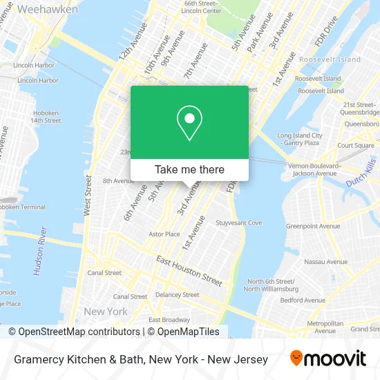
See Gramercy Kitchen & Bath, Manhattan, on the map
Public Transit to Gramercy Kitchen & Bath in Manhattan
Wondering how to get to Gramercy Kitchen & Bath in Manhattan? Moovit helps you find the best way to get to Gramercy Kitchen & Bath with step-by-step directions from the nearest public transit station.
Moovit provides free maps and live directions to help you navigate through your city. View schedules, routes, timetables, and find out how long does it take to get to Gramercy Kitchen & Bath in real time.
Looking for the nearest stop or station to Gramercy Kitchen & Bath? Check out this list of stops closest to your destination: 3 Av/E 20 St; E 23 St / 3 Av; 2 Av/E 20 St; E 23 St/3 Av; 23 St-Baruch College; 23 St; 14 St-Union Sq.
Bus: 28, BM3, BM4, M102, M103, M15-SBS, M34A-SBS, M101, BM1, BM2, M15.Train: 1.Subway: 5, 6X, L, N, R, 4, 6, Q, W.
Want to see if there’s another route that gets you there at an earlier time? Moovit helps you find alternative routes or times. Get directions from and directions to Gramercy Kitchen & Bath easily from the Moovit App or Website.
We make riding to Gramercy Kitchen & Bath easy, which is why over 1.7 million users, including users in Manhattan, trust Moovit as the best app for public transit. You don’t need to download an individual bus app or train app, Moovit is your all-in-one transit app that helps you find the best bus time or train time available.
For information on prices of bus, subway and train, costs and ride fares to Gramercy Kitchen & Bath, please check the Moovit app.
Use the app to navigate to popular places including to the airport, hospital, stadium, grocery store, mall, coffee shop, school, college, and university.
Gramercy Kitchen & Bath Address: 234 3rd Ave street in Manhattan
- Sheepu Animal Care Hospital,
- Susucar Autopart,
- Everyday Meal Magic,
- Rita N Digital,
- Outset Summer Program,
- Citipups Village,
- Gramercy Park Flower Shop: Gramercy Park Location,
- Gramercy Park, New York,
- 養生之道,
- Sal Anthony's,
- The Style Cipher,
- 32 Gramercy Park Owners Corporation,
- John Madere Photography,
- La Pizza Fresca Ristorante,
- Chase Atm,
- E 19th St 3rd,
- Studio 123 Bowery,
- Bleu Blanc Rouge NY - French Classes and Summer Camp,
- Lior Vaknin,
- Decor Gallery and Framing at Gramercy
Places Near Gramercy Kitchen & Bath (Manhattan)
- Mountainside Hospital, Glen Ridge,
- Rockefeller Center, Manhattan,
- San Gennaro Feast, Manhattan,
- Chinatown, Manhattan,
- SoHo, Manhattan,
- Bellevue Hospital, Manhattan,
- Queens Center Mall, Queens,
- Pier 83, Manhattan,
- 1 Police Plaza, Manhattan,
- 111 Centre New York City Supreme Court, Manhattan,
- Hudson Yards, Manhattan,
- 911 Memorial, Manhattan,
- 66 John Street, Manhattan,
- Wall Street, Manhattan,
- Times Square, Manhattan,
- 3 Stone St, Manhattan,
- Katz's Deli, Manhattan,
- qqqq, Manhattan,
- 376 Hudson Street, Manhattan,
- 26 Federal Plaza, Manhattan
How to get to popular places in New York - New Jersey with public transit
Get around Manhattan by public transit!
Traveling around Manhattan has never been so easy. See step by step directions as you travel to any attraction, street or major public transit station. View bus and train schedules, arrival times, service alerts and detailed routes on a map, so you know exactly how to get to anywhere in Manhattan.
When traveling to any destination around Manhattan use Moovit's Live Directions with Get Off Notifications to know exactly where and how far to walk, how long to wait for your line, and how many stops are left. Moovit will alert you when it's time to get off — no need to constantly re-check whether yours is the next stop.
Wondering how to use public transit in Manhattan or how to pay for public transit in Manhattan? Moovit public transit app can help you navigate your way with public transit easily, and at minimum cost. It includes public transit fees, ticket prices, and costs. Looking for a map of Manhattan public transit lines? Moovit public transit app shows all public transit maps in Manhattan with all Bus, Train, Subway, Light Rail, Ferry and Cable Car routes and stops on an interactive map.
New York - New Jersey has 6 transit type(s), including: Bus, Train, Subway, Light Rail, Ferry and Cable Car, operated by several transit agencies, including MTA Subway, Metro-North Railroad, LIRR, PATH, MTA New York City Transit - Express routes, MTA Bus, NJ Transit, NYC Ferry, NICE bus, Bee-Line Bus, NJ Transit Rail, Norwalk Transit District, Hartford Line, River Valley Transit and HART